Day 1: Snohomish, WA to Marblemount, WA
https://ridewithgps.com/routes/33017720?privacy_code=oQx2uIyD4idOpOJe
I initially came across this bicycle tour and company (Bicycle Adventures) from a Google search over three years ago. It’s taken this long to finally begin another Bucket List item that Covid-19 didn’t cancel. It was touch-n-go for a bit but this small business, headquartered just outside of Seattle, was also committed to a return to conducting tours. The location, design, and ending of this particular tour was all greatly appealing. It’s a point-to-point tour covering 9 days starting from about 60 miles north of Seattle and ending in Glacier National Park, Montana. The final day is an overnight train ride back to Seattle. Too cool.
After an early pick-up from the hotel by the lead guide and quick trip into Seattle to pick-up a couple of other tour riders, it was off to BA headquarters to load the bikes and other necessary items needed to support a tour of this length and duration. Once the load out was completed, time to head to the start point – The Snohomish Bakery. The 15-passenger van had ample room to accommodate physical distancing for the 4 passengers and driver. We all wore masks and made good use of the provided hand sanitizer.
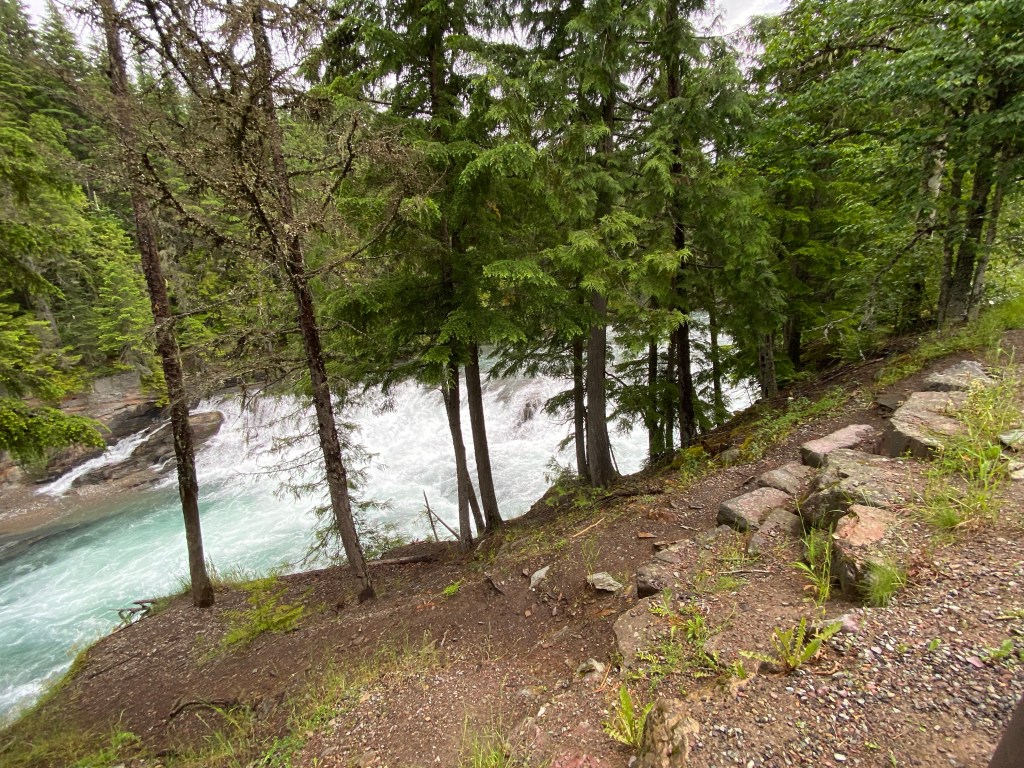
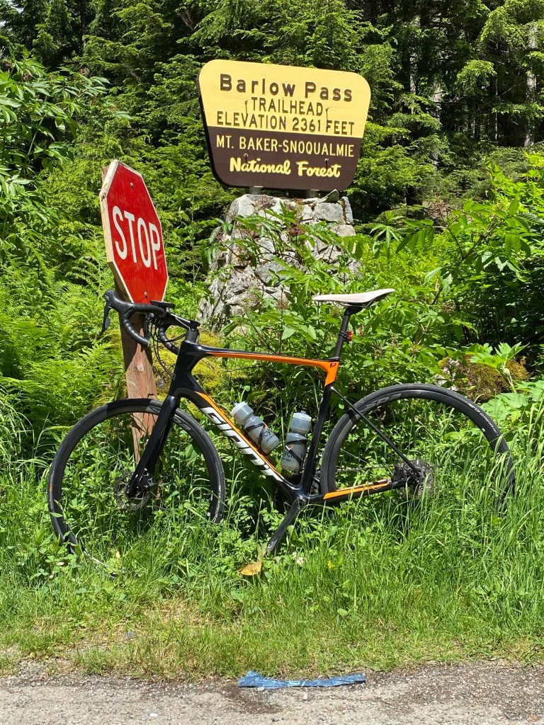
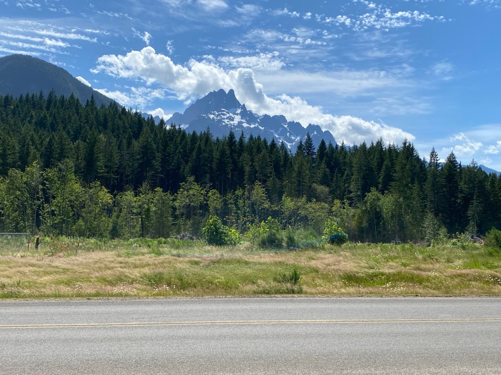
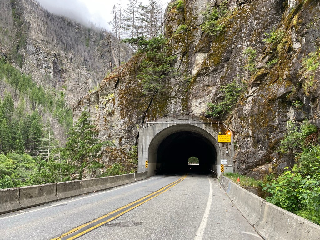
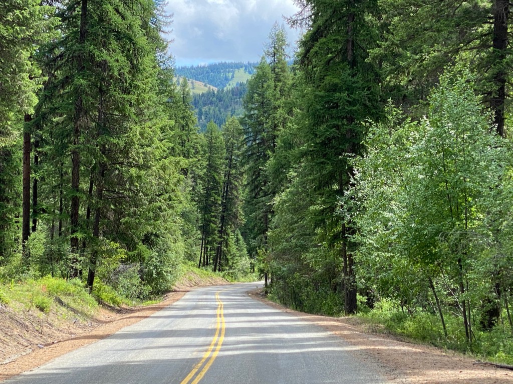
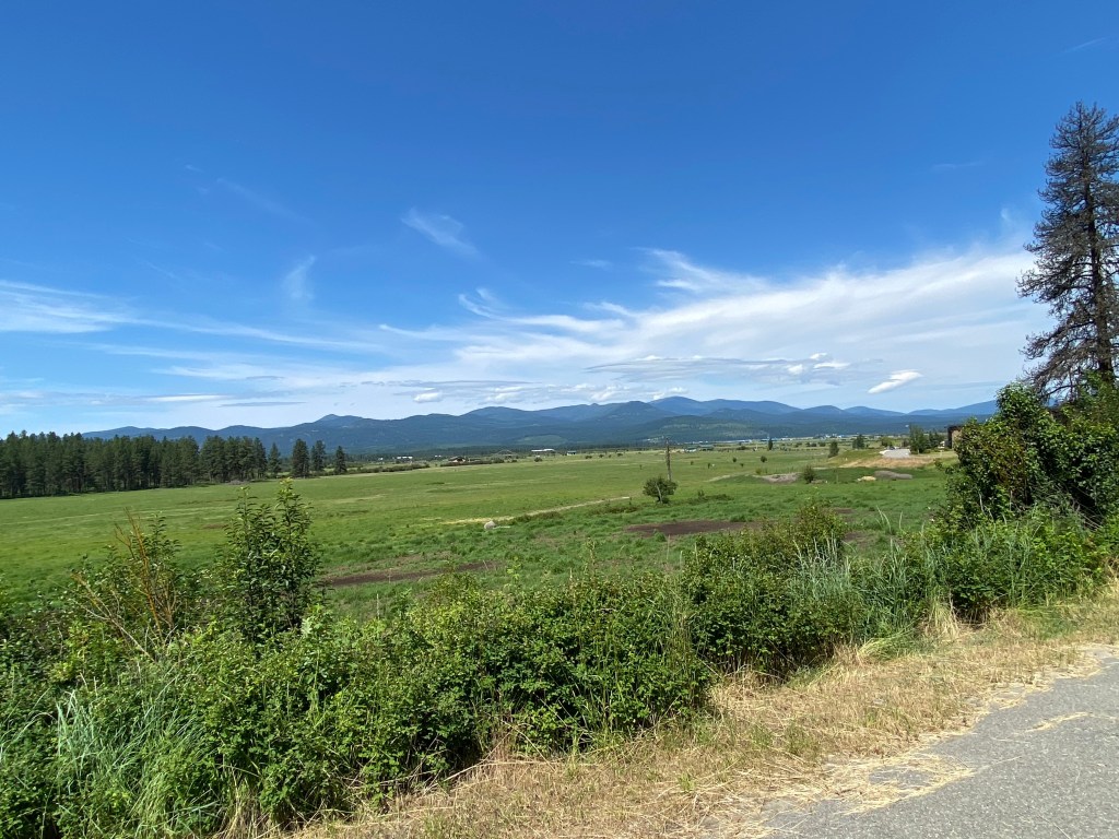
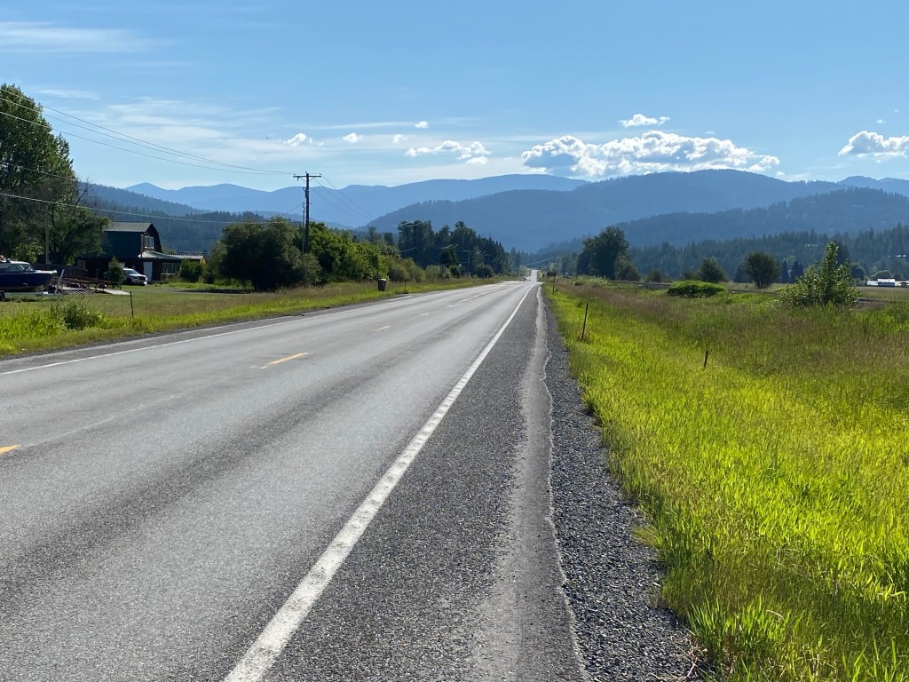
The final tour rider (bringing the total to 4 plus 2 guides) is a local and rode to the bakery. While the guides prepped our bikes – pedals and saddles – we visited the bakery. Can’t go wrong when you start the day with a scone! Afterwards it was time for the overview of the day’s itinerary. Then it was time to get the show on the road. The first 6 miles was along the Centennial Trail. Not a big fan of trails on a road bike but it wasn’t nearly as congested as the W&OD back home. Did see some natural wildlife – a bald eagle and a small pond with about a dozen ducks huddled together in a couple of groups. We finally left the trail for the roads and made our way to Mt Baker – Snoqualmie National Forest. The Pacific Northwest Scenery is a must see for anyone who hasn’t and requires a return visit for those who have. The climbing on the day’s route wasn’t inconsequential but most of it was manageable in the big chainring without really spiking the power output. Having a GoPro would’ve been much more convenient than removing my iPhone from it’s double-layered ziplock baggie moisture protection solution. But then, I would’ve stopped more often and taken more pictures. Is that a bad thing? Regardless, there were lots of opportunities to take pictures of the heavily forested or barren mountains and the dozens of rivers and creeks that were either crossed or paralleled. After the guide prepared lunch at Barlow Pass, and most of the climbing behind us, it was time to remount the bike and continue on to our destination. The first 14 miles after lunch was mostly a descent on a gravel road through a fair bit of old growth forest. Now I’m very much a novice when it comes to gravel but disc brakes are a definite plus. Having 28mm tires doesn’t hurt either. I’ll be honest, there was a fair bit of breaking going on. The gravel was pretty packed but potholes were a concern in several sections and the dappled sunlight didn’t help visibility. Only me and one other rider (the only female in the group) braved the gravel section – the others rode in the van. At some time after the gravel section the Giant bike developed a noisy crank along with a front derailleur rub anytime the chain was beyond the the midpoint cog of the cassette. Rub worsened as cross-chaining increased. Maybe I’m just hard on cranks because my Evo often makes the same annoying noise. Nearing the end of a long day, around the 95-mile mark, a black bear ran across the road. Again, a GoPro would’ve come in handy but alas, I have no iPhone confirmation of the bear sighting.
After 97 miles and over 4000 feet of climbing, we rolled into Marblemount, WA. According to the 2010 census, population was 203. Cell phone coverage was non-existent. Tonight’s lodging is at the Buffalo Inn and dinner was at Mondo.


Day 2: Marblemount, WA to Mazama, WA
https://ridewithgps.com/routes/33017754
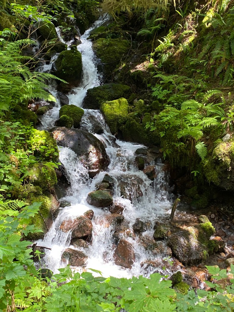
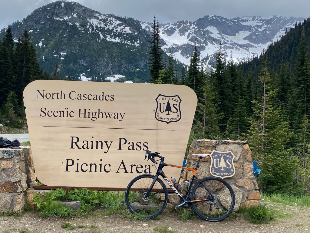
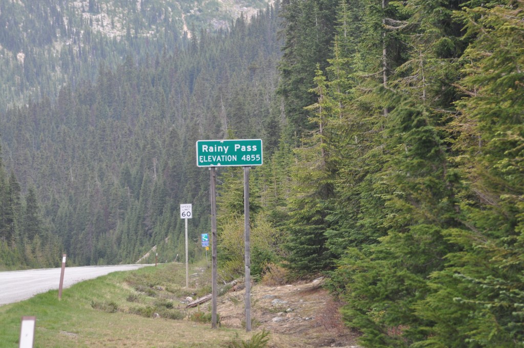
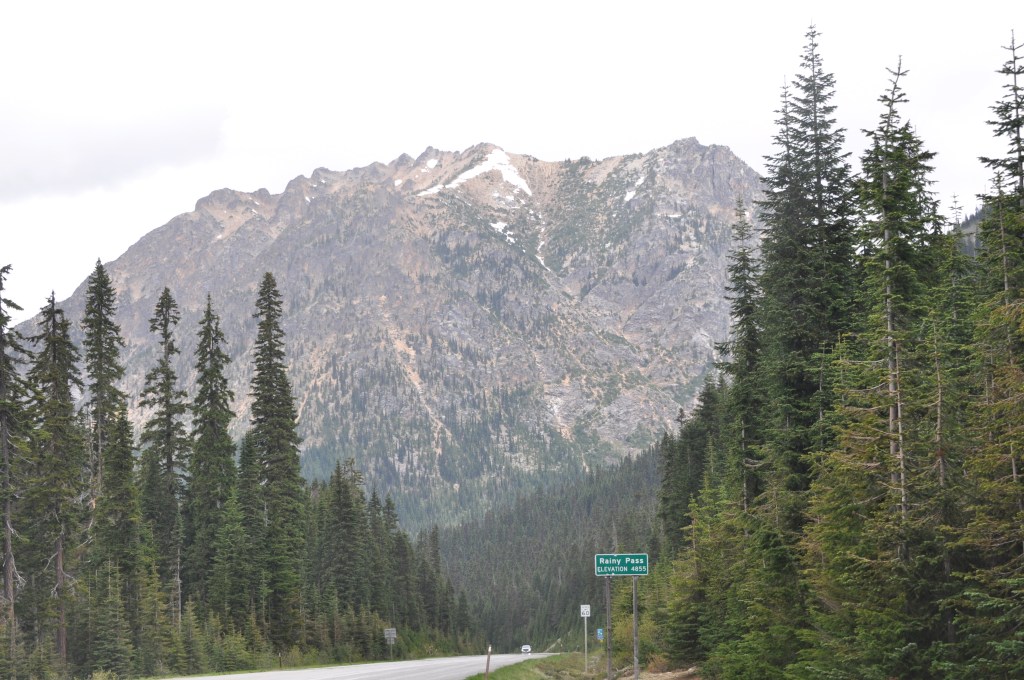
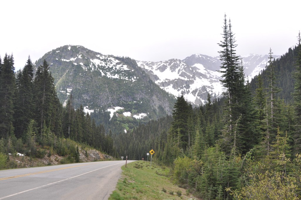
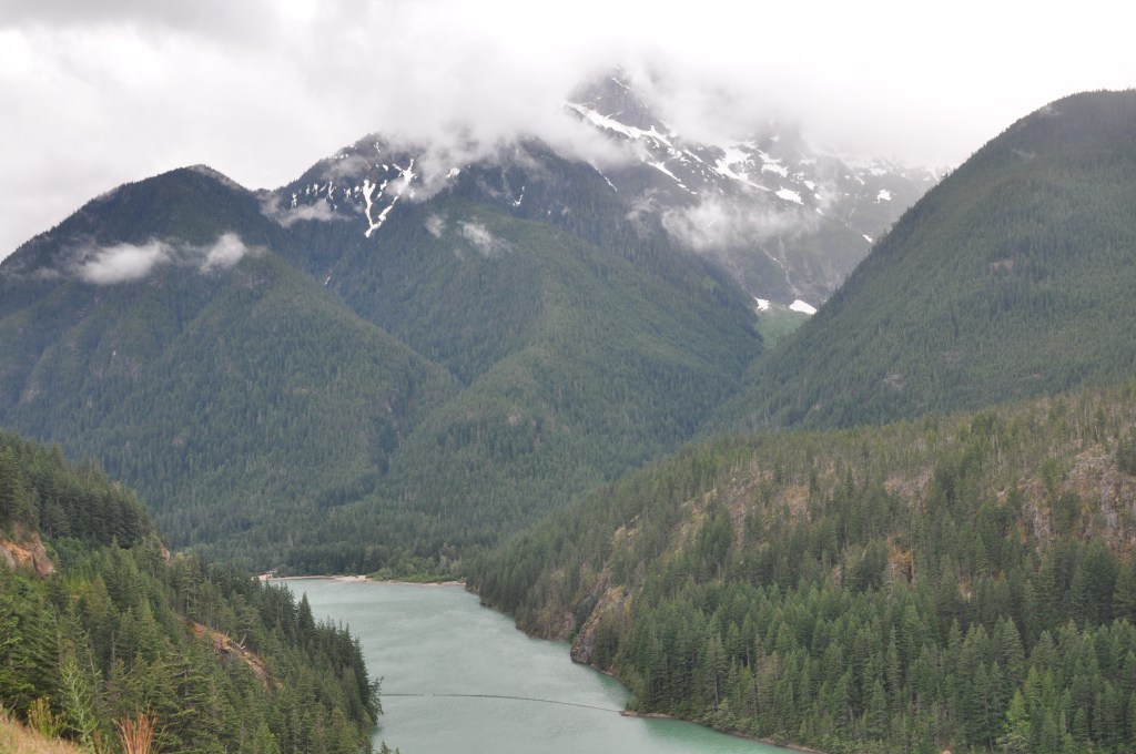
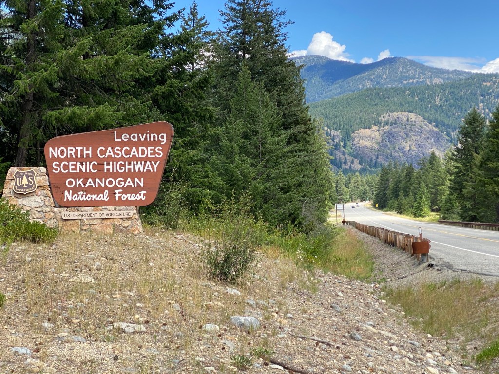
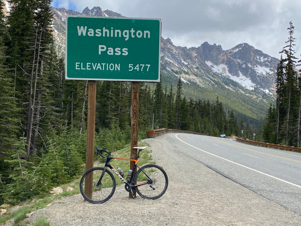
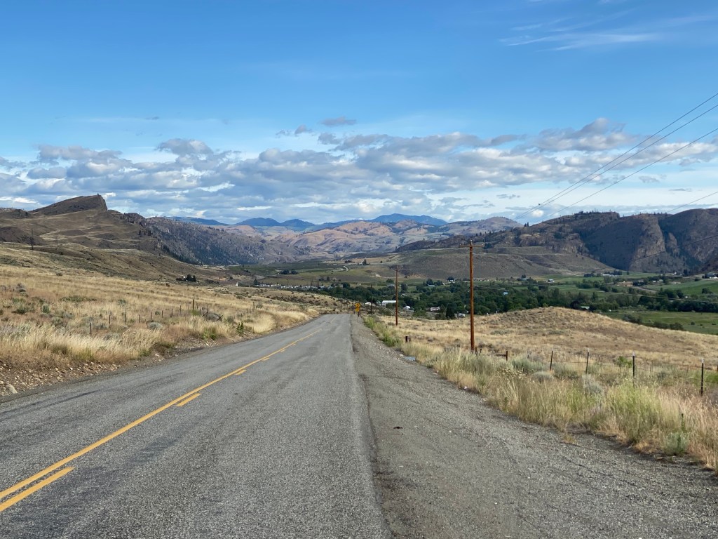
The forecast said wet – all day wet. Figured the chances of one of the tour days being a foul weather one was likely but wasn’t looking forward to it. Woke up at 0600 to wet pavement and a lingering heavy mist, not quite a sprinkle. However, while eating a continental breakfast in the hotel parking lot and getting ready for the day’s ride, the precipitation stopped and the pavement started to dry. Seemed like the Cycling Gods had a different plan than the weather prognosticators. The road is rather flat for the first 15 miles or so as the route ultimately passes through the North Cascades National Park and Okanogan National Forest. The elevation rises gradually as the road parallels the Skagit River. Most of the next 40 miles are spent pedaling uphill. Yes, there are a few, short descents but the bulk of the stretch is uphill. Rainy Pass is first at mile 51+ in the ride at an elevation 4855 ft. Along the way, the picturesque cascades are too numerous to count and stopping to take pictures would make the day unbearably longer. Suffice it to say there are many and all are photo-worthy. Lunch (packaged southwestern salad) was at the Rainy Pass picnic area. And it did rain. Thankfully we were able to erect an ‘instant canopy’ before it poured. The rain only lasted about 10-15 minus but also lowered the temperature to the upper 40’s. There was also snow on the ground at Rainy Pass. After lunch and still shivering again, the cycling resumes with a frigid 2500m descent followed by a 3-mile climb to Washington Pass at 5477 ft of elevation, the highest point on North Cascades Highway. The mountains surrounding Washington Pass are often referred to as The American Alps due to its resemblance to the European Alps. The next nearly 20-miles is a no brakes required descent into Mazama, an unincorporated community with nearly the same population as Marblemount. Totals for today are 75.3 miles, 6772 ft of climbing, and total moving time of 4:48.
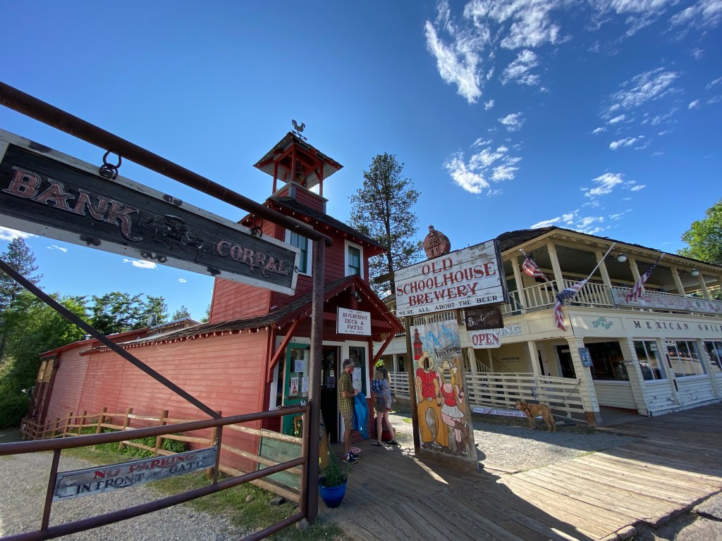
Tonight’s lodging is at the Mazama Country Inn and dinner was at The Old Schoolhouse Brewery in nearby Winthrop.


Day 3: Mazama, WA – Omak, WA
https://ridewithgps.com/routes/33017759?privacy_code=zMBEjVCso2bxeq2S
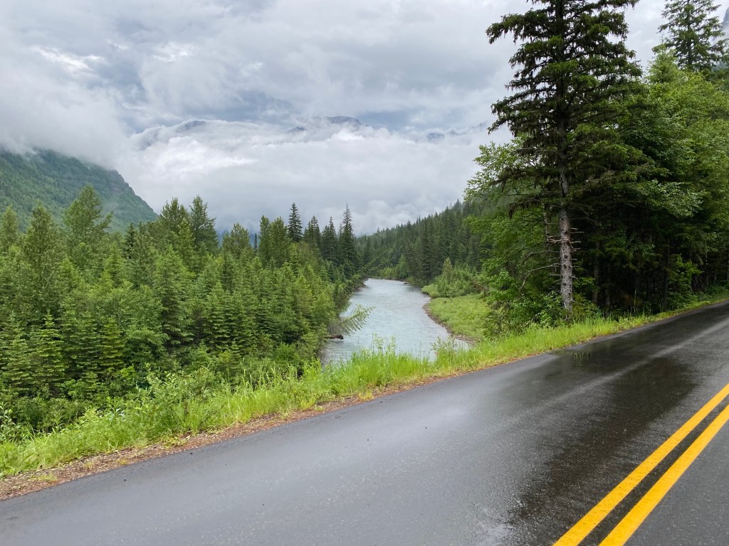
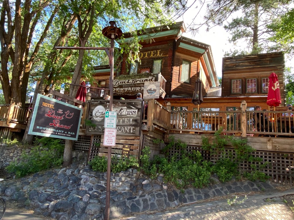
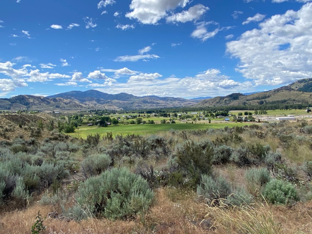
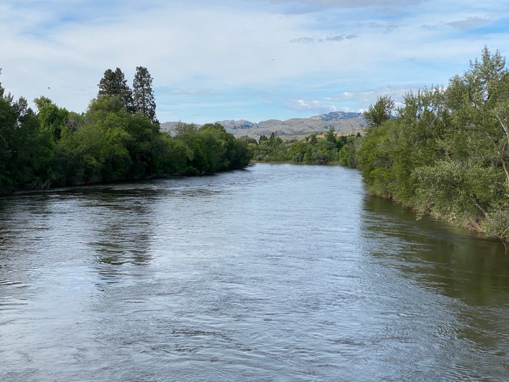
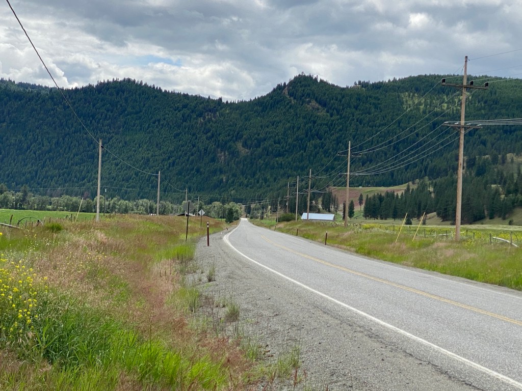
A shorter ride meant sleeping in a little longer this morning as departure was 0800. Individually boxed, light continental breakfast consisting of yogurt, hard boiled egg, and a pastry, prepared by the hotel was just a kick start to get the motor running. After an abbreviated ride overview, it was off to Winthrop for a more substantial breakfast at The Duck Brand hotel, restaurant and bar (it is for sale for those contemplating a career change). The 14-mile ride through the Methow Valley, a 60-mile long glacier valley, on North Cascades Highway 20 offers a different view from the previous couple of days. To the left are rounded, scrub grass covered hills; to the immediate right is the Methow River, and; well across the river are mostly forested hills. Only stopped once along the way for a photo opportunity.
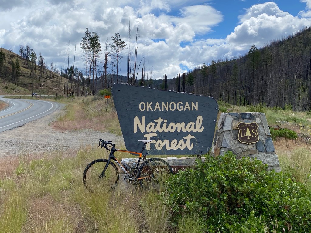
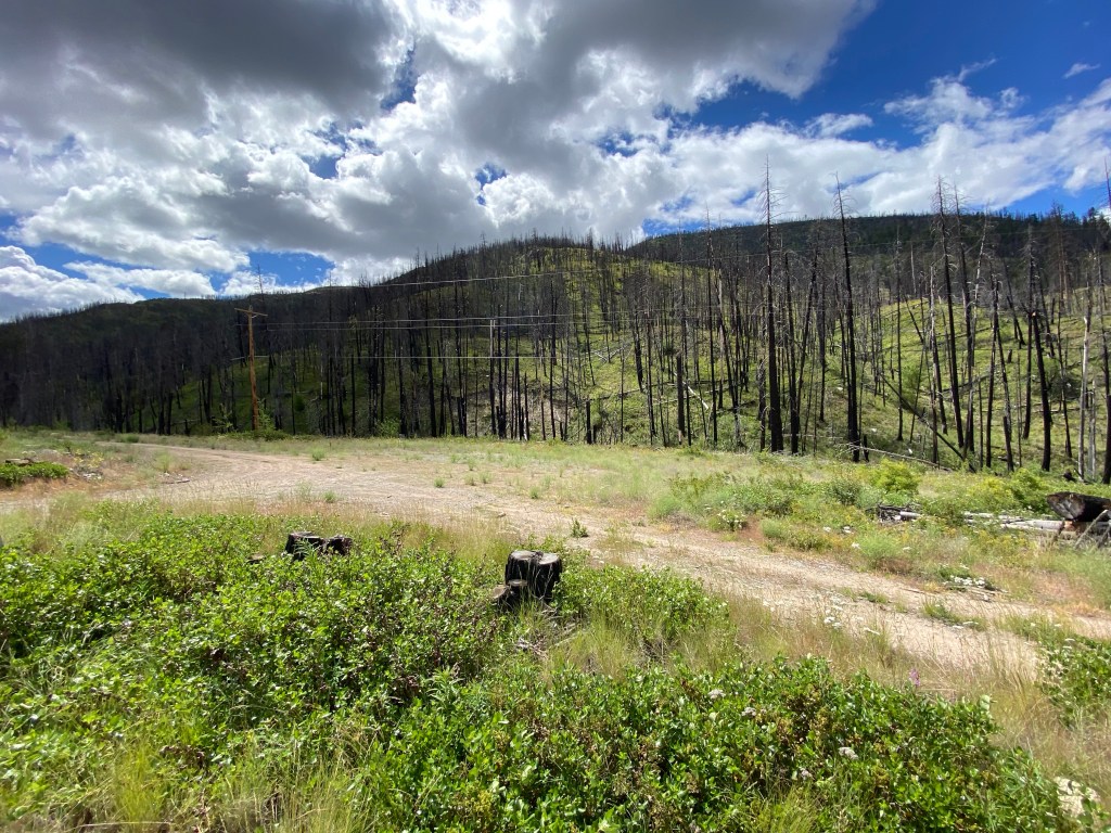
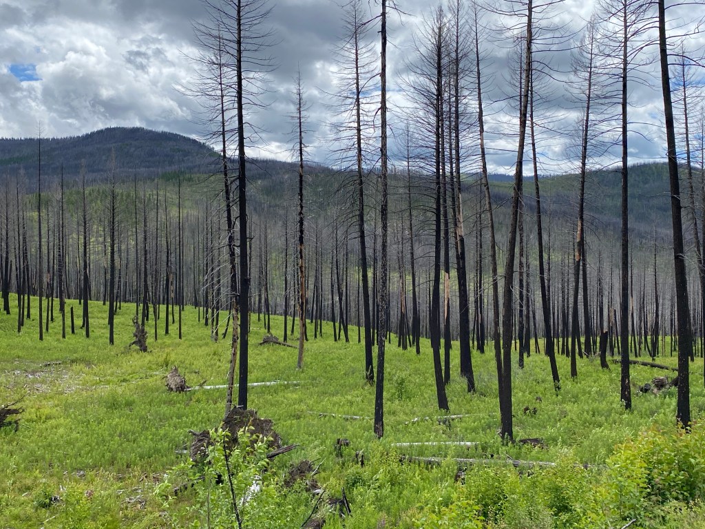
A hearty plate of delicious pancakes added more fuel to the engine in preparation to conquer the only climb of the day: a 10-mile climb through the Okanogan National Forest to Loup Loup Pass at 4020 feet of elevation. The climb starts around the 25-mile mark and while the gradient isn’t especially daunting, averaging 4.5%, it was still 65 minutes of mostly steady climbing with a couple of false plateaus thrown in for mini-recoveries. There are still visible signs of the forest fire that destroyed over 300,000 acres back in 2015. On the positive side, there is also ample evidence of regrowth and new growth.
After topping off the water bottles and a quickly consuming a guide-prepared lunch, a surprise sun shower precipitated (no pun intended) a hasty departure. Descending in wet weather is better left to others. Rode through a couple of short rain spits before leaving the foul weather behind. Most of the final 25 miles was downhill except for a short, one mile rise just to break up the monotony of being in an aerodynamic tuck position. Predominantly a tail wind for most of the ride, the descent turned blustery with more of a swirling wind with both cross- and head wind gusts. Rode past a huge apple orchard but didn’t make a photo stop. Too close to the end and legs were ready to get off the bike.
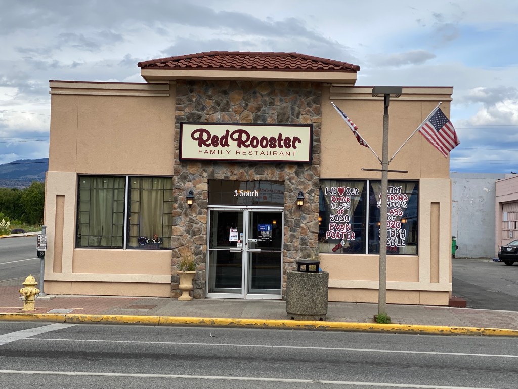
Pulled into the parking lot of the Best Western Peppertree Inn ahead of the support vehicle after 3:18 of riding and 3,432 feet of climbing over 59.3 miles. Dinner was at the Red Rooster Family Restaurant. The Chicken Genovese wasn’t too bad.


Day 4: Omak, WA to Colville, WA
https://ridewithgps.com/routes/33017726
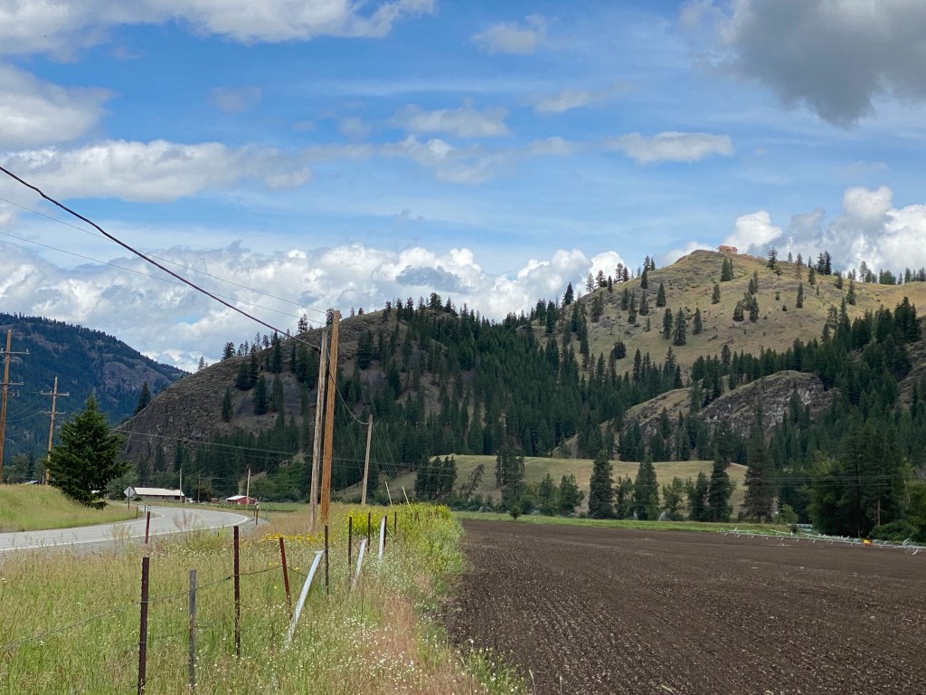
Long day meant earlier wake-up and departure time of 0730. Started the day with a rather disappointing continental breakfast at the hotel – a single egg and cheese English muffin and orange juice. Passed numerous orchards riding north out of Omak with the first 22 miles generally flat and covered at a 20 mph average. Then the fun started in Tonasket, WA shortly after crossing the Okanogan River. A series of climbs covered from mile 22 to 48 to our lunch destination at Bonaparte Lake. Once again, the gradient wasn’t daunting, mostly in the 3-4% range but there was a fair bit of it. Arrived at our lunch rendezvous ahead of the support van and had time to take a couple of photos. Since there were more miles ahead than behind, ate lunch and resumed riding. The last mile or so of the descent out of the Bonaparte Recreation Area was a little hairy due to numerous, large potholes. Needless to say, brakes were applied more frequently during the stretch. Also crossed over 8-10 cattle guards but only saw 2 cows anywhere near the road. Incidentally, that was the same number of mule deer that safely crossed my path.
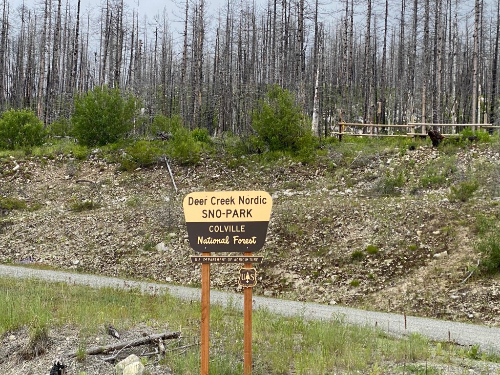
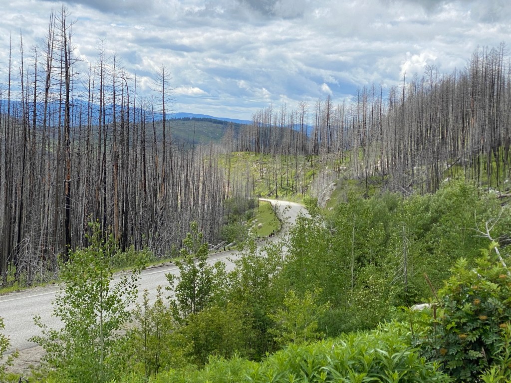
Mile 80 started the pyramid, aptly named for its ridewithgps profile resemblance to the geometric shape. It’s a 9-mile climb through the Okanogan National Forest that transitions to the Colville National Forest near the summit. Initially there was a meager power target for the climb but that was rudely jettisoned about 4 miles into the climb. The first mile and a half or is deceiving and fosters thoughts of an overly optimistic climbing time. However, the grade quickly increases from 3% to an average of 5.2% for the next 6+ miles. To add insult to injury, there’s a mile near the summit that averages nearly 7%. The power target was replaced with, just crest the climb. The devastating effect of wildfires is far more evident in this section of the Okanogan. Charred remains stand sentinel in vast hillsides of lush green undergrowth. The recovery process continues but it will take time.
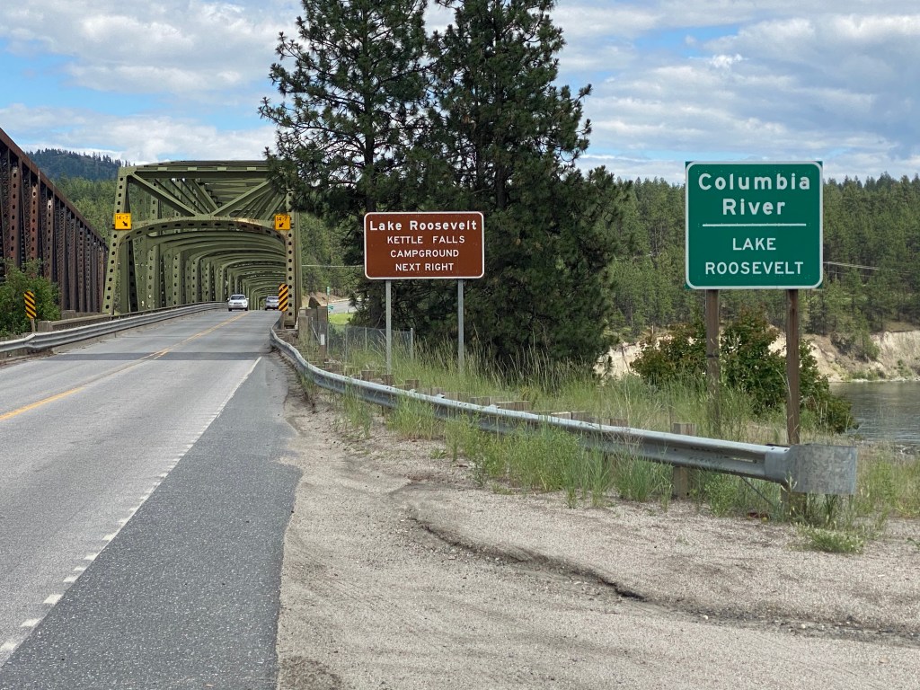
Stopped to take a few pictures just short of the summit then began the 11-mile, mostly brake-free, descent. Took a right turn at the bottom (why does it seem like most descents end at a T-intersection?) to ride beside the Kettle River for 15 miles until it merges with the Columbia River and Lake Roosevelt. After crossing the Columbia River, there’s a nasty 1.2-mile climb with an average 4.3% grade. Keep in mind, this comes at the 117-mile mark of the ride. The legs are already toast and it’s a struggle to maintain a 2.5 w/kg effort. Worse yet, the final 11 miles are into a headwind.
Finally roll into the Comfort Inn parking lot after nearly 7.5 hours of riding to cover 128 miles and 7,733 ft of elevation. Both the duration and length are PRs. Dinner tonight was at the Fired Up Brewery.


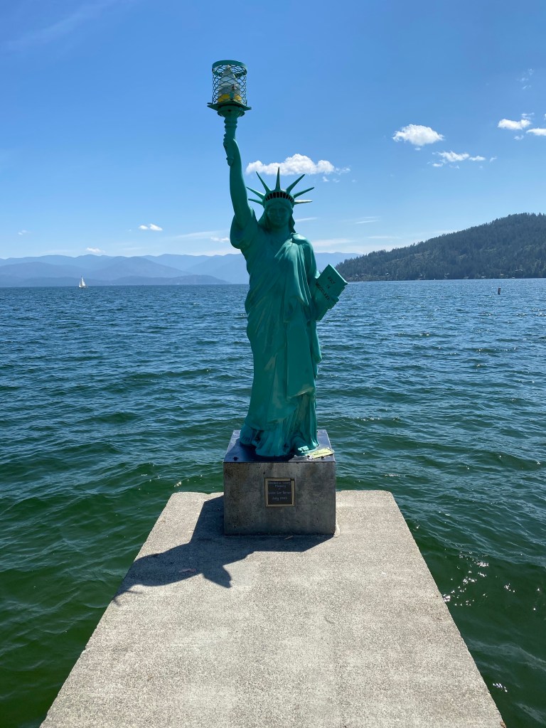
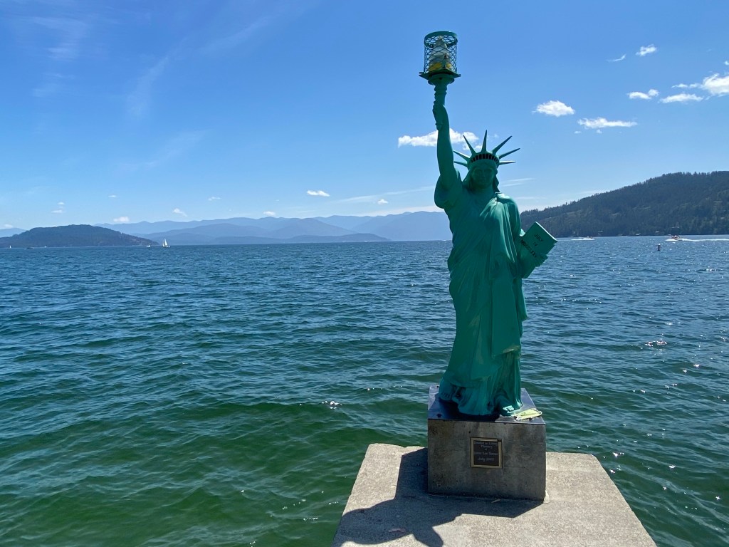
Day 5: Colville, WA to Sandpoint, ID
https://ridewithgps.com/routes/33017733
Another early wake-up and long day in the saddle. The continental breakfast at the hotel was much better than yesterday’s fare. It was self-serve and all you can eat with numerous offerings. The different approaches to customer safety in terms of food management/services between hotel chains is amazing. Physical spacing marks on the floor, ‘must wear mask’ signage, clear plastic shields at the check-in desk are common but there’s lots of room for variations. I was the only one silly (feel free to replace with another adjective of your choosing) enough planning to ride the entire route so out of bed at 0530, breakfast at 0600 and riding away from Colville by 0630.
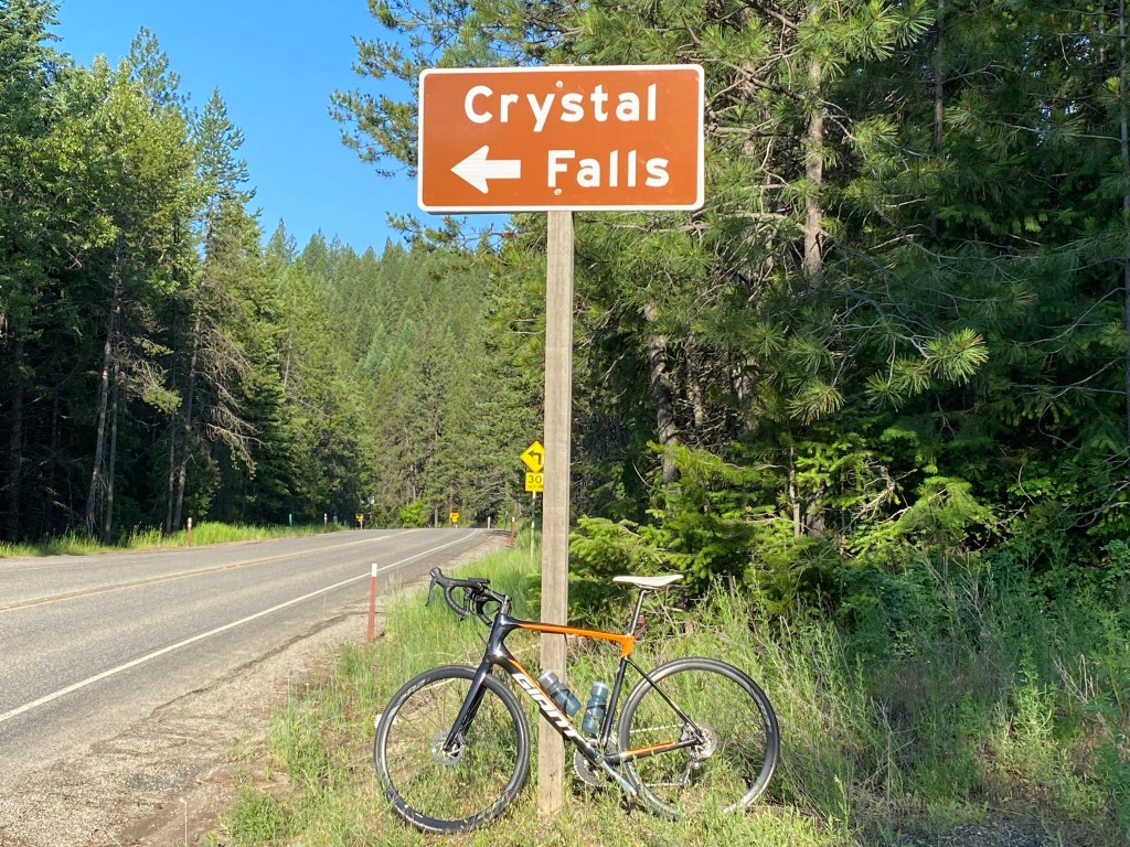
The climbing starts about one mile removed from the hotel parking lot and would cover over 3200 feet within the first 32.5 miles. Based upon the route profile, this initial portion of the route is referred to “the shark’s fin.” For those of a geometric persuasion, it’s nearly a quarter of a circle or quadrant. Most of the gradient was below 5% but after yesterday’s ride, it was still over two hours of pedaling mostly uphill. Did stop once to take a photo of Crystal Falls.
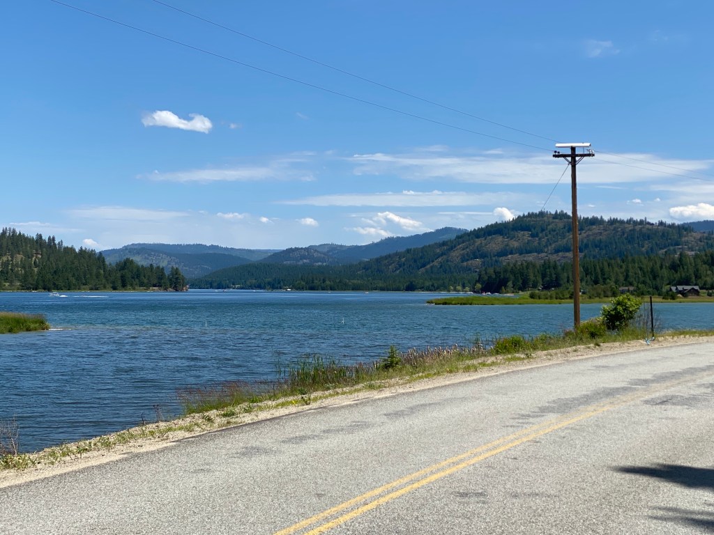
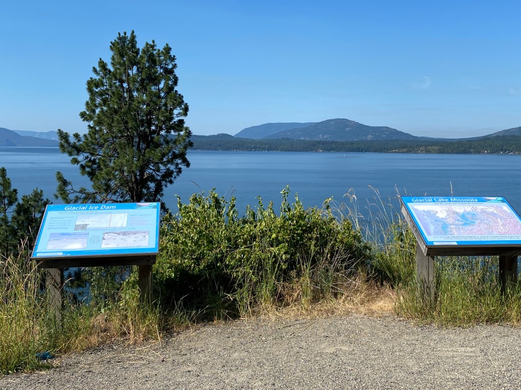
A little past the 40-mile mark, turned right onto LeClerc Rd and continued for the next 50 miles with the Pend Orielle River on the right. Interestingly, it’s one of the few rivers that flows north (at least in Washington) changing from its westward flow leaving Lake Pend Oreille enroute to the Columbia River. Caught up with the rest of the crew around the 52-mile mark for and had a decent paceline going for the next 19 miles for an early lunch stop. This stretch was generally flat with a few mild rollers. After the guide prepared lunch, the next stop was a picture opportunity at the Idaho border close to the 90-mile mark. Get to add another state to list of places I’ve cycled. It’s also the first time I’ve been in Idaho.
Crossing the Pend Orielle River in the Newport, WA-Oldtown, ID area puts the river on the left for the next 30 miles or so. Dufort Rd is a 12-mile stretch of rollers that would’ve been far more enjoyable if the legs didn’t have 230 miles and 11500 ft of climbing in them over the past 48 hours. There was a surprise 3.5-mile gravel section from 110.6 miles to 114.3. Initially ignored the navigation directions on the Roam because gravel/dirt wasn’t mentioned in any of the pre-ride discussions. The gravel was very compacted with few potholes and in much better condition than the gravel section on day 1. The final climb of the day was a 2.5-mile rise beginning just after the 114-mile mark. Typical of many climbs this week, it averaged less than 3% grade but felt worse on tired legs.
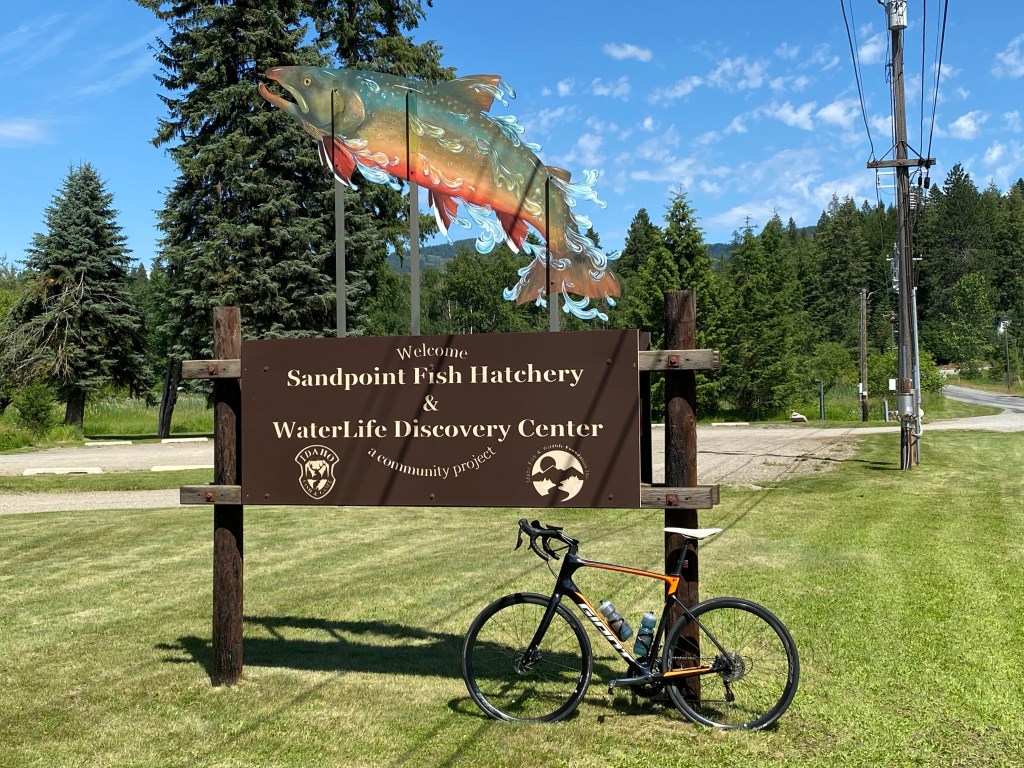
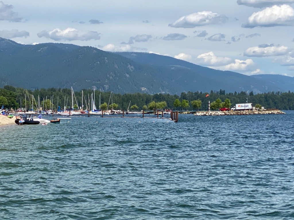
Finally, at the 122.8 mark, a left turn on the bike path (the old bridge) and a 2-mile crossing of Lake Pend Oreille followed by a couple more turns and today’s ride ends at the Edgewater Resort in Sandpoint, ID.
Today’s summary is 125.6 miles with 5,022 feet of climbing in 7 hours and 16 minutes of moving time.
Dinner this evening is at the hotel restaurant, Trinity at City Beach.


Day 6: Sandpoint, ID: Schweitzer Resort Road Climb
https://ridewithgps.com/routes/33250919
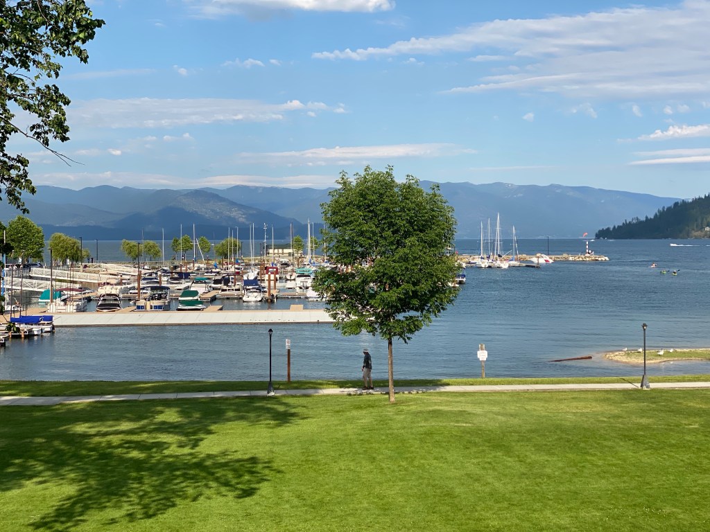
Today is an off day – time to do whatever. So naturally there’s another ride. A short one but it contains an 8.5-mile climb up to Schweitzer Mountain Resort. Today it’s only me, the two guides plus a former BA guide who now makes Sandpoint his home. Wisely, the others decided to sleep in. Thankfully it’s an easy paced ride as we all stay together up the climb. From a gradient perspective, this is the hardest climb so far as it averages 5.6%. There are several switchbacks with long, fairly straight stretches in-between. The legs don’t have much in them and even maintaining 2.7 w/kg is an effort. HR is in the proper range but local muscle fatigue in the quads make the climb a mental challenge as well.
There’s a fair bit of construction activity at the summit – condos, private residences, expansion of the ski village. The view back down to the lake is stunning. After a raspberry scone and orange juice, time for the descent which is a little too technical for my comfort levels. Lots of brake at the hairpin turns to slow down the 40+ mph straighter sections.
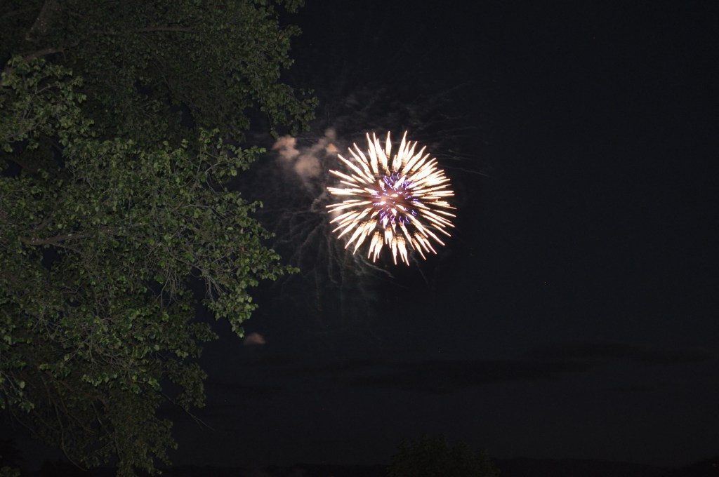
After a quick change of clothes, it’s off to Spuds Waterfront Grill for breakfast – French toast and breakfast potatoes. Will have to remember to start including pictures of the culinary aspect of the trip. Rest of the day is relax, early dinner, then watch the fireworks display from the hotel balcony.
Return to Trinity at City Beach for dinner: house green salad, portobello mushroom stuffed ravioli, fresh roles, and a side order of fries. Water and Laughing Dog Amber to drink!


Day 7: Sandpoint, ID to Libby, MT
https://ridewithgps.com/routes/33017745
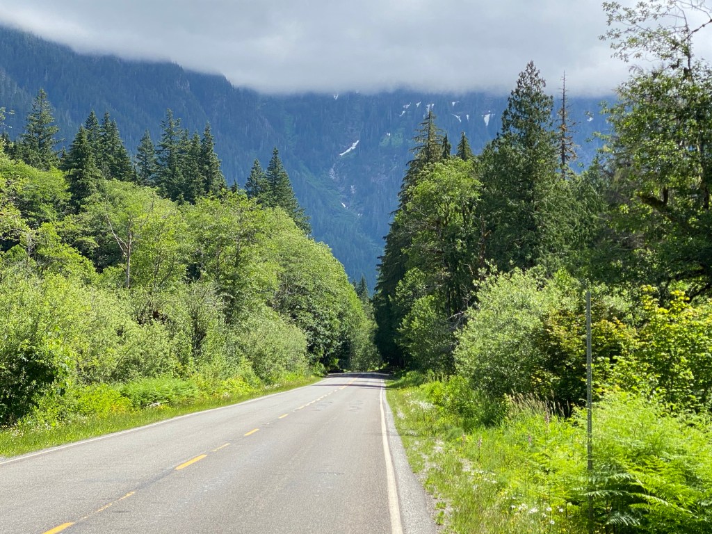
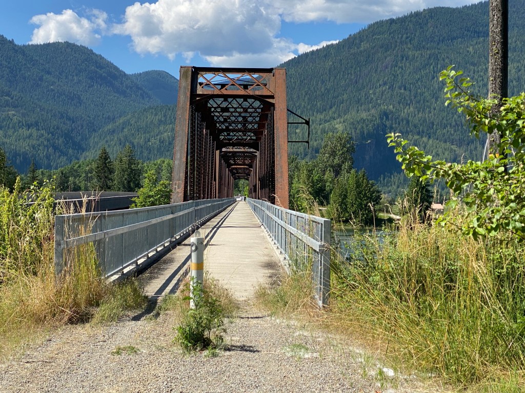
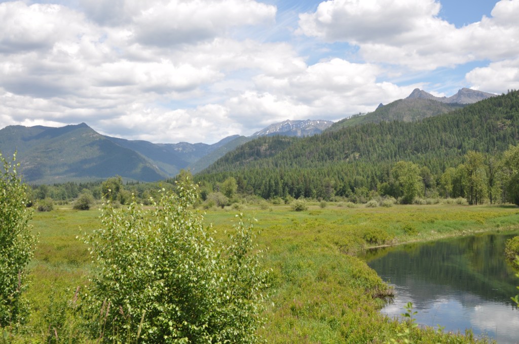
The 4th of July fireworks and festivities enabled a later start – 0800 for breakfast at the van which included muffins, Greek yogurt, croissant and juice. Today’s ride was just short of a century with considerably less climbing than previous days. It would be a good barometer of muscle recovery after the short ride yesterday and climbing to follow in the next two days. Goal today was 2.5 w/kg average on the flats and hold tempo pace, 3.5 w/kg, on the few sustained climbs. The route would primarily follow a series of waterways leaving Idaho and entering Montana. The first 1.5 miles headed north on the Sandpoint Byway Bike Trail until it ends at ID-200. The next nearly 15 miles skirted Lake Pend Oreille (pronounced pond oh-RAY and means “hangs from the ears” or “earloops” in French) and its various tributaries and watersheds in a clockwise direction: Pack River, Ellisport Bay and Denton Slough. The road is sandwiched between the lake on the right and the Kaniksu National Forest on the left and runs generally flat with numerous cutouts to enable photo opportunities.
A slight left just past mile 16 onto Business Loop 200 provides an elevated view of the waterway on the right. Riding through Clark Fork and crossing the river that shares the same name will keep the river on the left all the way into Idaho. The first real test for the legs comes at mile 31 with a 1.5-mile climb ranging between 1 – 3.5% grade. Not a significant challenge but legs respond well and able to remain in the big chainring. A more rigorous test would shortly follow with a 3-mile climb with short pitches exceeding 7%. Once again, able to stay in the big chainring. As it turned out, the entire ride was in the big chainring.
The advertised 3-mile gravel section went the way of many Loudoun County gravel roads – replaced with fresh, smooth asphalt. Apparently, Montana is not a proponent of geographic signage as there was no indication of a border crossing. Looking at the ridewithgps file, seems that the fresh pavement started at the state boundary. A return to the 200 designated roadway, albeit ID 200 shortly after crossing the Clark Fork River again near Heron, ID puts the waterway (Cabinet Gorge Reservoir) back on the right. Weirdly, new iPhone 11 Pro died, battery fully discharged, and no longer had access to music or camera. A sneaky left-hand turn, don’t miss it, travels north through most of the Bull River Valley with the Cabinet Mountains and Kootenai National Forest providing contrast. The road undulates and progresses to short sections of rollers. Legs remain strong and able to keep a greater than 19 mph average while still keeping AP below the 2.5 w/kg target.
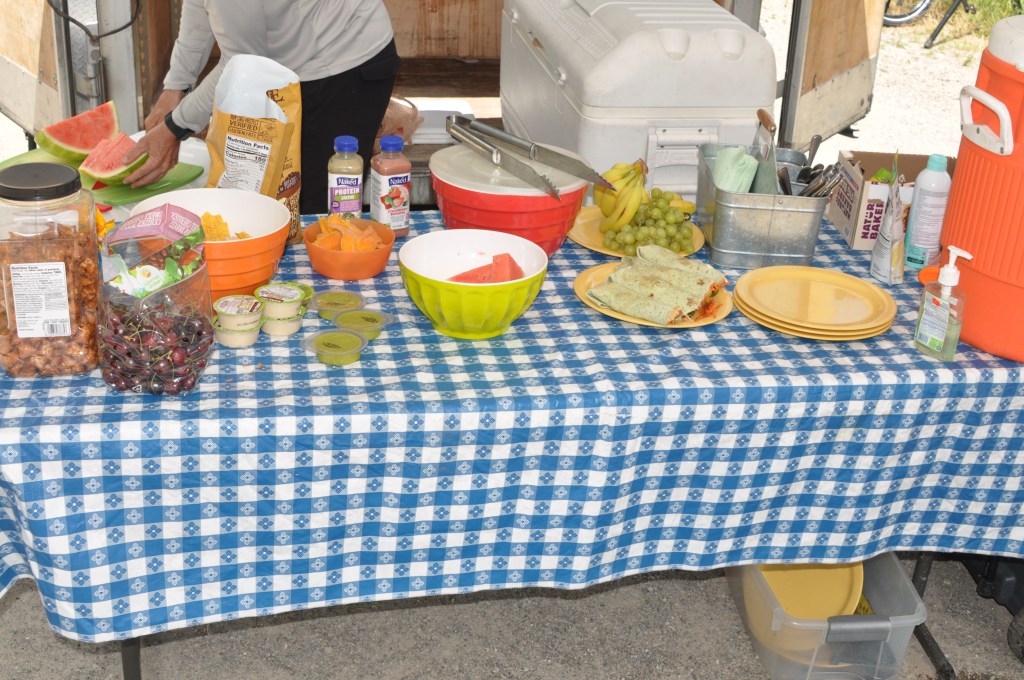
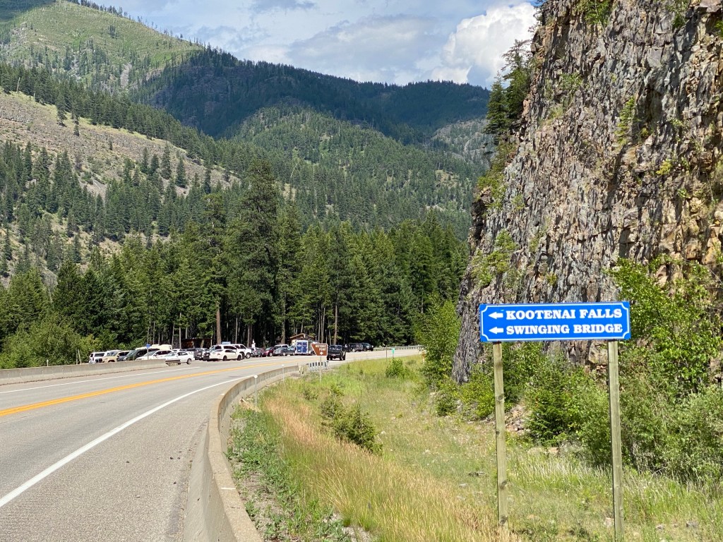
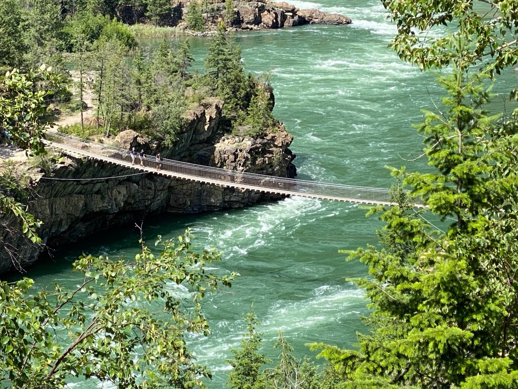
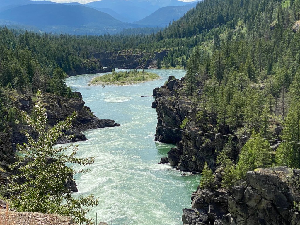
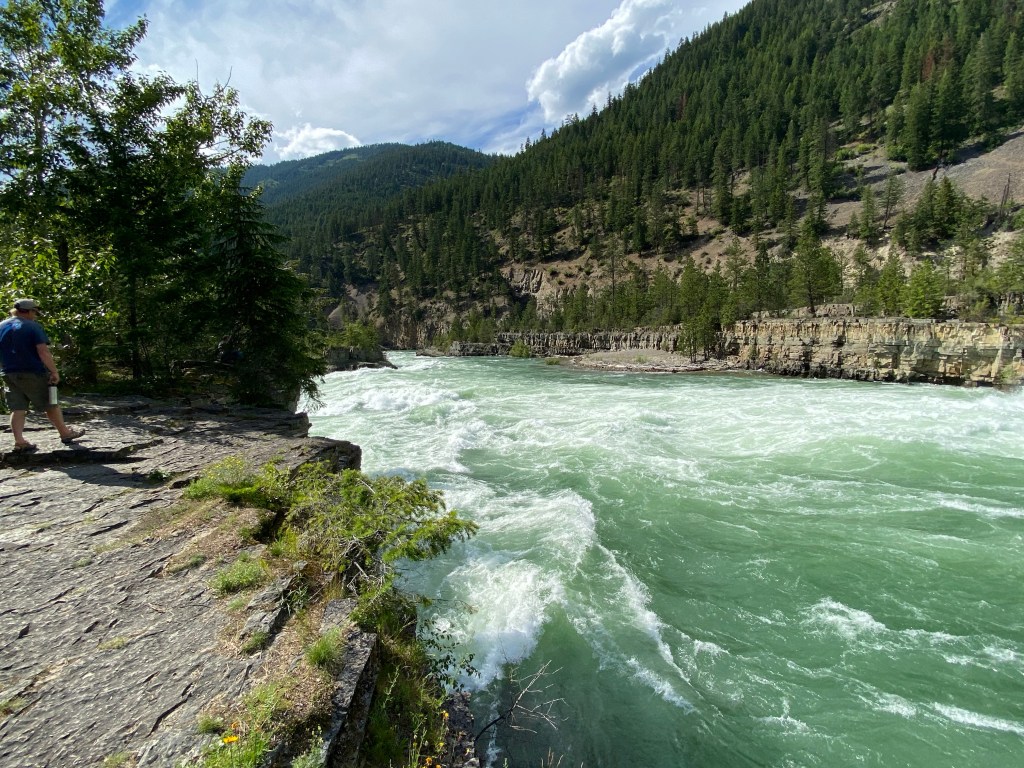
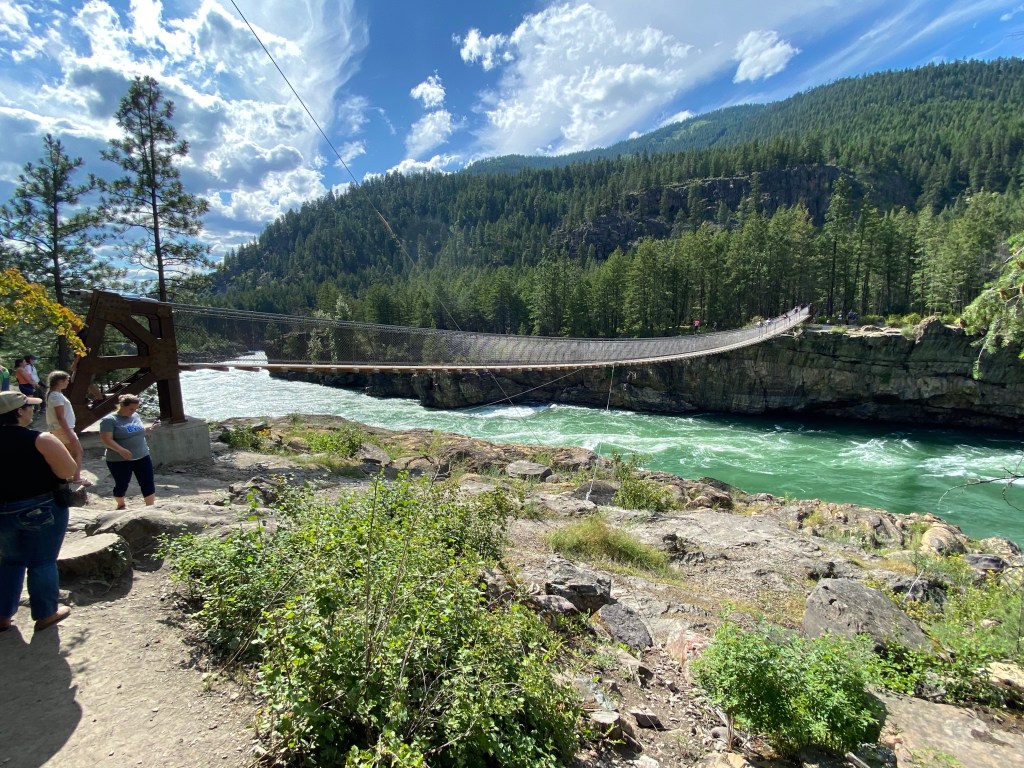
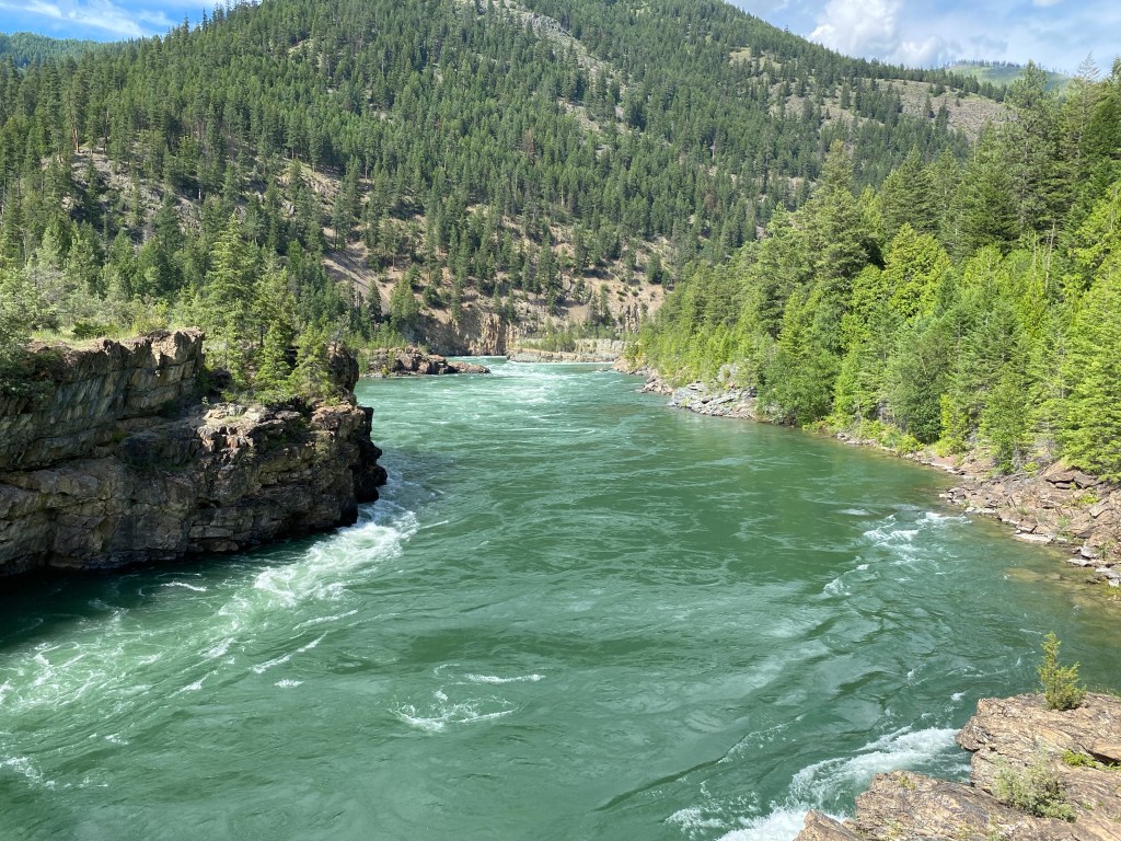
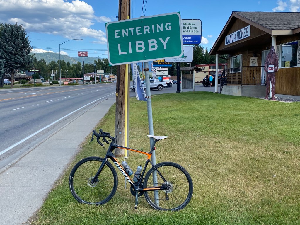
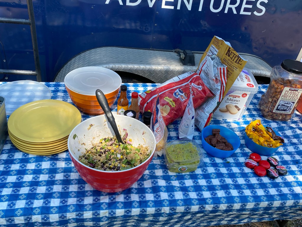
Lunch is near the 62-mile mark in a cutout next to the Bull River. Gorgeous scenery and lunch is the best yet – chicken and apple wraps, banana, and watermelon. And a surprise birthday cake! Left the iPhone charging in the support van for the next stretch. After a rather lengthy pause, the ride resumed with the next stopping point, Kootenai Falls and ice cream at mile 87. The rollers continue and get a little longer but grade rarely exceeds 3%. Executed a u-turn upon reaching the Falls to add a few miles to ensure the ride is at least a century. Have 2 scoops of birthday cake ice cream and walk to both the Falls and the swinging bridge for photos. iPhone was sufficiently charged to take pictures. Only 11 miles remain until Libby, MT. Rollers continue and able to increase overall average speed to 19.7 mph at just under 2.5 w/kg.
Lodging at the Montana Country Inn and walked across the street to the Switchback Bar & Grill for dinner. The restaurant was experiencing staffing challenges which delayed the preparation and delivery of the food. The waitress was struggling but wasn’t her fault at all. Ate way too many of the fried pieces from the Switchback Sampler and ate 2 entrees – chicken burrito and chicken parmigiana. And had a piece of surprise birthday cheesecake. Not a huge fan of cheesecake but it was pretty good. Once again I am remiss in providing photographic evidence of the meal.
Total for today is 102 miles, 3,192 ft of climbing with 5:10 of moving time. TrainingPeaks app and web version provide different weekly totals but web version provides the following summary:
Duration: 35:37 hms
Distance: 614 mi
TSS: 1539
El Gain: 32966 ft
Work: 23473 kJ


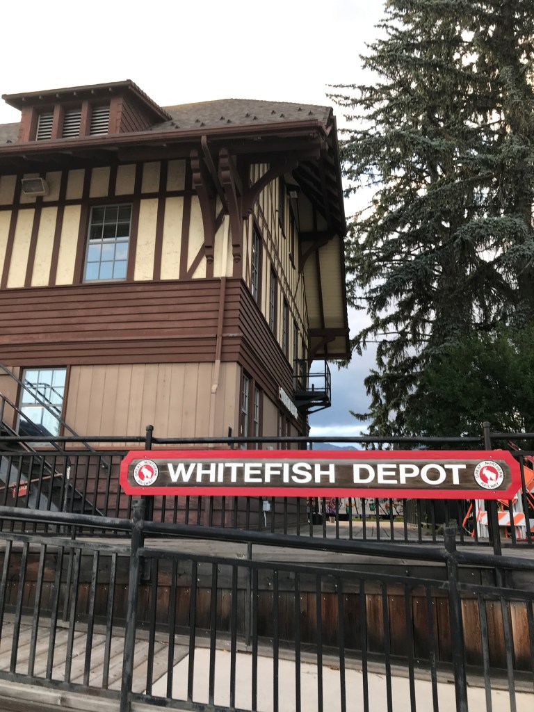
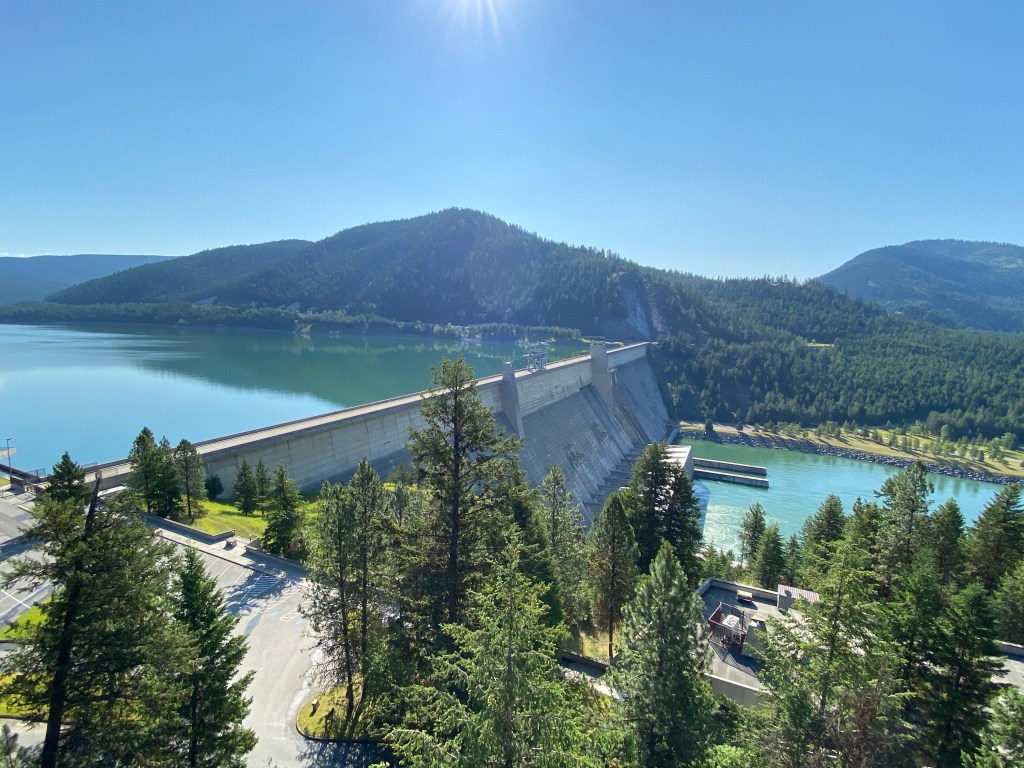
Day 8: Libby, MT to Whitefish, MT
https://ridewithgps.com/routes/33017713 (itinerary route)
https://ridewithgps.com/trips/52240976 (actual first route)
https://ridewithgps.com/routes/33320865 (actual Whitefish route)
Depressingly, only two days remain on the Epic Empire Adventure. Today’s ride was scheduled to be 76 miles and riding in the support van for the last stretch to stay off the busy highway to Whitefish. Departure time was 0800 with a short ride down the road to Henry’s for breakfast: stack of pancakes and hash browns to get the day started. The route had more elevation than the previous day but only one major climb up to Libby Dam. Yesterday’s recovery was short-lived. Today was going to be a dead-leg ride.
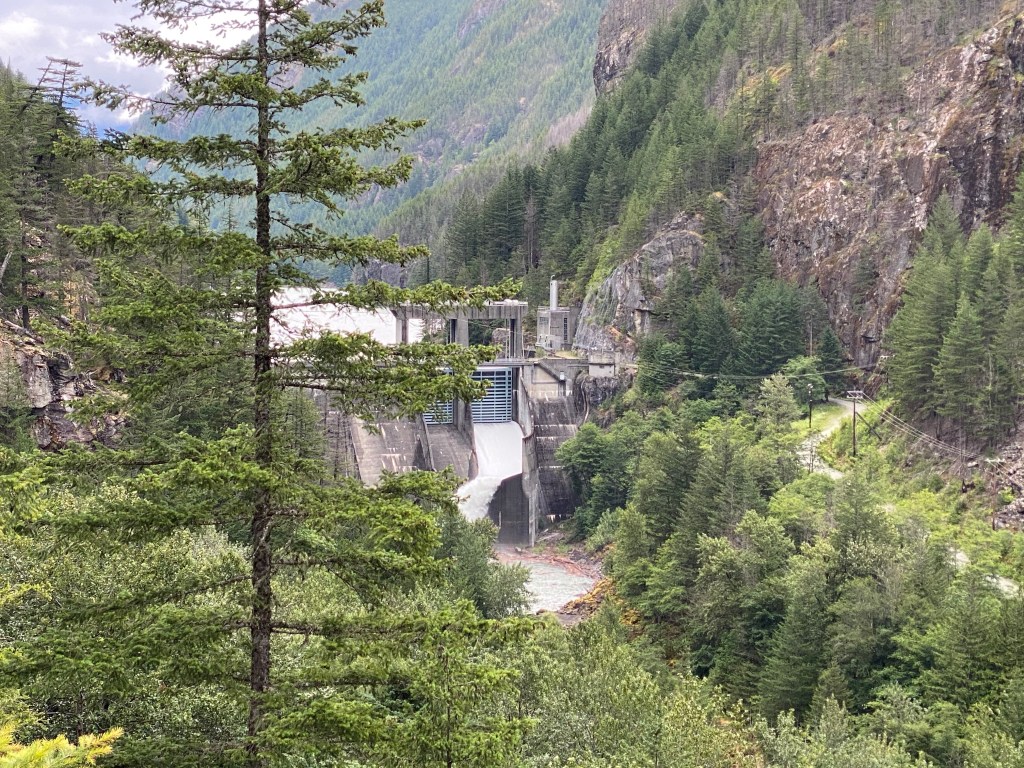
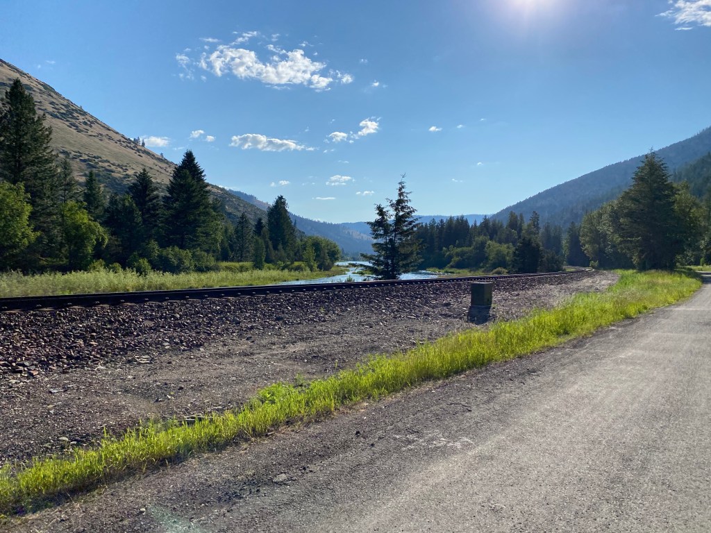
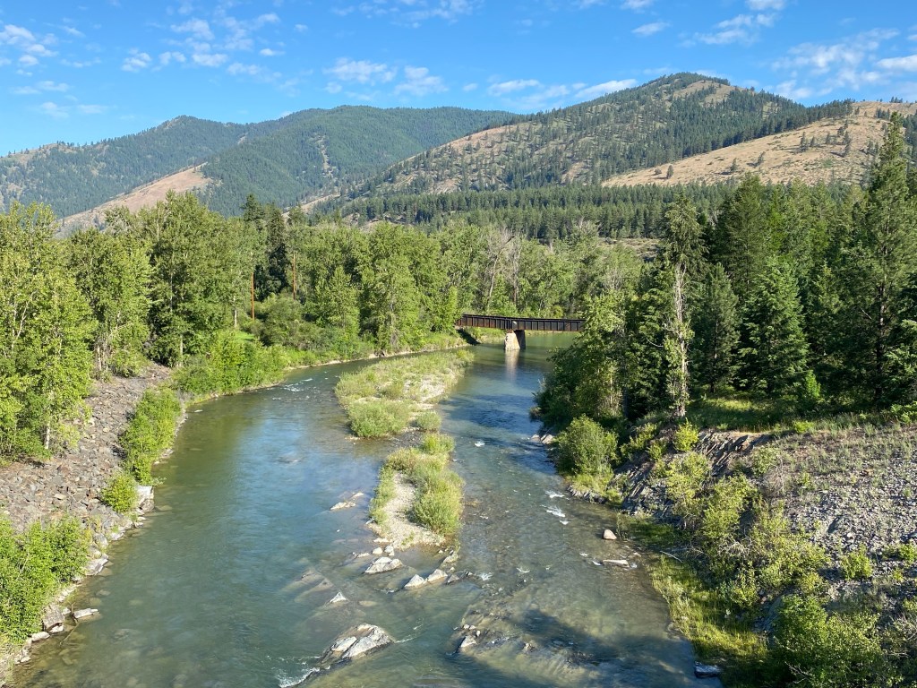
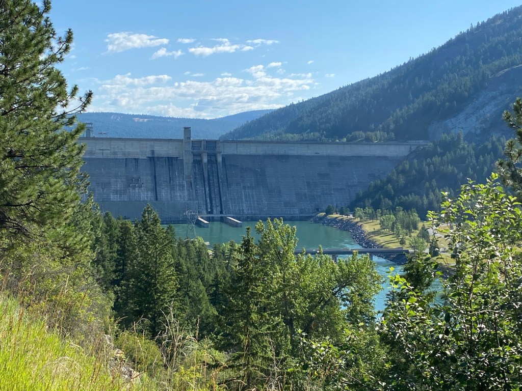
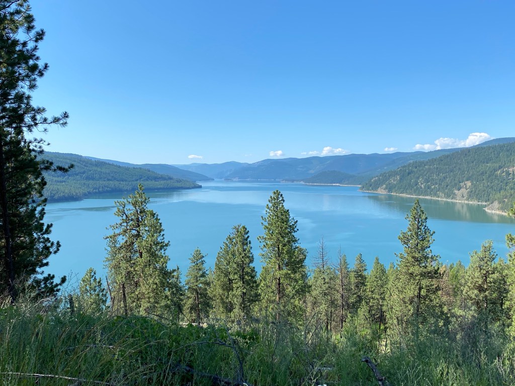
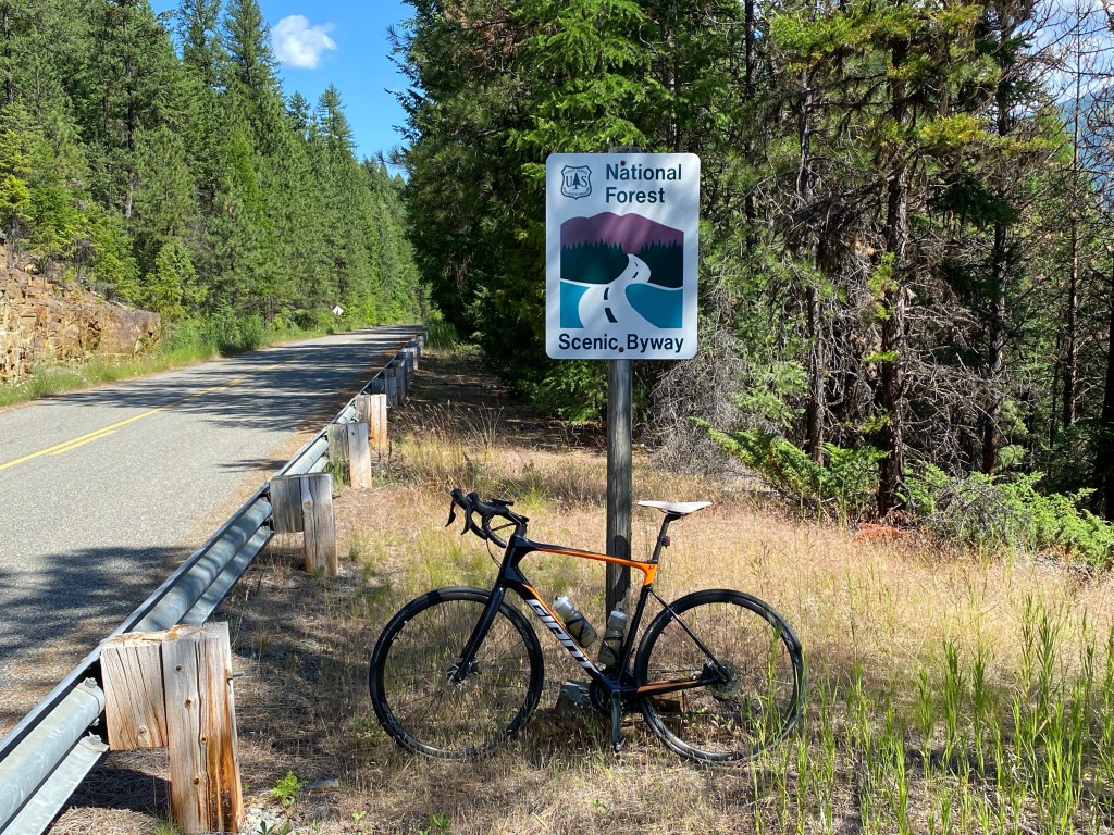
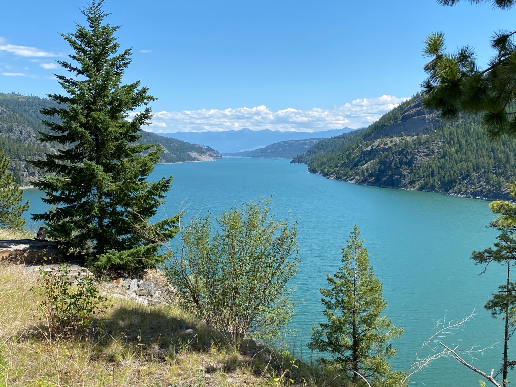
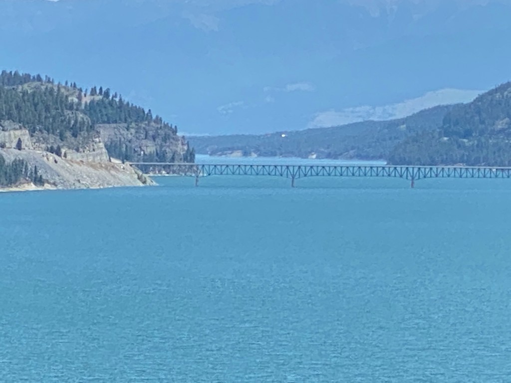
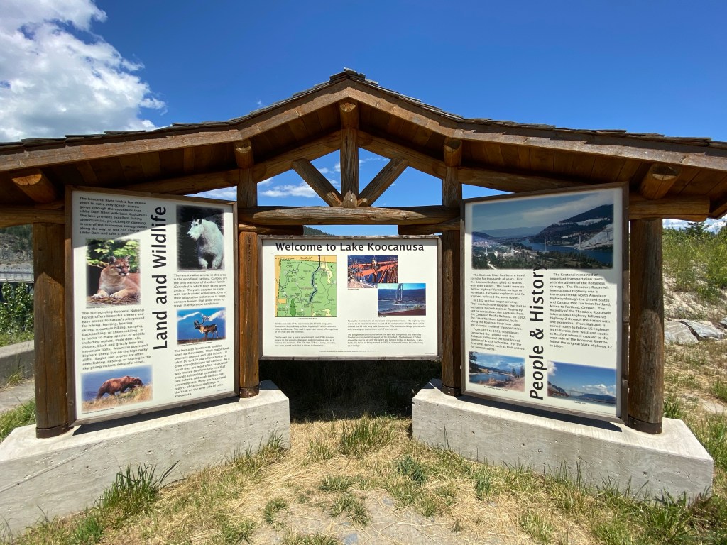
After breakfast the route heads east through Libby connecting with MT-37 S. This is a narrow two-lane road with minimal traffic, essentially a wide bike lane through the Kootenai National Forest. Second bear sighting of the trip but further away than the first one and no picture. Crossing the Kootenai River about 15 miles outside of Libby, the next 45 miles are on a forest development road (FDR no. 228) also called a National Forest Scenic Byway. The two-lane road is closed in the winter and stays on the western side of the river and Lake Koocanusa (created by the dam). The 2.5-mile climb to Libby Dam begins around the 17.5-mile mark and averages 4.1% with a max grade of 9%. The 422-ft dam ended the seasonal flooding caused by the Kootenai River and created the 90-mile long Lake Koocanusa which extends well into Canada. The name was the winning entry of a naming contest derived from the first 3 letters of KOOtenai River, CANada, and USA. After the obligatory stop at the dam for pictures, the road still climbs for a bit then becomes a series of rollers with a few that graduated to actual climbs. The sluggishness of the legs is surprising based upon yesterday. Didn’t intend to push the pace then but apparently did as they want to part of any sustained effort. Lots of coasting and easy pedaling today. Passed by only a single vehicle going north on the FDR and that was on the climb to the dam. Saw maybe a dozen vehicles headed south. Lunch is at a cutout overlooking the Koocanusa bridge at the 60-mile mark. A guide prepared salad and fruit are the main items on the menu today.
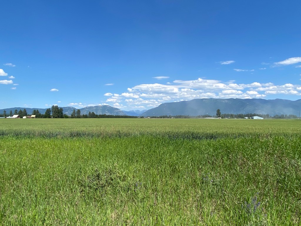
Group decides to start the van ride early with the option of riding around Whitefish once we arrive. Once again, it’s me and the guides for a 28-mile ride around Whitefish that was downloaded from ridewithgps. Pace is very easy and legs are better than morning ride. Go figure; miles 80-94 seem easier than miles 50-60. Big Sky county is in full effect on the ride with a fair amount of gravel thrown in as well. Passed a huge canola (technically no such thing as canola plant – the yellow flowering plant is a specially bred variant of rapeseed that is low in erucic acid) farm with several gigantic fields and Hammer Nutrition headquarters.
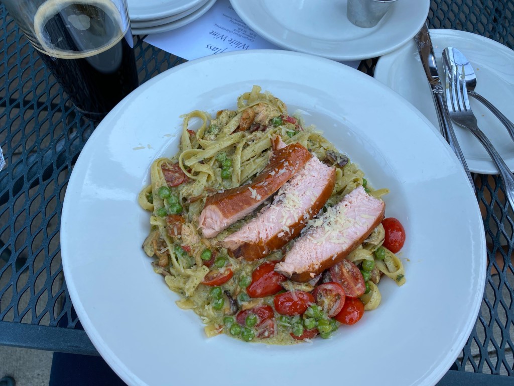
Lodging is at the Grouse Mountain Lodge with dinner at the in-lodge Logan’s Bar and Grill. Dinner was Pesto Fettuccini with smoked salmon.
Ride summary is 94.1 miles with 4,013 ft of climbing over 6:04 of moving time.


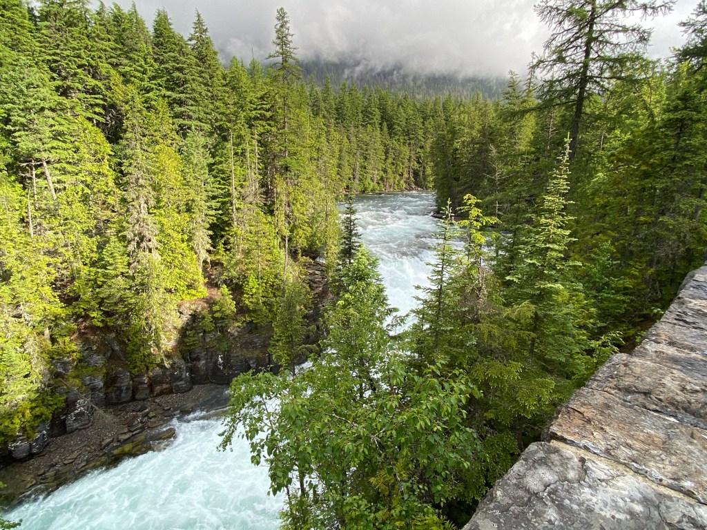
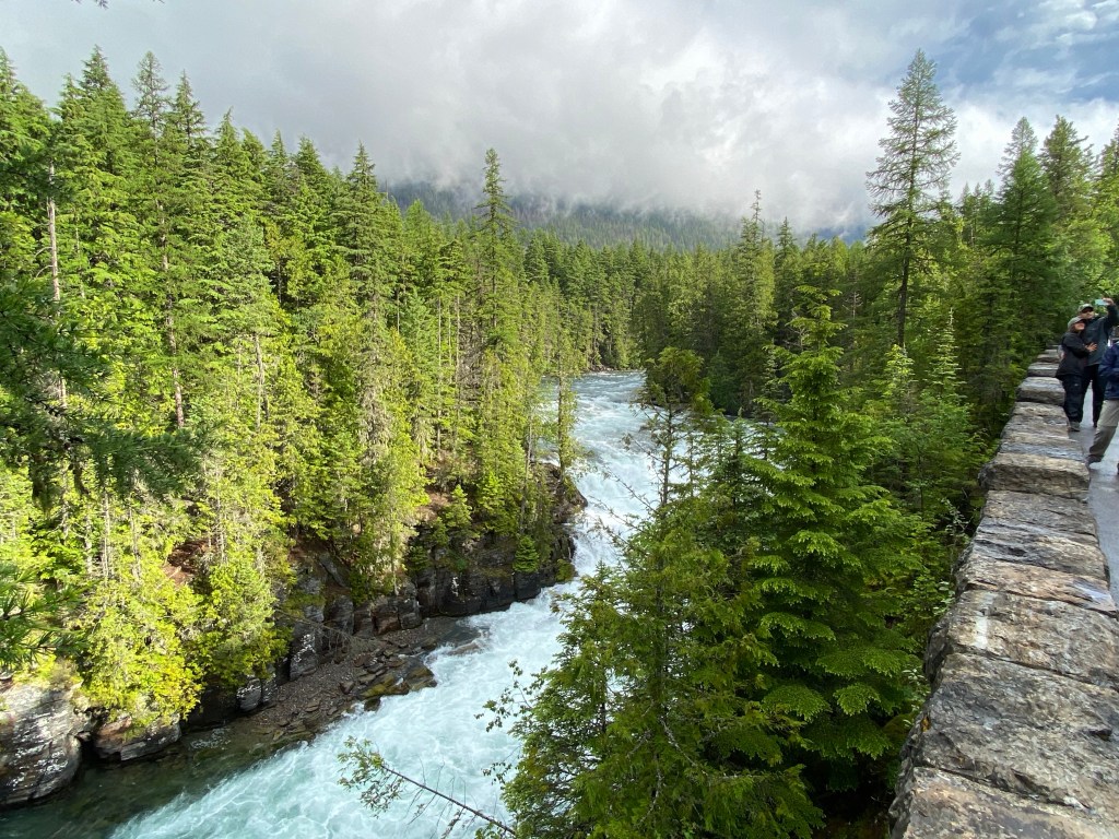
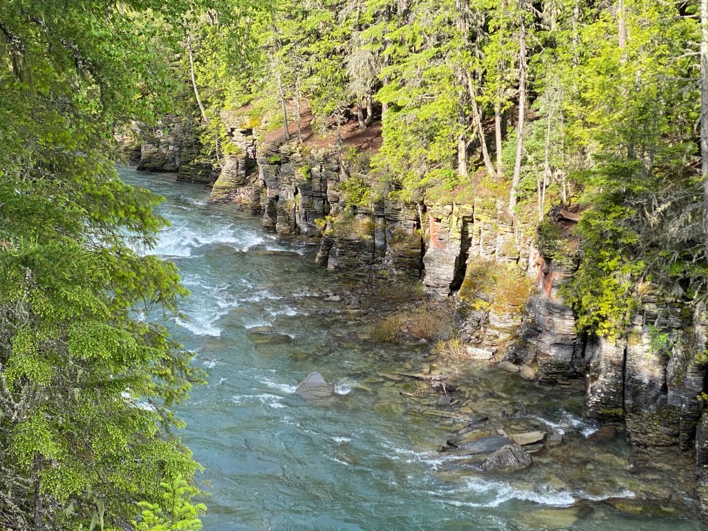
Day 9: Going-to-the-Sun Road to Logan Pass/Continental Divide
https://ridewithgps.com/routes/33017765 (itinerary route)
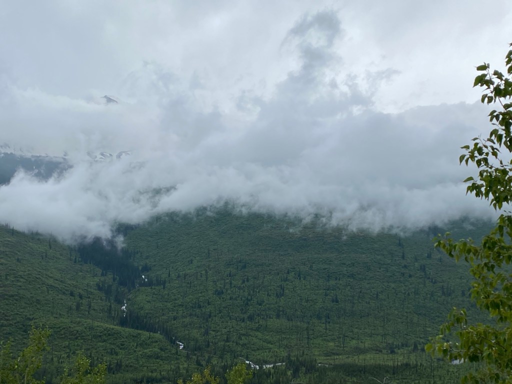
Inauspicious start to the final cycling day of the tour. Forecast called for rain and it was correct. Group called another audible and adjusted the schedule. Ordered and picked up the breakfast-to-go then rode in the support van to Apgar Village. If light rain continued, plan was to ride as far as possible. Weather forecast called for a mid-morning break but then nasty weather around 1 pm. Heard from other guests at the Lodge that the road was closed to motor vehicle traffic at Avalanche Trail but didn’t know about restrictions for cyclists. Fortunately, the cycling gods were watching and stopped the rain before the van made it to Glacier.
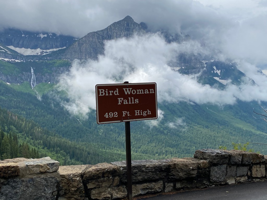
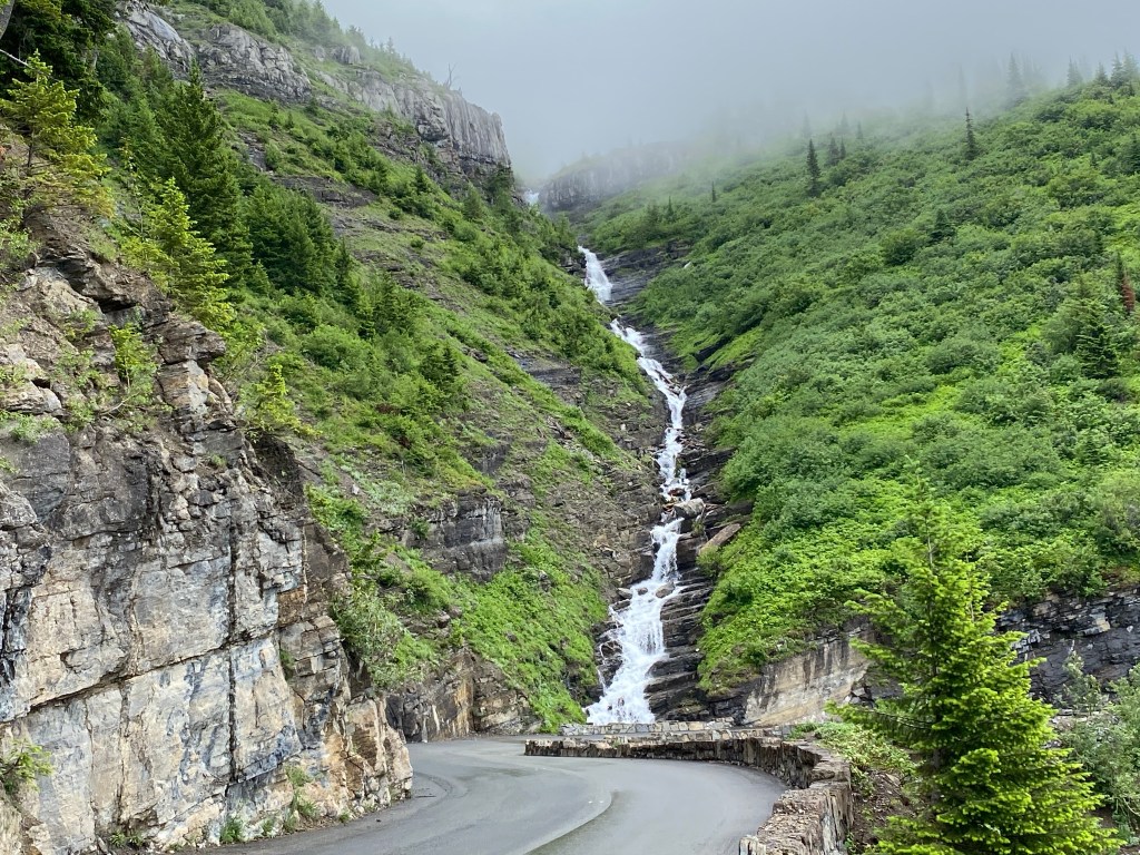
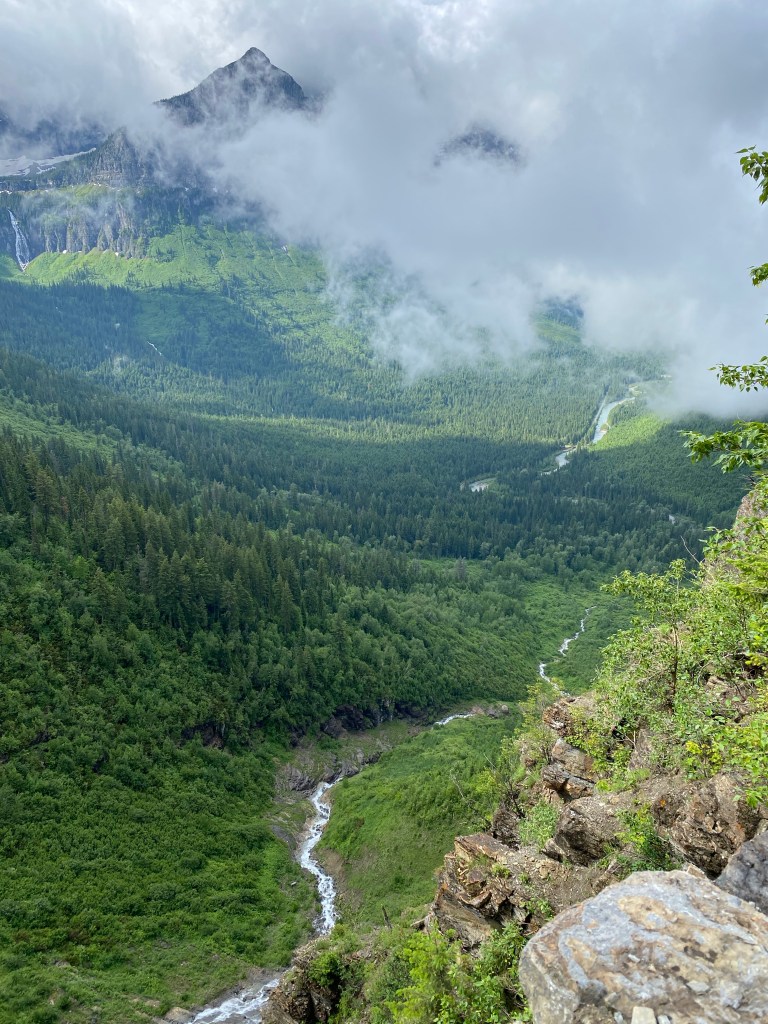
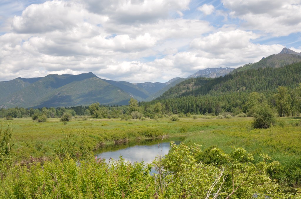
It’s 30 miles from Apgar Village, elevation 3169 ft, to Logan Pass, elevation 6646 ft, with the last 10 miles being the climb. The road runs between the Livingston Range on the left and Lewis Range on the right; both of the Rockies. The first 20 miles only has 700 ft of elevation change. Legs are better than yesterday but not as good as two days ago. There’s minimal vehicular traffic at 8 am and the trip to Avalanche Trail goes quickly although there are a few stops for pictures. It could easily take an entire day driving to the summit as there are so many spectacular views and photo opportunities. The guide arrives first at Avalanche and learns a ride to the summit isn’t going to happen today. The road is closed to all traffic a short ways beyond “the loop.” Very disappointing that won’t be able to cross completing Going-to-the-Sun Road off the Bucket List. Logan Pass was just recently cleared of all snow but road repair is still ongoing. Well, at least the rain stopped. The ascent starts right at the 20-mile mark and much of the gradient falls between 3.5 – 5.5% although there are brief pitches that hit nearly 8%. The road is closed at Bird Woman Falls – about 4.5 miles and 1300 feet short of Logan Pass. The climb isn’t hard and the scenery demands a casual pace. This ride isn’t about power goals or anything else. Just enjoy the moment. Everyone on the tour made it to the Falls.
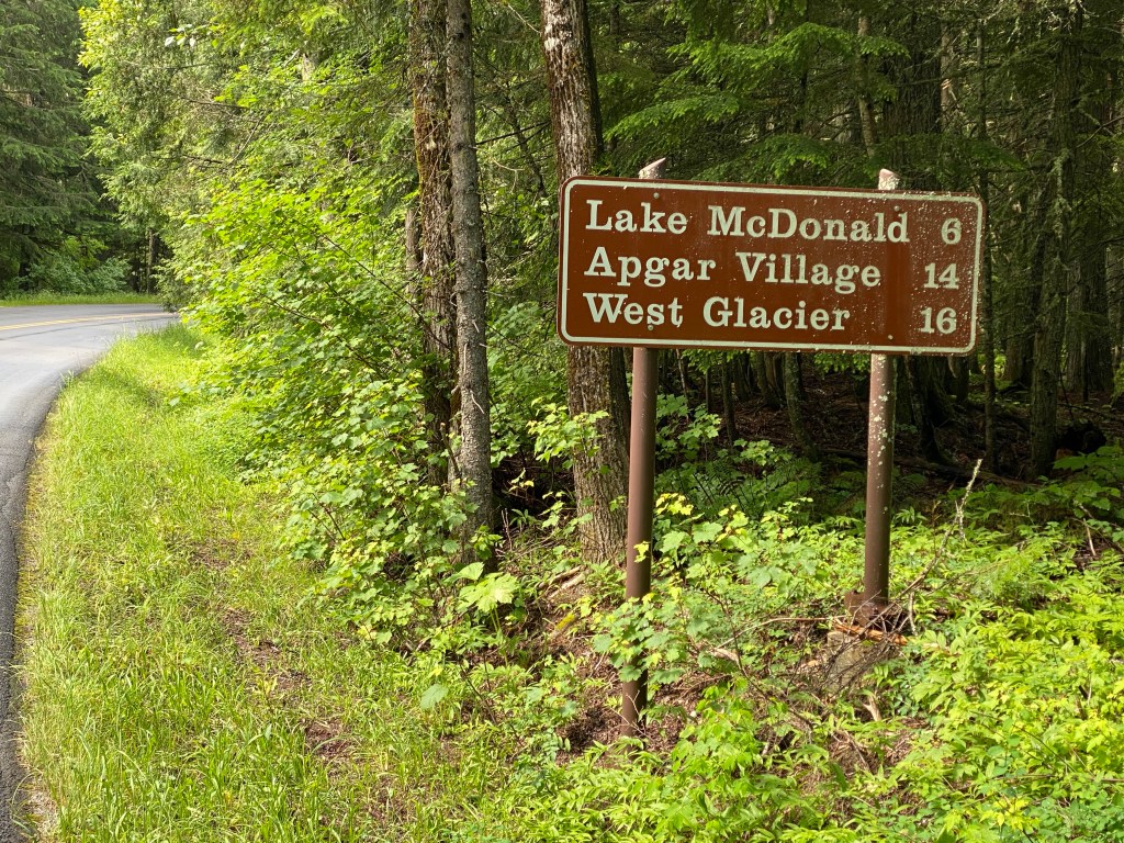
Although the rain stopped, the pavement is still wet and the descent was easy but frigid. Legs seemed to have forgotten how to pedal once the road leveled out. Quads were cold, definitely not a smooth pedal stroke. Portion of rode beyond Avalanche Trail was filled with cyclists. Not being a bike snob but would categorize most of them as recreational cyclists. Doesn’t matter. They were out there riding. Would be interesting to know how far most of them went but that question will remain unanswered. Returned to Apgar Village but was stopped and scolded by a Park Ranger for being on the road between 11 am – 4 pm. Didn’t argue that the placement of the signs (i.e., northbound and southbound cover different sections of the same road) was confusing. Was less than a mile from the Village. Apologized and thanked her for not issuing a written warning or citation.
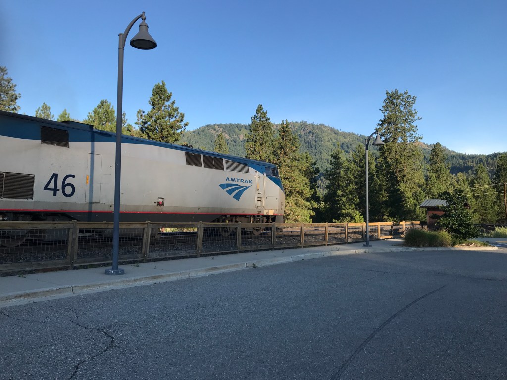
Sadly, the cycling portion of the Epic Empire Builder (tour name taken from Amtrak train that runs from Chicago to Seattle daily) concludes with an incomplete ride on the Going-to-the-Sun Road in Glacier National Park. Now I’ll just have to make other arrangements to ride the complete route and cross it off the Bucket List. It’s been a fantastic tour of 9 days of riding across three states (two new ones for me). Scenery was just incredible. Not enough adjectives to properly describe the sights and sounds. Met more great cycling enthusiasts and created memories that will last a lifetime.
Epic Empire Builder 9-day Summary
Duration: 44:50 hms
Distance: 758.9
TSS: 1835
El Gain: 39475 ft
Work: 28465 kJ
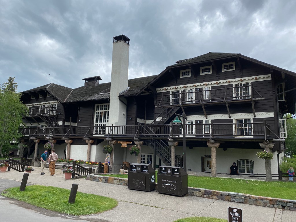
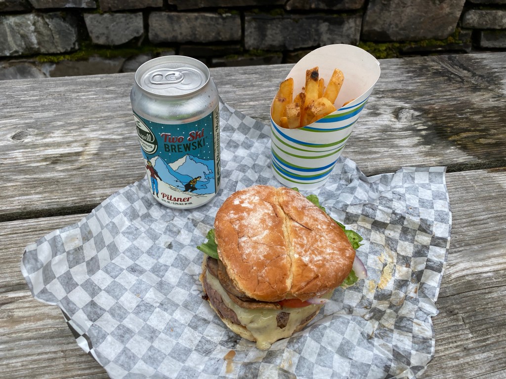
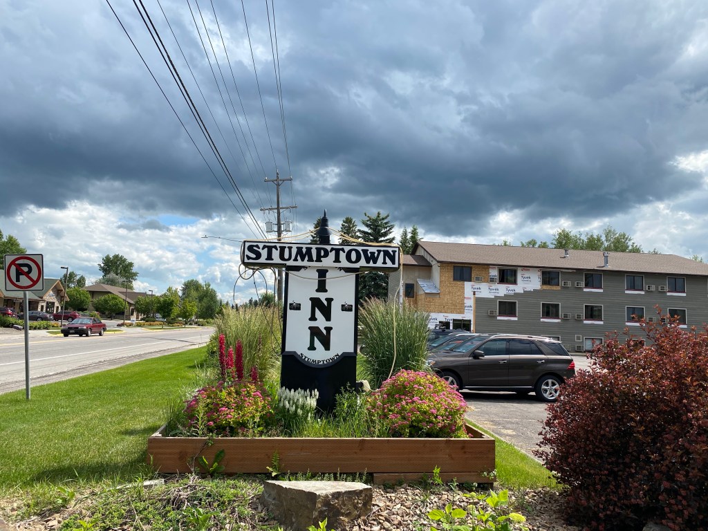
Waited for the support van then loaded up and headed back to have lunch at Lake McDonald Lodge’s Jammer Joe’s Grill and Pizzeria: elk burger, fries, and 2 ski brewski. Burger was good but do be honest, couldn’t tell the difference between ground elk and ground beef. Departed Glacier National Park in the support van and returned to Whitefish. Crashed hard (slept, not vehicular accident) on the drive. Guides had secured use of a room at the Stumptown Inn (couldn’t find Taylorstown) so everyone could shower. Rearranged luggage situation to have a day bag for the train ride as the bulk of our stuff would return via the van and not the train. Bid farewell to one of the guides who had an 8+ hour drive back to Seattle with the bikes, gear, and luggage. The rest of us walked around downtown Whitefish. Quaint little town that I’m sure is economically suffering from the decline in tourism due to CV-19. Second bike shop actually had a full kit, sans socks, promoting the shop, which I purchased. Every other shop visited during the last 8 days only had jerseys and generic shorts – not even bibs. Had time for a beer, or two, at a local pub before dinner at Pescado Blanco (nice play on words) and had bison enchiladas with Banana Fosters for dessert.
Train departure slipped several times to right in 15-min increments. Finally departed around 10 pm. Naturally the dining car closed at 10 and was unable to take advantage of the first drink on the house. Late by design? The sleeping car had its own bathroom/shower stall and the bed was already pulled out. Another first – overnight train ride. Adieu Montana and Idaho.