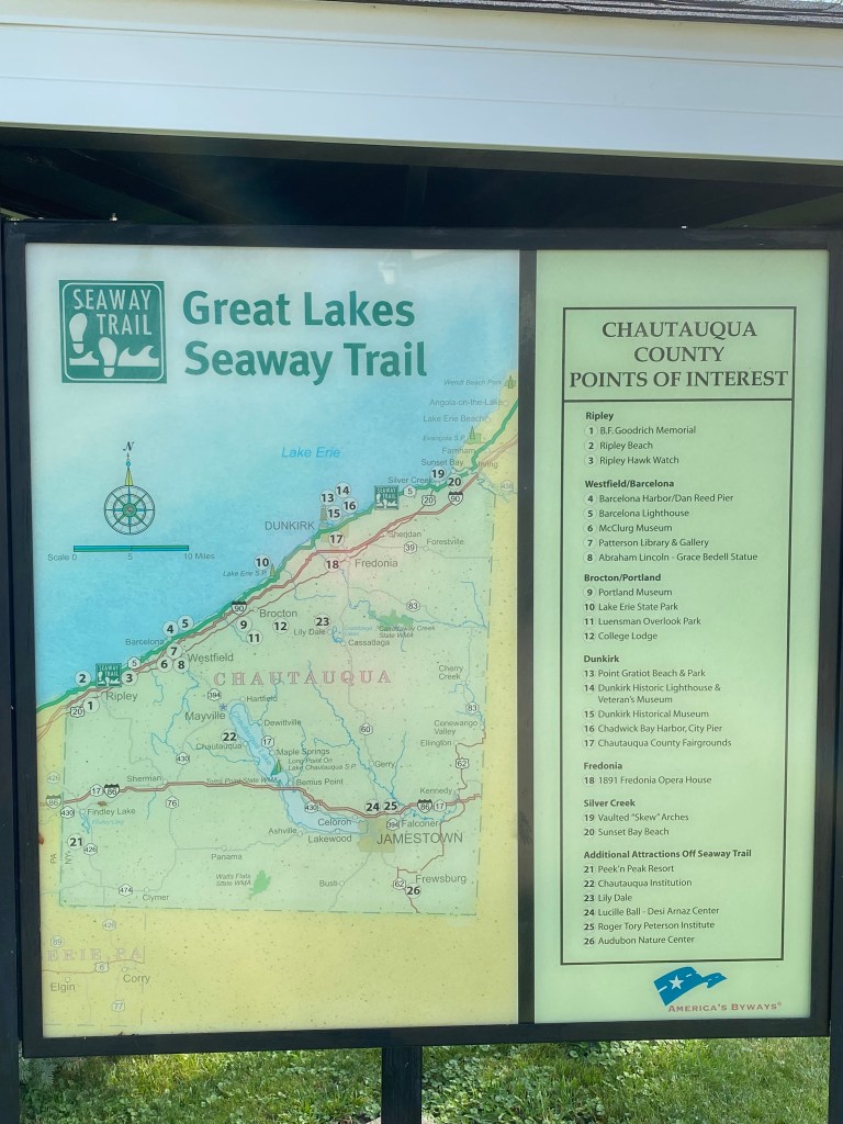
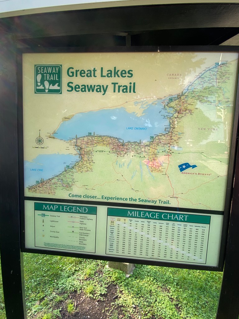
The Great Lakes Seaway Trail
From Wikipedia
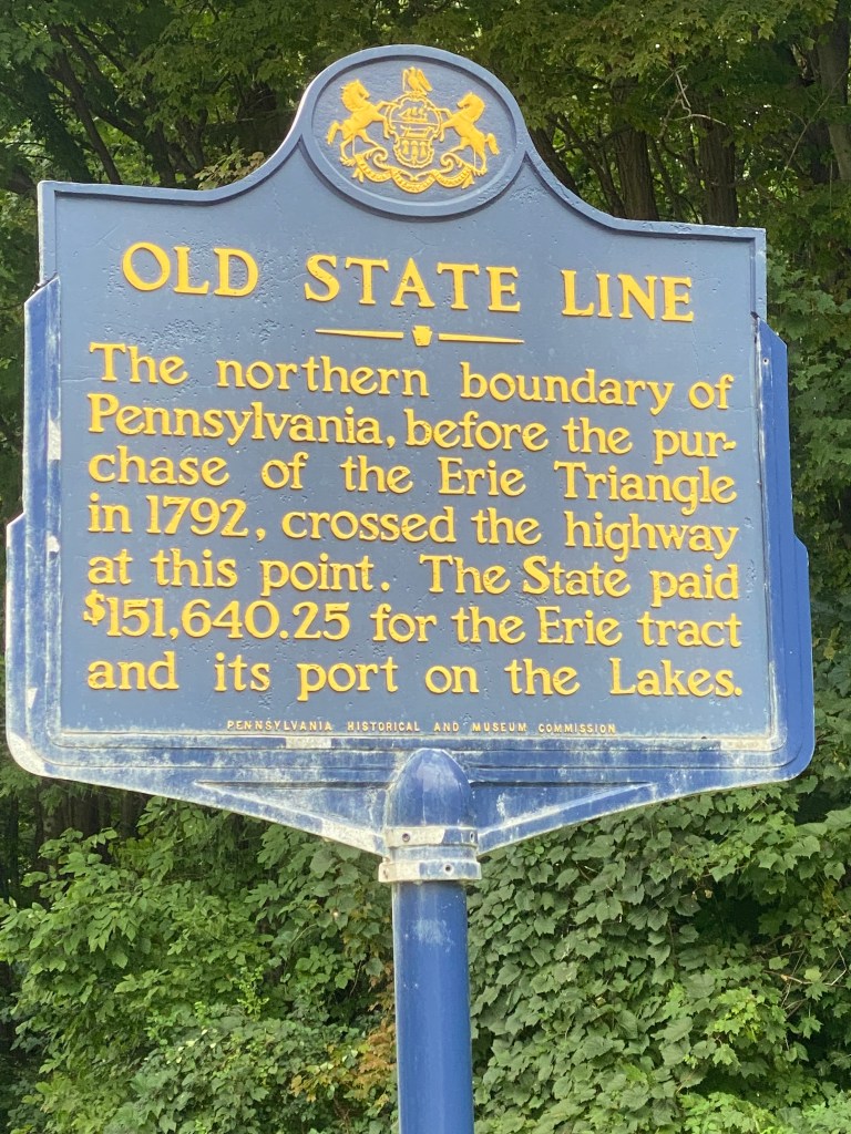
The Great Lakes Seaway Trail, formerly named and commonly known as the Seaway Trail, is a 518-mile (834 km) National Scenic Byway in the northeastern United States, mostly contained in New York but with a small segment in Pennsylvania. The trail consists of a series of designated roads and highways that travel along the Saint Lawrence Seaway—specifically, Lake Erie, the Niagara River, Lake Ontario, and the Saint Lawrence River. It begins at the Ohio state line in rural Erie County, Pennsylvania, and travels through several cities and villages (including the cities of Buffalo, Niagara Falls, Rochester, Oswego, and Ogdensburg) before ending at the Seaway International Bridge northeast of the village of Massena in St. Lawrence County, New York. It is maintained by the non-profit Seaway Trail, Inc.
The Seaway Trail was first designated in 1978 as an 80-mile (129 km) byway leading from the Seaway International Bridge to the Thousand Islands Bridge. It was extended southwestward across the state of New York in the mid-1980s and into Pennsylvania in 1996. The byway is recognized as a state scenic byway by both New York and Pennsylvania (the latter designation coming in 2003) and was named a National Scenic Byway in two stages. In New York, the Seaway Trail became one of the first byways in the nation to be declared a National Scenic Byway when it received the distinction in 1996. The Pennsylvania portion of the byway was added in 2005. The Seaway Trail was officially renamed the Great Lakes Seaway Trail in 2010.
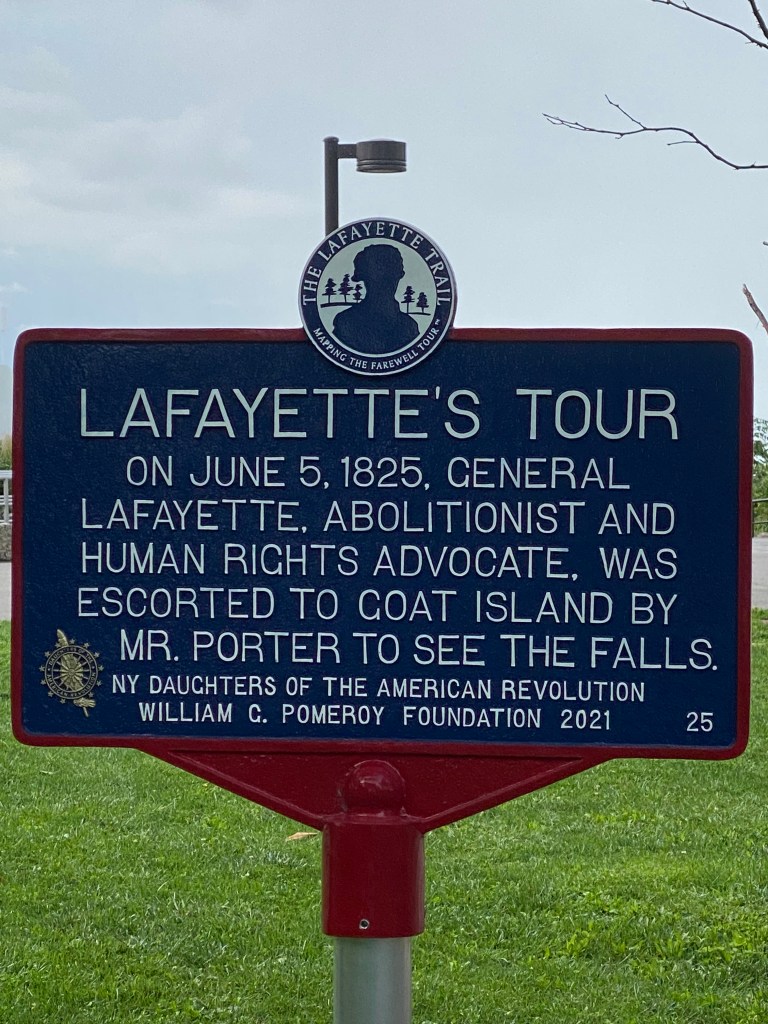
Thanks to my sister and septuagenarian parents for SAG support. Sis was on tap to provide SAG support for the planned Natchez Trace Parkway excursion two years ago. That adventure was delayed a year due to the unfortunate incident with a guardrail. The Missus subsequently provided SAG last year to enable completion of the Natchez Trace in four days. This year’s adventure is 7 days on the Great Lakes Seaway Trail from the OH/PA border to Rooseveltown, NY. The original itinerary included two forays into Canada: Niagara Falls and; a day trip to Montreal at the conclusion of the Trail. Even though the border is open for those fully vaccinated with proof of a negative Covid PCR test within 72 hours of planned entry, the rising rate of the delta variant infection may result in changes to border crossing requirements. The Missus was very uncomfortable and concerned changes may result in a forced quarantine that would prevent me from walking my daughter down the aisle on her wedding day. Neither of the cities are going anywhere and it certainly isn’t worth making the two most important women in my life angry. So instead, we’ll visit the Falls on the U.S side and extend a day to enable a short ride in New Hampshire (a new state to add to the list). This will be the first time probably since my undergraduate collegiate days that we’ve all been together for a week. Look forward to the scenery and stopping at small villages. Plus I’ll be able to appease my inner pharologist.
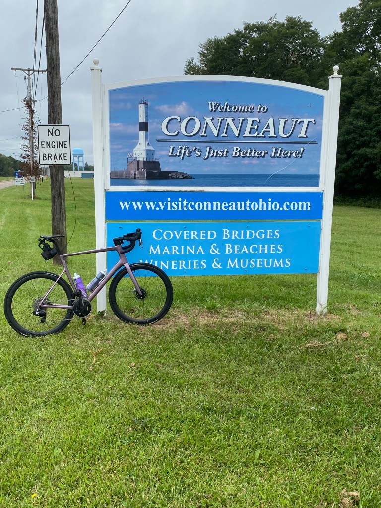
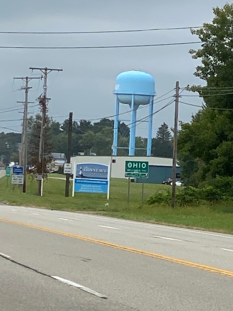
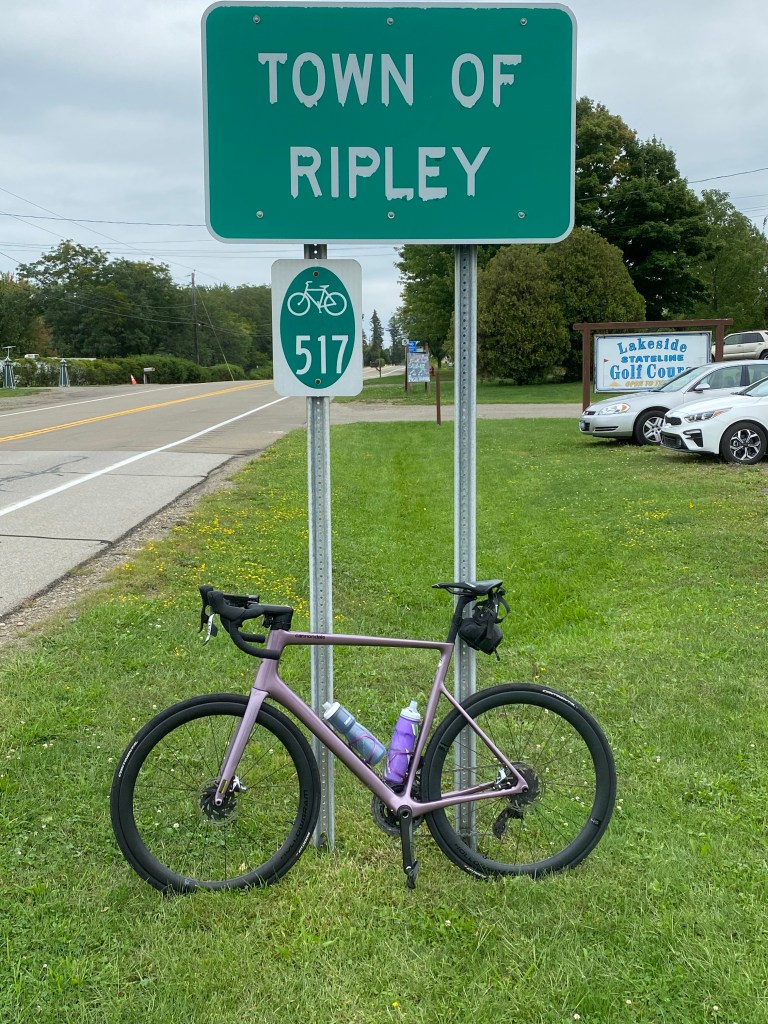
Great Lakes Seaway Trail Day 1: Conneaut, OH – Ripley, NY
D: 68.34 miles Avg: 19.3 mph TSS: 214
T: 3:32:56 AP: 214 W IF: 0.78
E: 1,204’ NP: 242 KJ: 2733
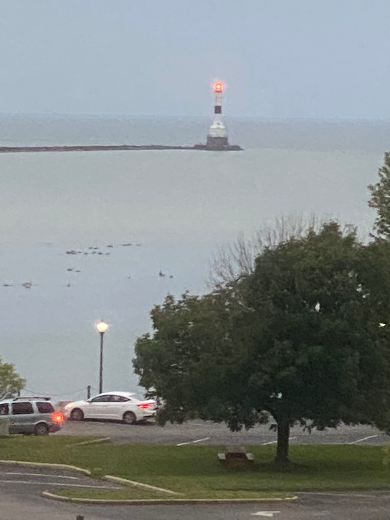
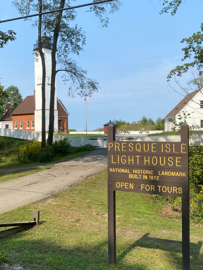
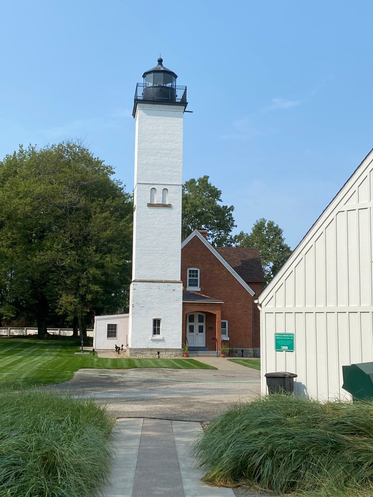
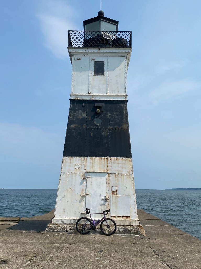
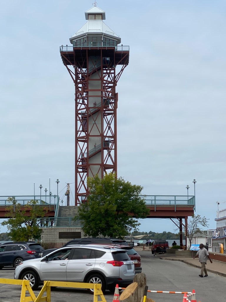
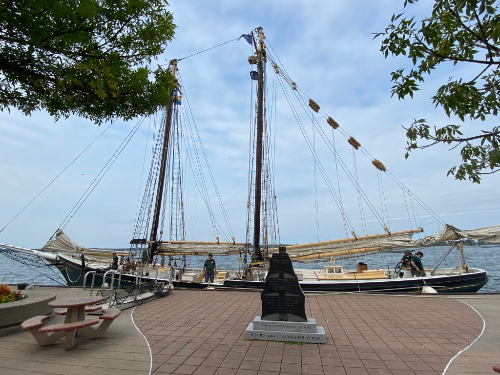
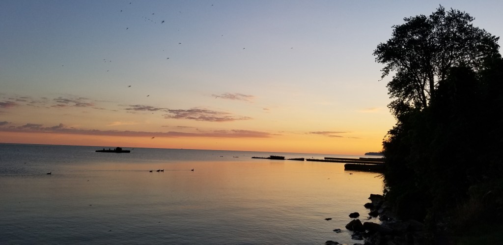
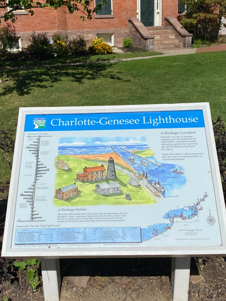
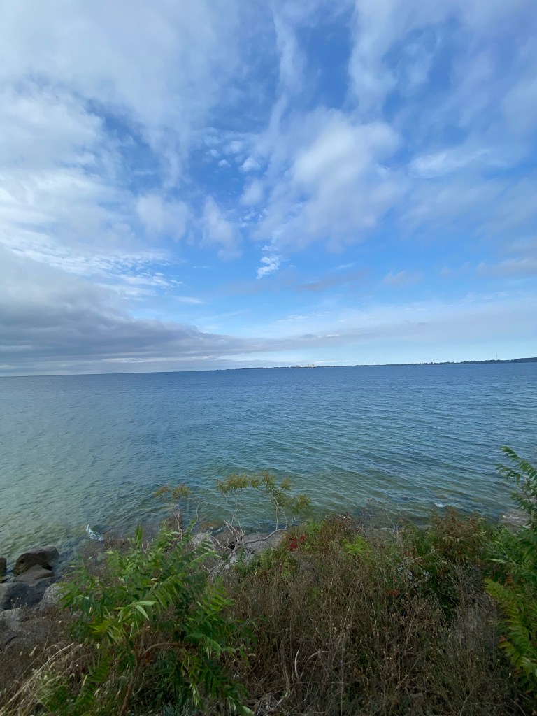
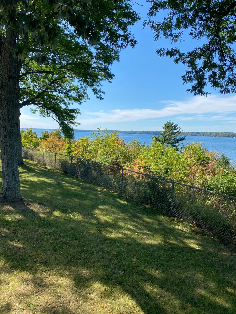
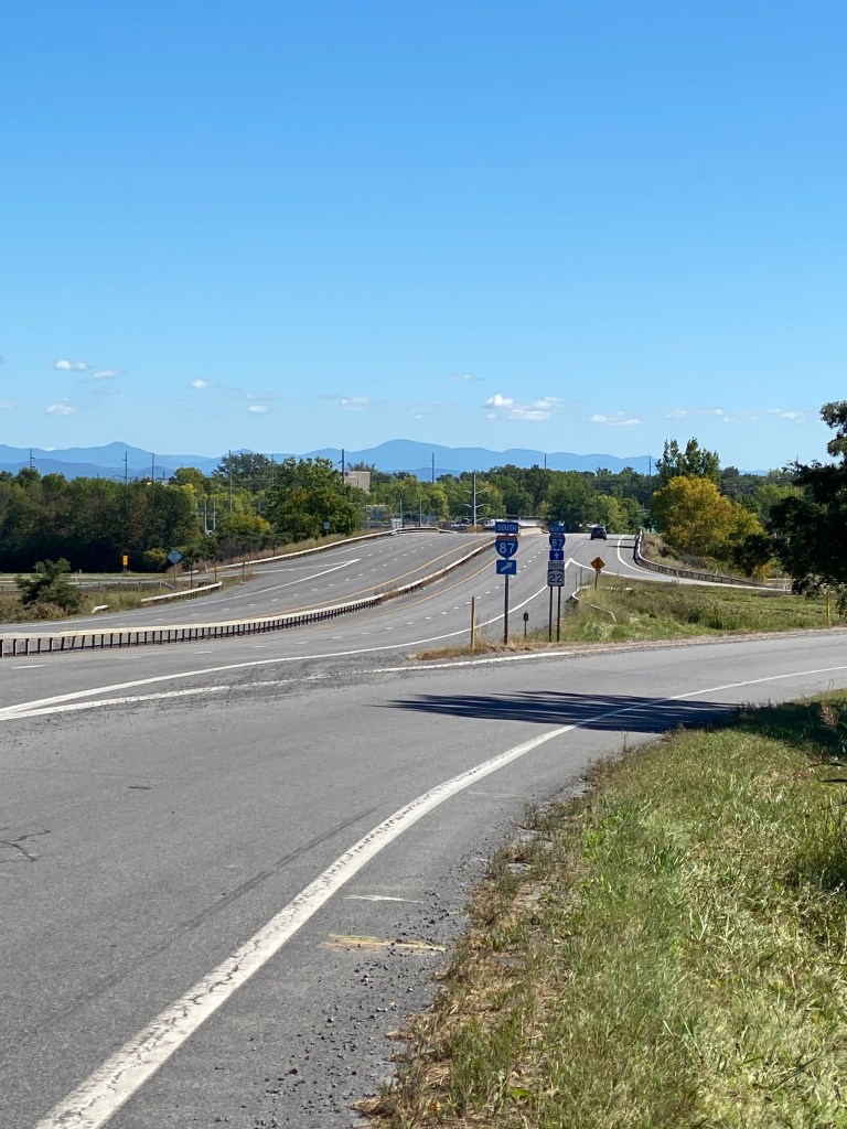
A pretty good first day on the Seaway Trail; not overly long and broken up by a couple of lighthouse stops. The Trail is fairly well-marked with road signage and the pavement is in decent shaped. A few sections even had relatively new pavement. Nothing remarkable from Conneaut to Presque Isle which doesn’t have an entrance fee. Surprisingly, all of the island beaches were closed. Don’t know if the season ends on Labor Day weekend or not. As a result, traffic was minimal although there were a couple of ladies on scooters who didn’t think the 25 mph speed limit applied to them. I silently chuckled when one of them dropped a personal item from their scooter and gave a shrill shriek when a following car ran over the item. The first sign indicated the Presque Isle Lighthouse was open but the gate to the actual compound and welcome center was closed and barred with a sign suggesting visitors shop online. The few glimpses of lake water on the northwest side of the Isle were a crisp blue; certainly not the murky color I was accustomed to seeing. I caught up with the SAG crew on the way to the North Pier Light which was hidden behind two huge piles of sand. After a few photos and fresh water bottle, it was off to Erie proper. Didn’t quite follow the RidewithGPS route and ended up on State Street, Dobbins Landing, to see the Bicentennial Tower which was built in 1996 to commemorate Erie’s bicentennial year 1996. The Landing also had a two-masted schooner and paddlewheel boat moored at the dock.
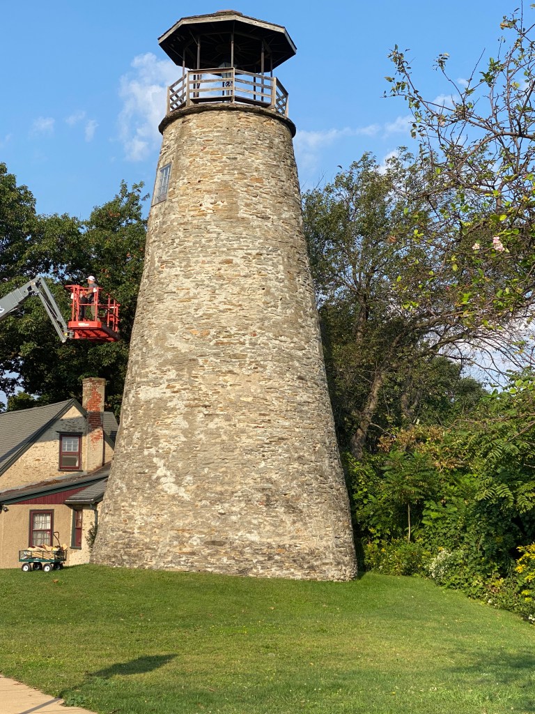
Eventually made it to the Erie Land Lighthouse. Noteworthy, it was one of the first two lighthouses authorized by Congress for construction on the Great Lakes. Built in 1818, the tower was actually built three times as it was eventually discovered that a layer of quicksand was beneath the foundation. Perhaps the shoreline was different back in the 19th century but visiting it today, the location doesn’t seem very appropriate for signaling ships the hazardous conditions were near. The lighthouse isn’t very tall, tower height is only 48 feet, and it’s set back from the shoreline quite a bit.
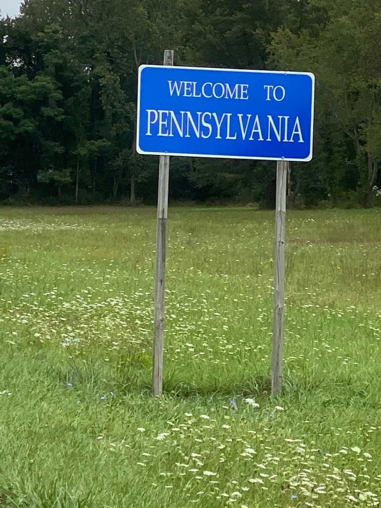
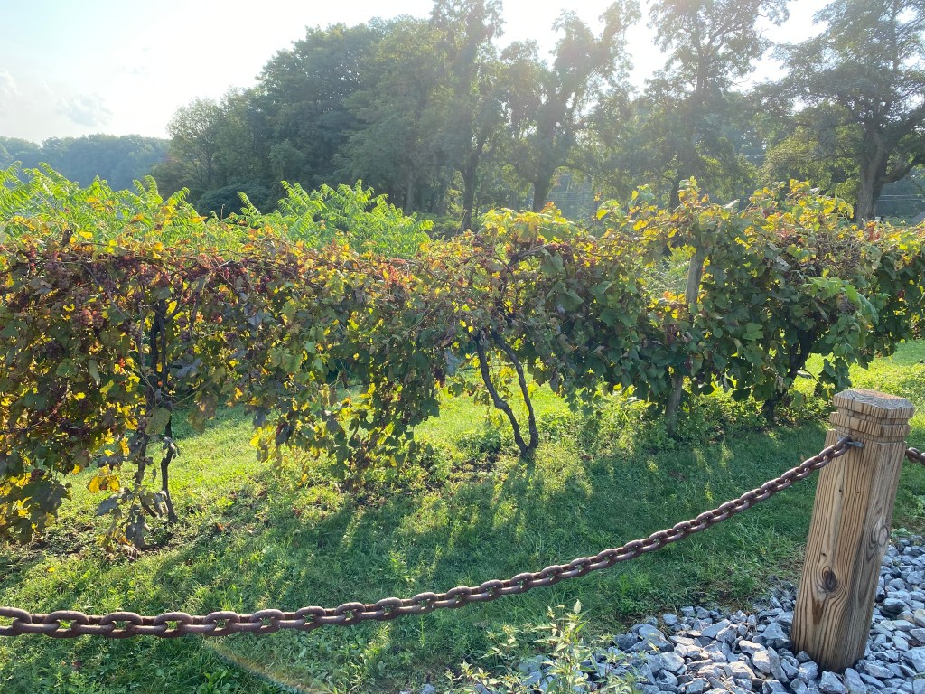
Back on the road to complete cycling in three states on one ride. Absolutely astounded by the amount of vineyards as one approaches North East, PA and extending to Ripley, NY. Learned that this area is the largest and oldest Concord grape-growing region in the world. Finished the last ~ 10 miles accompanied by Sis as she also brought her bike to squeeze in a few rides around her arduous SAG duties. Lodging was at the Pines Motel on Lake Erie. Not exactly a posh hotel but it was a place to crash for the night.
Dinner was at Meeder’s Restaurant in Ripley which seemed to be the only place open. Ripley had a population of 2,253 according to the 2020 census but declined nearly 7% from the 2010 census. Other restaurants further away were all closed on Monday. Guess it’s a thing here and other locales as well. Typical American fare so it was meatloaf, sweet potato fries, and a dinner salad. Is it necessary to request the salad be served first? Seems natural to me and I failed to do so. As a result, it was actually brought out last. Meal was fine; nothing spectacular but sweet potato fries are so much better baked compared to fried. Will say the restaurant needs to invest in a new milk shake machine. Whatever contraption is currently in use makes a very loud and annoying noise that seems to last about 15 minutes. Signage outside the restaurant boasted world famous pies. Naturally had to taste a piece. Well the chalkboard in the back room listed over 30 pies and several with peanut butter. Disappointingly, the only one available was peanut butter nutter butter. The serving size was enormous and was pretty good. Still, world famous seems a stretch. So ends Day 1.


Great Lakes Seaway Trail Day 2: Ripley, NY – Niagara Falls, NY
D: 99.39 miles Avg: 20.4 mph TSS: 253
T: 5:52:19 AP: 200 W IF: 0.73
E: 1,696’ NP: 225 KJ: 3505
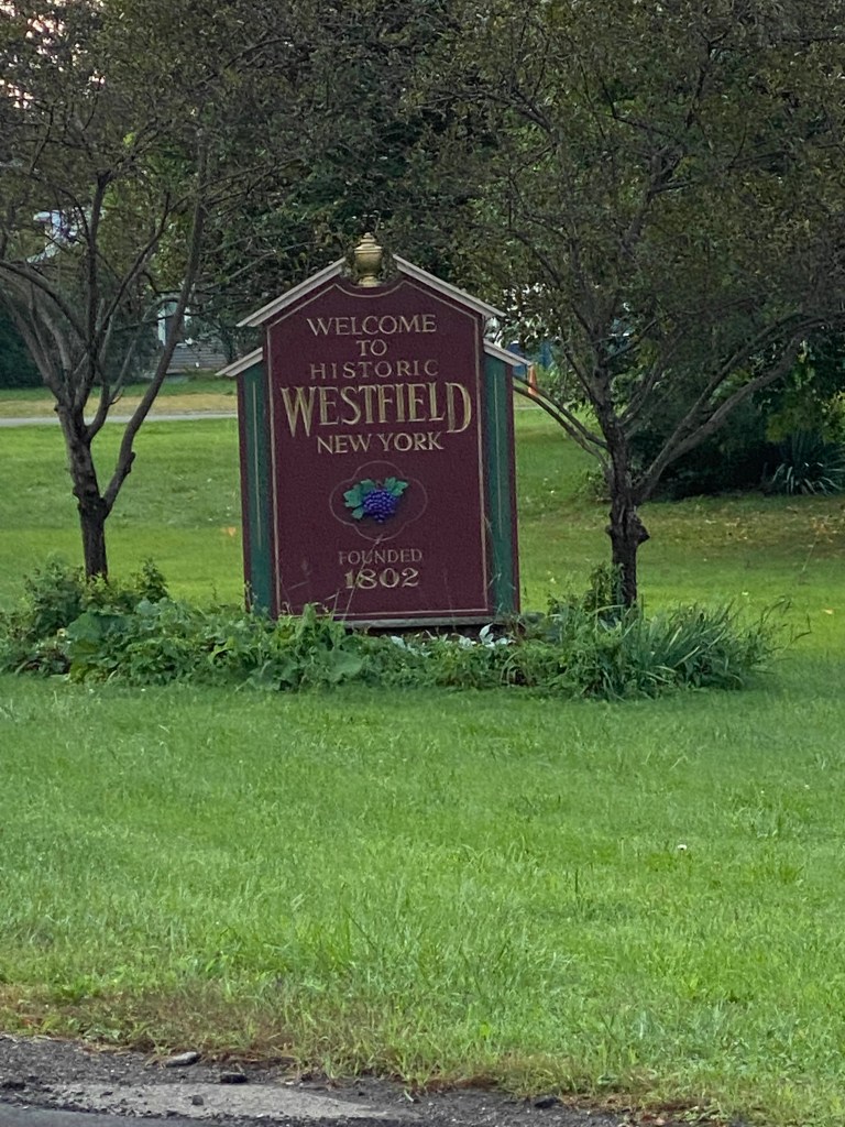
Early rise necessary today since planned cycling miles were more than yesterdays. The all-US revision to the adventure changed the lodging plans and increased the distance to somewhere around 95 miles. Didn’t really know exactly since it would be a combination of Day 2 and Day 3 RWGPS routes. The previous Day 2 route didn’t end at our lodging location as it was initially on the Canadian side. The breakfast bus was departing at 0650 and headed to Westfield Main Street Diner. Meeder’s also served breakfast and opened an hour earlier. Dinner didn’t warrant a repeat visit so we tried somewhere different. Besides, didn’t want to risk someone ordering a milkshake. Main Street didn’t provide menus, but had it written on a couple of whiteboards strategically placed throughout the dining area. French toast (only 2 slices), home fries, and orange juice for me.
Passed a Welch’s factory on the way to the restaurant so at least we know where some of the grapes end up. Returned to the motel, repacked the vehicles, prepped the bike, water bottles (using 4 today) and all of the electronic devices (Wahoo Roam loaded with route and GoPro camera), sent the Wahoo link to the Missus (don’t get me started on that poorly functioning feature), synched the Apple Powerbeats wrap-around headphones with my mostly Sirius/XM Octane-inspired playlist, and started east before the planned roll time of 0900.
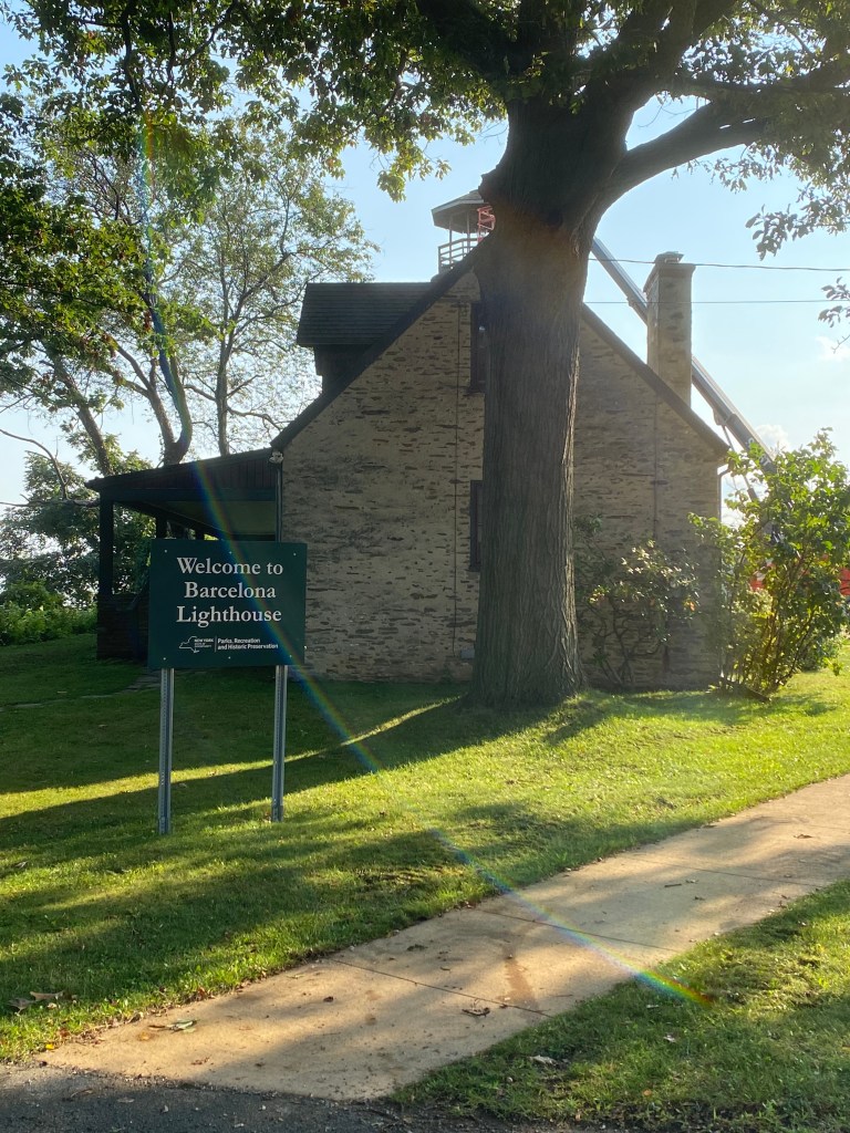
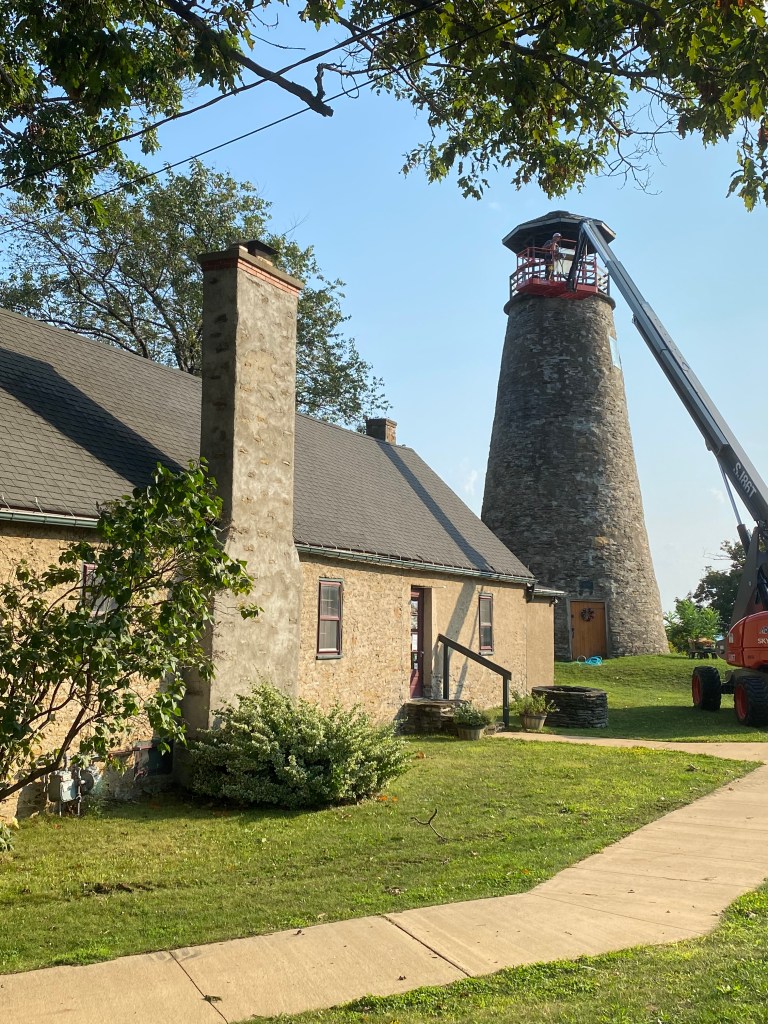
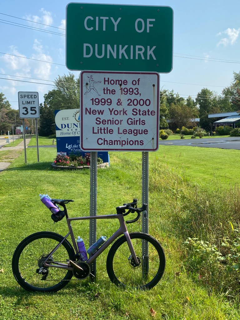
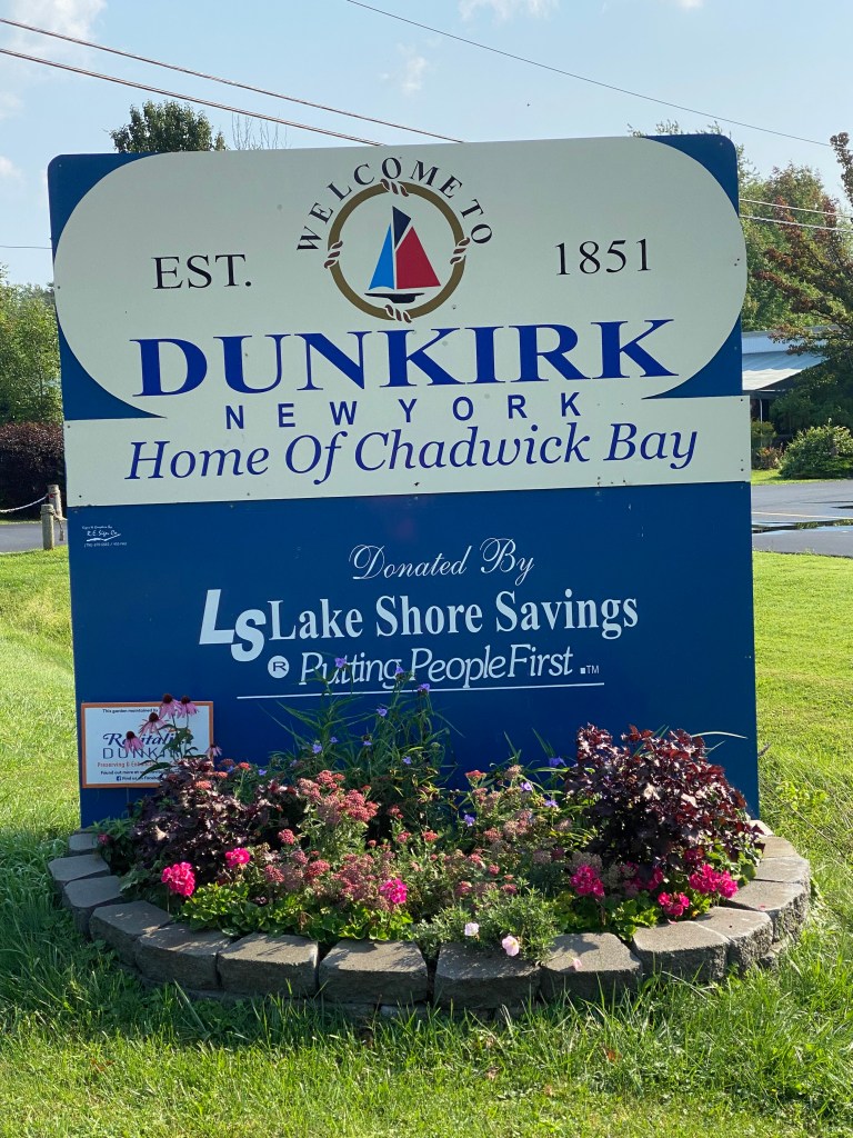
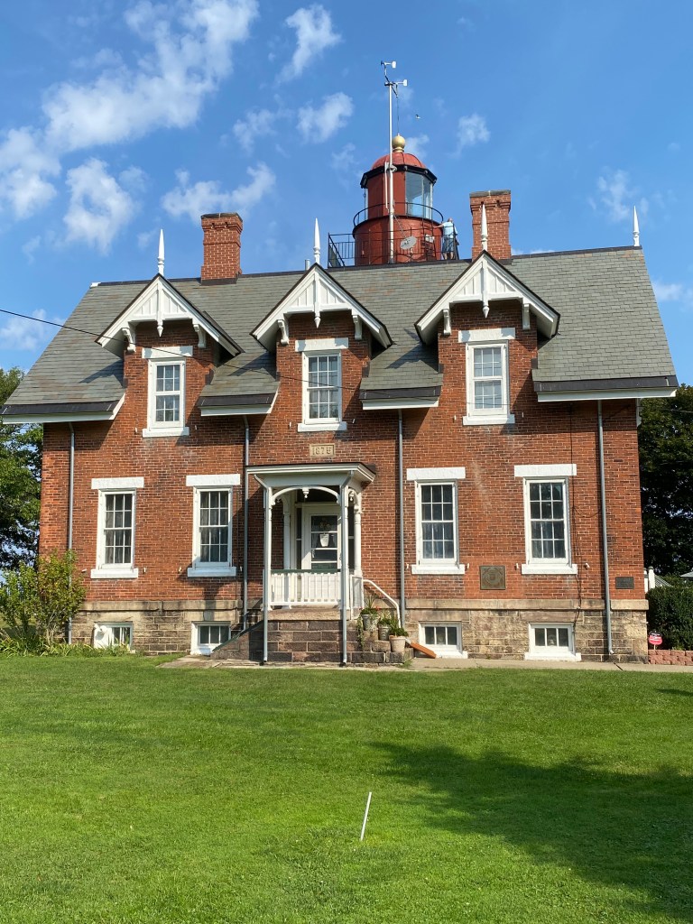
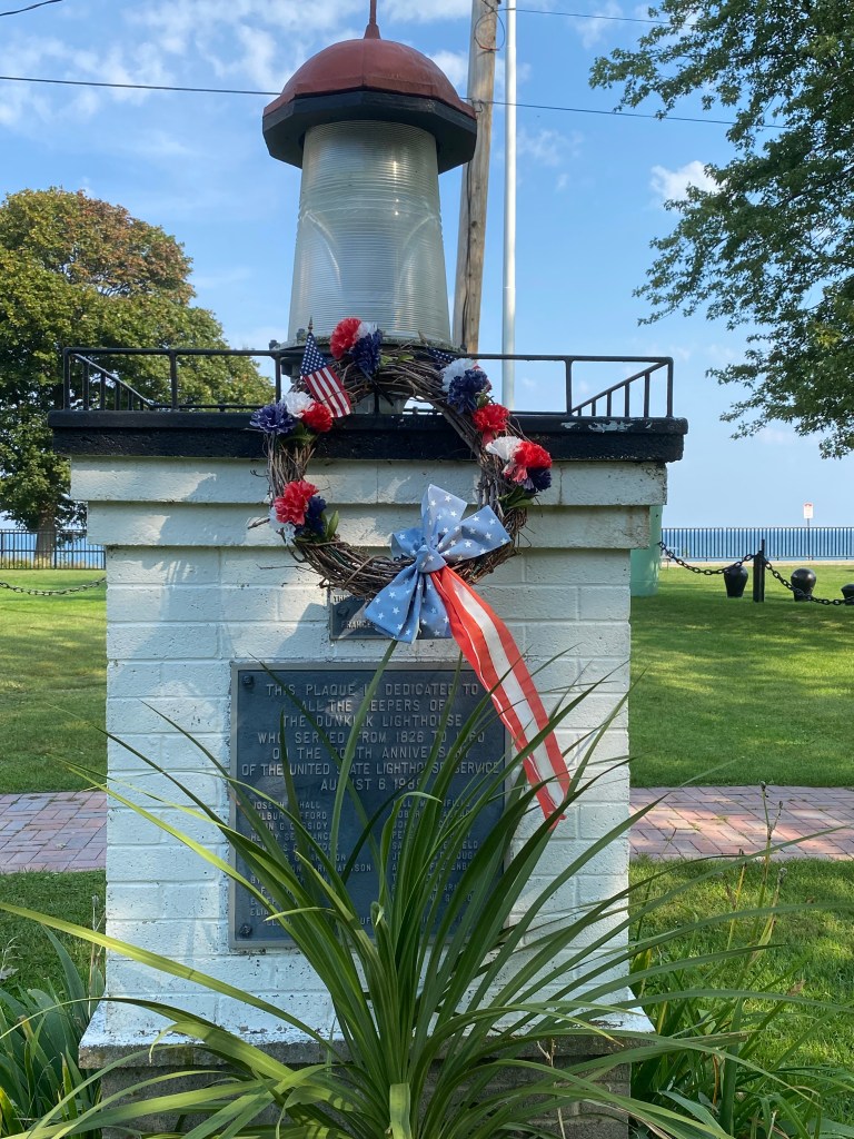
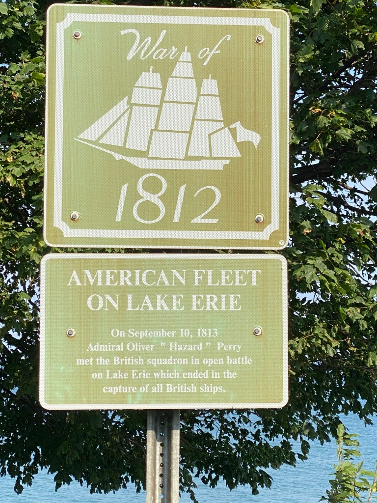
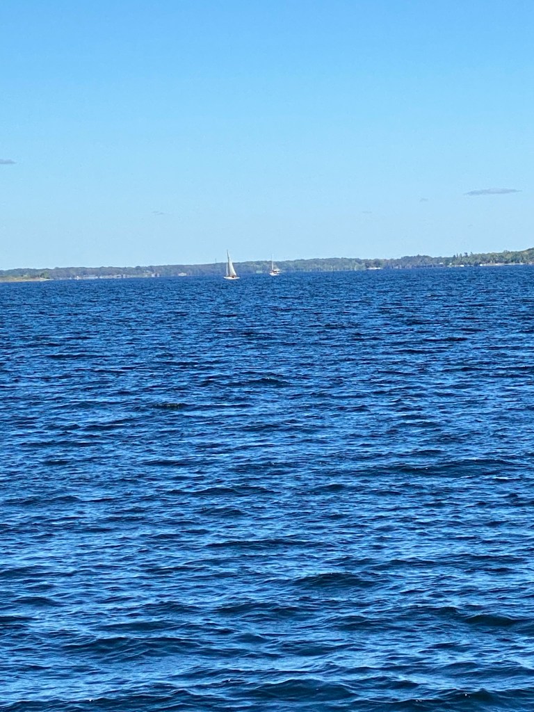
Cycling conditions were rather favorable; overcast with a slight cross/tail wind. Covered the initial 30 miles at a 22.5 mph pace while mostly maintaining an upper Z2 effort. Vineyards dominated the scenery for the first 20 miles with some corn fields thrown in here and there for a little variety. There was rarely any indication as to ownership, farm or winery associated with the acres of grapevines. Interstate 90 seemed to be the demarcation for fertile soil because there were hardly any vines south of I-90 which was only half a mile south of the Seaway Trail. The few vines viewed didn’t seem as healthy as those along the Trail. Unlike Day 1, views of Lake Erie were quite prevalent between the tree line on the left. The color was reminiscent of Caribbean or Florida panhandle beaches: teal or very light green close to shore then progressively darker blue as further out. First stop was about the 10-mile mark, the Barcelona (NY) Lighthouse also known as the Portland Harbor Light in Westfield, NY. Finished in 1829, the tower is only 40 ft tall, but it was the first natural gas lighthouse in the country. It was undergoing some level of renovation or cleaning, so the photos weren’t ideal. Next to the harbor was a single row of grape vines that were available to visitors for picking. Surprisingly, the row contained several varieties and colors of grapes. The view of the lake was simply stunning. Again, not the Lake Erie I’m familiar with. The next stop was 20 miles east at the Dunkirk Lighthouse. The original lighthouse was established in 1827 but experienced erosion problems which led to a 61-foot stone tower and Victorian residence being constructed in 1875. The first shot of the War of 1812 was fired near the west bank of the lighthouse.
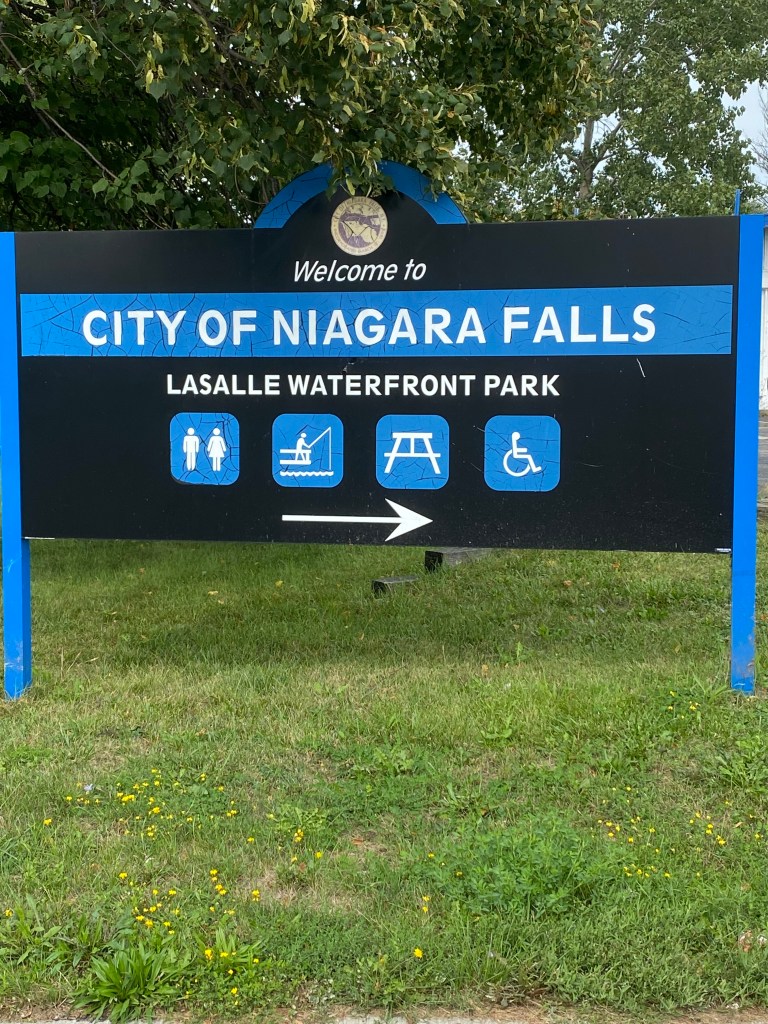
The next stop was Buffalo Lighthouse Park after another 35 miles. Traffic was far more congested and less bike friendly. Unfortunately, the park was closed to visitors, so no photos or descriptions offered. Disappointing though. Riding through Buffalo, Niagara, and Niagara Falls was no picnic; highway riding, stop lights, construction, milled roads and the last nine miles were into a head wind. Stopped at Campus Wheelworks in Niagara and picked up a new kit. Cool mural on the side of the building as well. There were also a number of paved paths that paralleled the road from Buffalo to Niagara Falls. Stayed on the roads because wasn’t sure if the paths would diverge from the route and take me off course. Rolled into the Hampton Inn parking lot a little after 3:00. Didn’t change the Roam screen to display total distance for the day and ended up just short of a century.
Had a bit of time to unwind before dinner at the Bella Vista Ristorante inside the Niagara Riverside Resort. Ordered a bread service, side Caesar salad (didn’t have to ask for it to be served before main course arrived) pasta ai gamberetti, and a draft Woodcock Amber Ale. End of Day 2.


pasta ai gamberetti
Great Lakes Seaway Trail Day 3: Niagara Falls, NY – Olcott, NY
D: 35.16 miles Avg: 19.7 mph TSS: 87
T: 1:47:07 AP: 193 W IF: 0.70
E: 301’ NP: 218 KJ: 1236
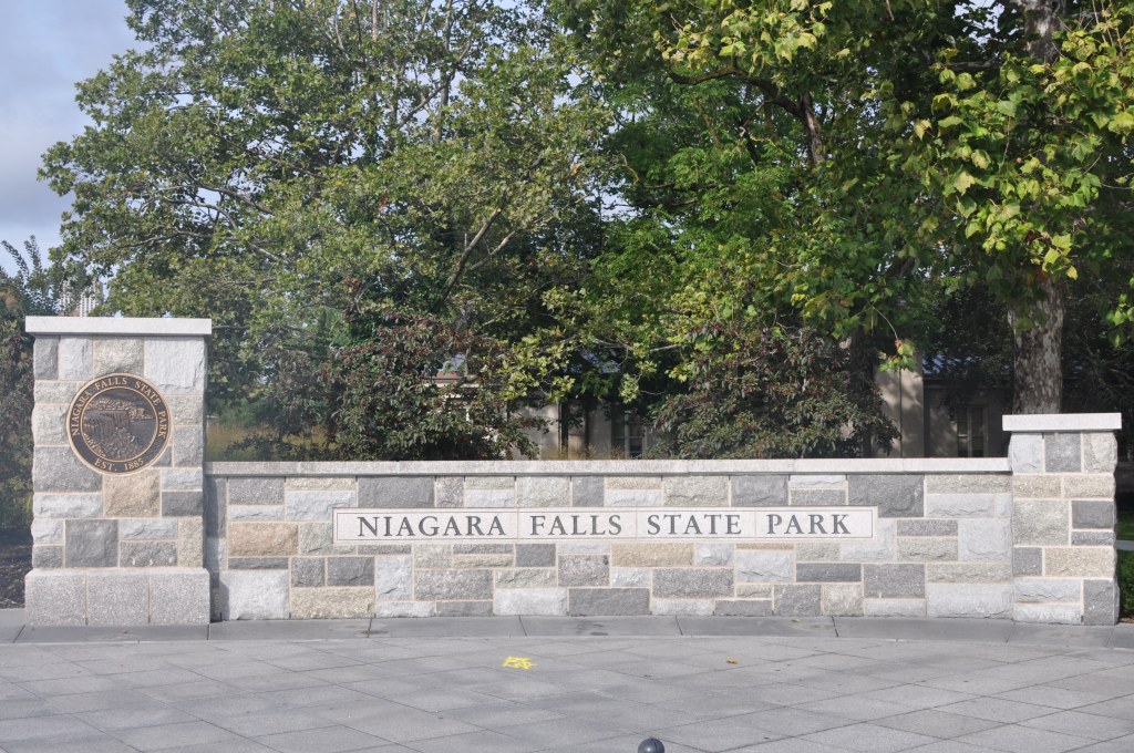
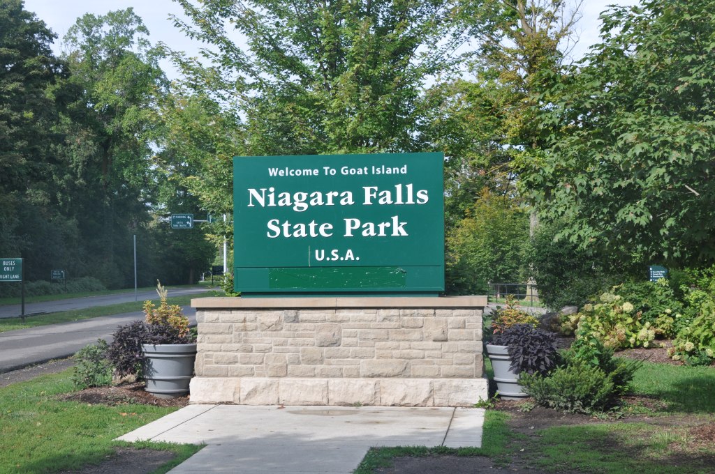
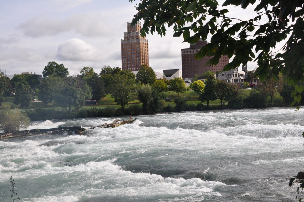
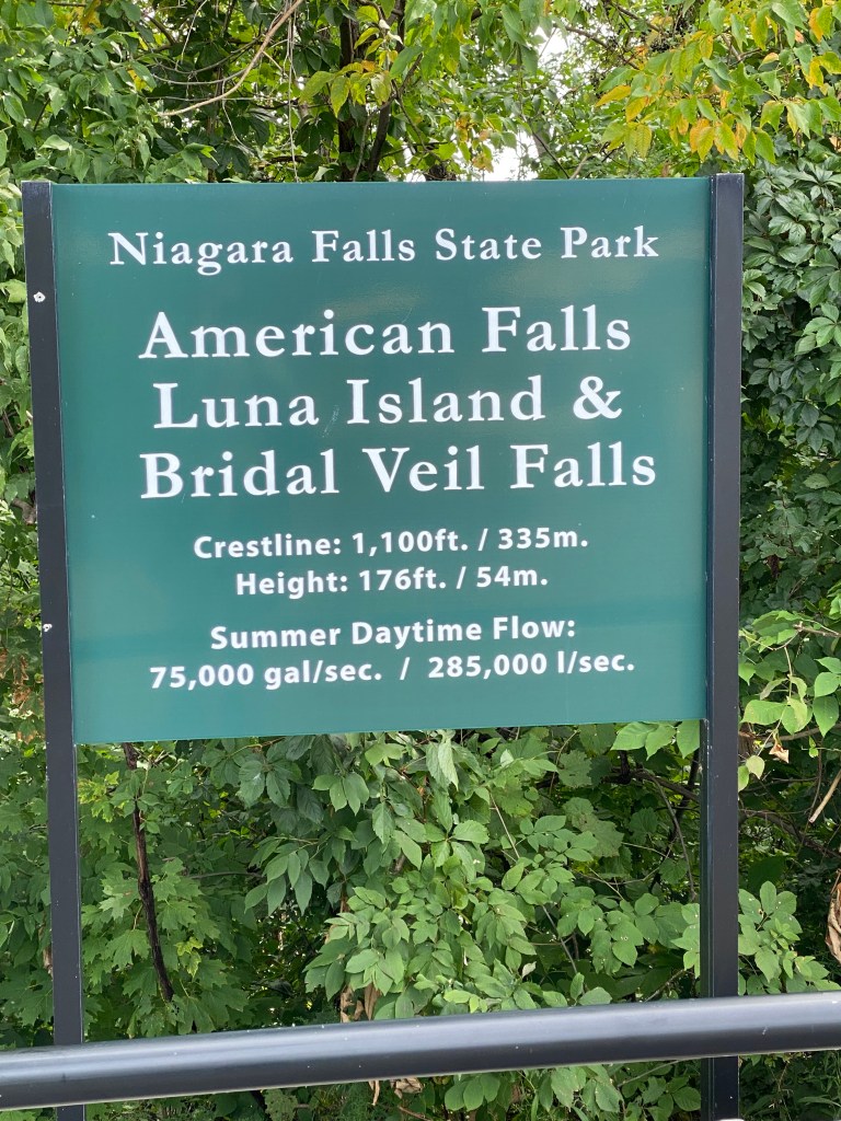
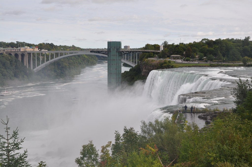
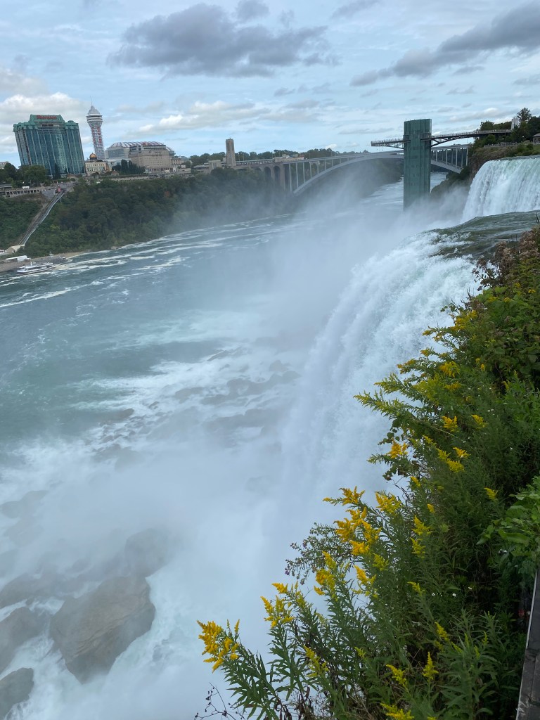
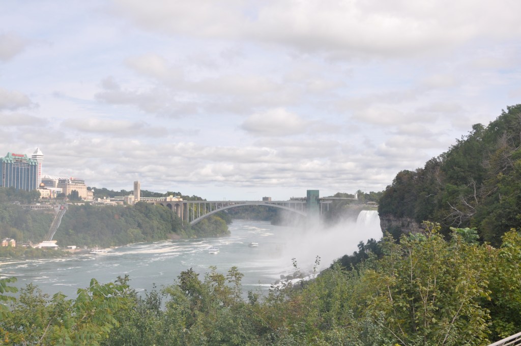
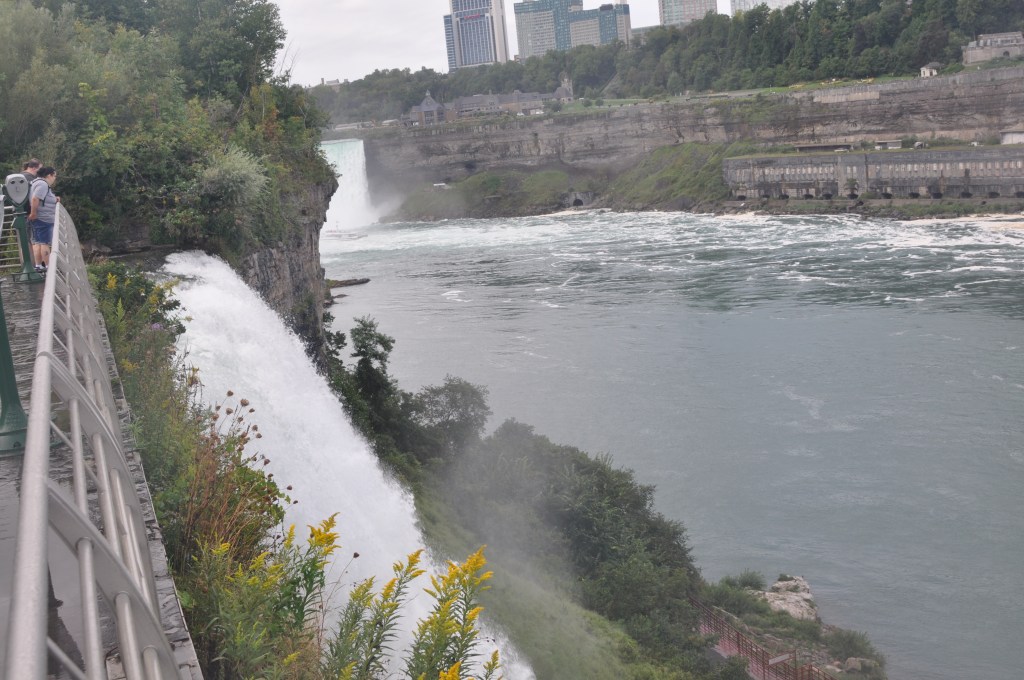
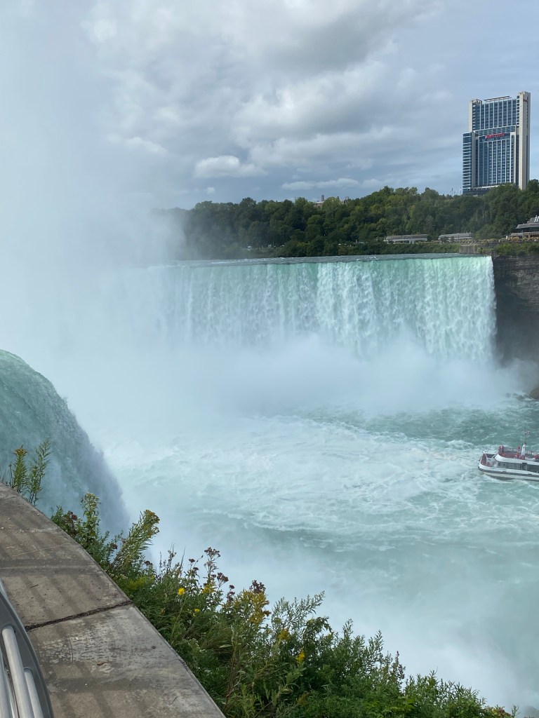
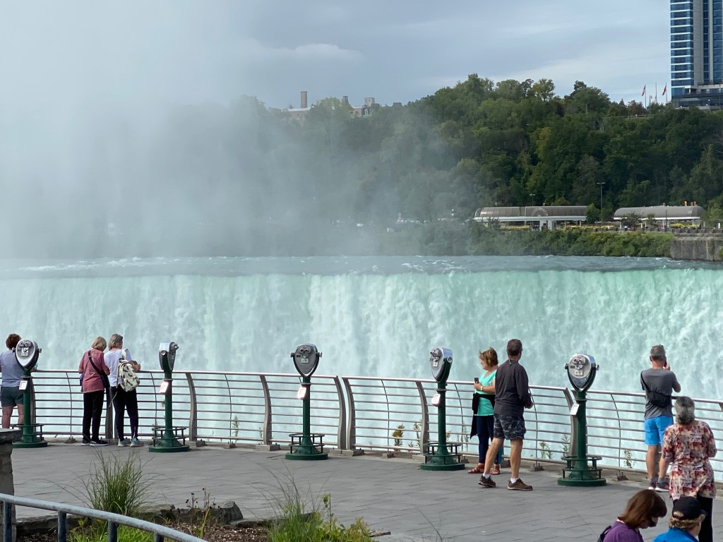
Relaxed morning with late rise (for those able to sleep) as breakfast was downstairs at 0830. Mostly standard Hampton Inn fare: waffle, scrambled eggs, kielbasa, cereal (Cheerios and Raisin Bran) French toast sticks, water, orange juice, and maybe one whole well-traveled banana. Actually peeled two but bruising was rather severe on one of them. Requested a late check-out and was granted 1:00 pm but really wanted 2:00. Still, better than 11:00. Spent the morning playing tourist at Niagara Falls. Walked to see the American rapids and falls, Bridal and Veil, then the star of the show, Horseshoe Falls. Everyone says the view is better from the Canadian side and I’m sure it is. Someday, maybe. The amount of water pouring over is 675,000 gal/sec. Amazing that the river never runs dry! It was a lot of walking for the parental units so took the trolley back to the visitor center and parking lot. None of us remembered walking as much when the entire family came to Niagara nearly 40 years ago. All any of us could remember was getting soaked (and enjoying none of it) on Maid of the Mist. Back to the hotel to pack up the vehicle and get ready for the shortest ride of the week. Even though approved for late check-out, still had to return to the desk to have our key cards reprogrammed so we could enter our rooms.
Frustratingly, the GoPro remote gave up the ghost and had had enough. Acted up a little towards the end of yesterday’s ride and wouldn’t charge. YouTube videos all seemed to indicate corroded contacts inside were the culprit. Contacts looked fine but you never know. Didn’t have rubbing alcohol on hand so used hydrogen peroxide to clean them. Didn’t seem to make a difference in restoring functionality. Only change was the screen indicates full battery life but none of the buttons worked. Urggh! Now forced to press the record button on the bottom as the GoPro is inverted beneath the handlebars and hope the mode isn’t accidently changed.
Today’s route was north out of Niagara Falls paralleling the Niagara River then turn east, northeast along Lake Ontario. Early afternoon traffic was minimal but still had lights to contend with until out of city limits. Temperature was cooler than the previous days even with a later start. Wind was a little stronger as well but still comfortable.
Waved at the Four Mile Campsite near Lewiston to the Minnesota couple we met at the Dunkirk Lighthouse. They sold their home and all their stuff and are traveling the country in small tow-behind camper. Indicated they would travel for year to year and a half then decide where to settle down. They really liked Michigan.
Although the vineyards mostly disappeared, there were far more wineries along the route compared to previous days. Appropriately, the Seaway Trail and the Niagara Wine Trail (one of 4 along the planned route) shared some of the same roads but unfortunately, wasn’t able to stop. Driving under the influence does apply to bicycles. The Niagara wine trail includes17 wineries and stretches across Niagara, Orleans and Monroe counties primarily growing vinifera grapes. European vinifera wines, including Riesling, Pinot Gris, Pinot Noir, Chardonnay, Cabernet Franc, Vidal Blanc and Sauvignon Blanc, thrive in the region. This region has been recognized by prominent wine publications as producing the best Pinot Noir, Cabernet, Ice Wine and Syrah that New York has to offer, along with top scores by wine critics and international wine competitions.
Today’s scenery was dominated by fruit orchards: predominantly apples. Saw several peach orchards but all except one were absent of peaches. Guess harvest time for peaches has passed. Fruit orchards have changed drastically over the past decade. Stately rows of mature fruit trees with expansive canopies are being supplanted high density, tall-spindle, low canopy trees; essentially a 10-ft trunk with small fruiting branches along its length.
Extensive corn fields returned to the scene as well as one cabbage field. Unfortunately, my agricultural crop knowledge is inadequate to identify at least four different types of produce and/or grain crops passed along the way.
The last 10 miles or so of the ride matched my expectations for the trip – quiet, country roads and nearly continuous, unobstructed views of the Lake (either Erie or Ontario). Nature really is amazing; it isn’t limited to majestic mountains.
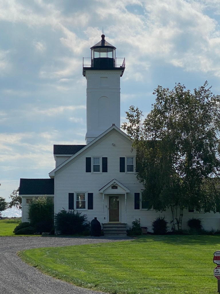
Once again, passed Sis on her end of day ride but this time it was much closer to our final destination, Olcott, NY, population < 1300. She turned around to give me the car keys then headed west again to complete her ride. The ride ended at the Olcott Beach Lighthouse (Replica) in Olcott Harbor on Lake Ontario at the mouth of Eighteen Mile Creek. The original light was 32.5 feet tall and completed in 1873. Dismantled in 1963, a group of local citizens known as the Olcott Lighthouse Society, raised $6,000 and work began on a full-scale reproduction in 2003. No blueprints or architectural drawings were available so historic photographs were used to develop the plans.
Parental unit wasn’t around so leisurely changed out of the cycling kit into t-shirt and shorts. When they did return, they indicated they were trying to find a gas station. GasBuddy app to the rescue. Nearest one was just short of 5 miles away. They did go that direction in their search, just not far enough. So drove them to the gas station to fill up.
Another example of not every article or picture found on the internet is true, accurate, or current. Thought it would be cool to stay at the Old Olcott Beach Fire Station Guestrooms and Suites. Reviews were decent and picture wasn’t concerning, however; have no idea when the picture was taken as reality bared little resemblance. Hard to tell it was previously a fire station. Yes, there are several white (very dirty and in disrepair) garage doors but no other markings indicating its previous life. It was fine for a night, but Sis did have the loudest bed ever. The noise wasn’t a squeak, but any movement caused the bed to moan its complaint.
Dinner was at Covey’s Cove, just a short walk away down Main Street. Menu was mostly bar fare (well, it was a bar but it had higher Yelp ratings than the other local establishments). Started with Chips and Salsa then had 3 beef corn tortilla tacos and two Rohrbach Scotch Ales. Spent the evening talking about family genealogy. The things you spend your entire life not knowing, mostly because the question was never asked and details never volunteered. Parental unit overcame separate broken home circumstances and relied upon grandmothers’ support during ‘tween and teenage years. Happy and proud to say they provide an excellent example of working together as they recently celebrated their 60th wedding anniversary.


Great Lakes Seaway Trail Day 4: Olcott, NY – Sodus Point, NY
D: 109.84 miles Avg: 19.2 mph TSS: 320
T: 5:42:30 AP: 216 W IF: 0.75
E: 1,624’ NP: 233 KJ: 4428
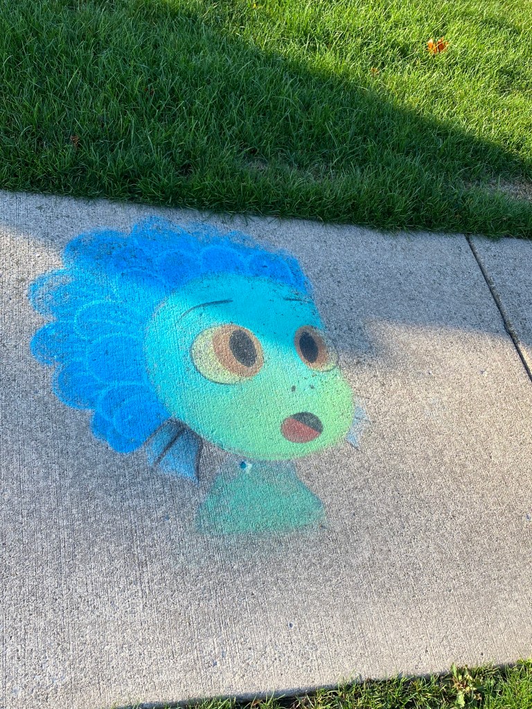
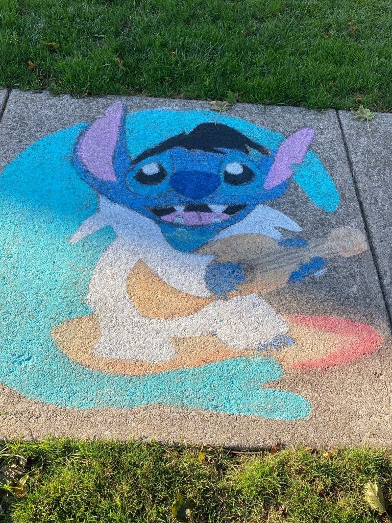
An early rise not necessary as the Park Place restaurant was a short walk in the opposite direction from last night’s dinner on Main Street. Again, not a lot of people around; tourist season concluded, many restaurants and shops closed for the season, and locals were elsewhere. Walked past some sidewalk art (pictures included) and closed Olcott Amusement Park (more like county fair rides but no pictures included).
Vegetable omelet chosen to power through the initial portion of the longest ride of the week. Made our goodbyes to the parental unit as their fun meter pegged out and they were headed west as Sis and I continued east. Started the ride later than desired but had no required arrival time in Sodus Point. Weather was still good although there was a bit of a headwind; not brutal but enough to be a nuisance. Landscape dominated by fruit orchards, again, mostly apple. There were other crops as well – butternut squash field and other unidentified plants (see previous comments about agricultural ignorance).
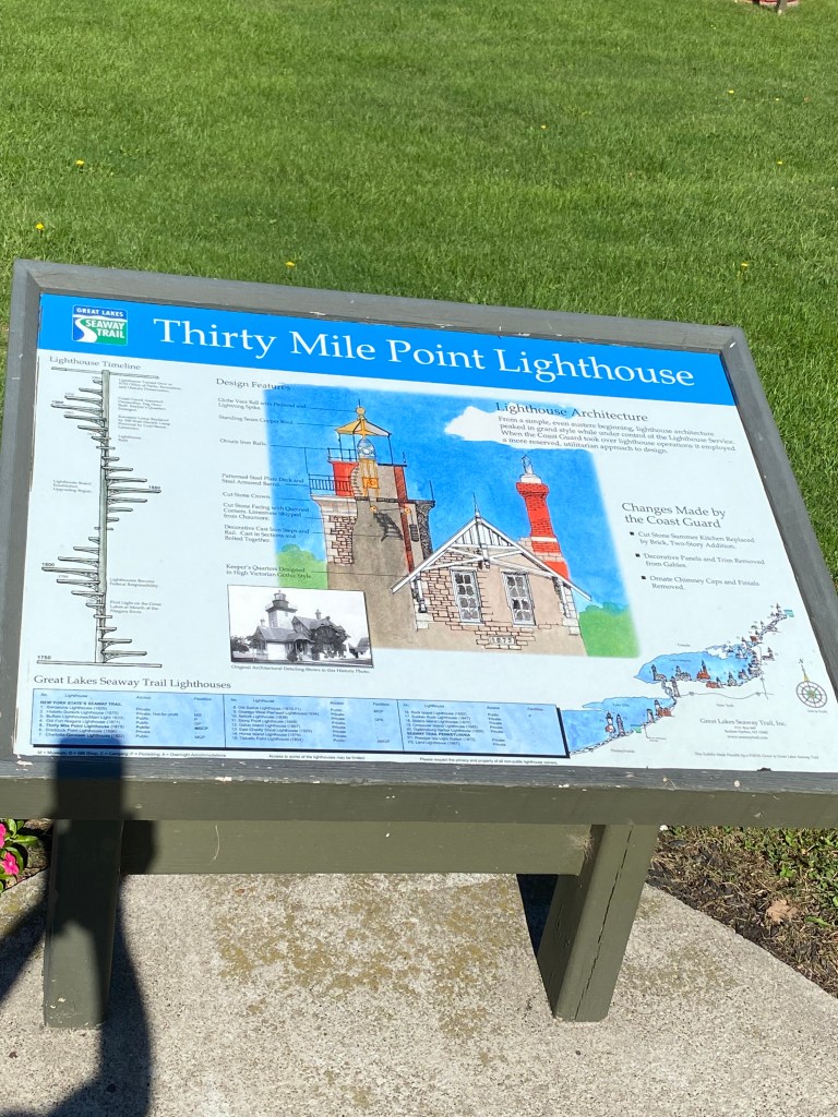
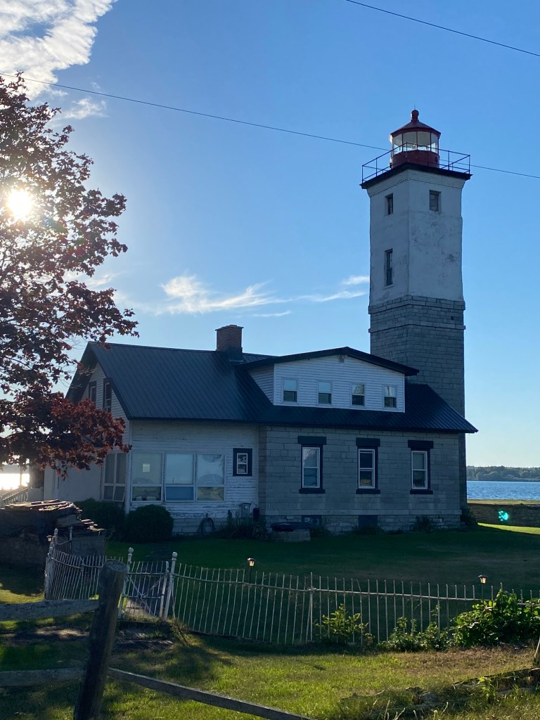
The first stop was in Somerset at the Thirty Mile Point Lighthouse on Golden Hill State Park. Distance from Niagara River is frequently used in naming conventions for some reason. The 70-ft tower and attached keepers’ quarters, 3-bedroom cottage on second floor available for rent, was built of stone from the eastern end of Lake Ontario in 1875 for $95,000. When finished the French lens produced 600,000 candlepower and was the most powerful light on Lake Ontario. The Light was decommissioned by USCG in 1958.
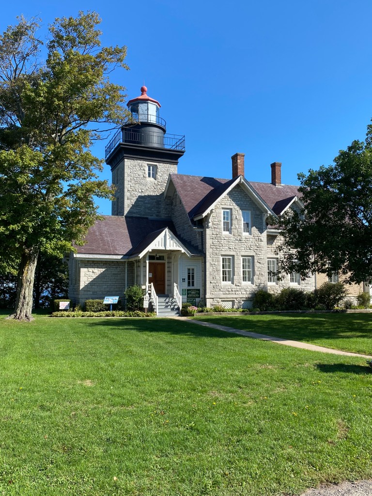
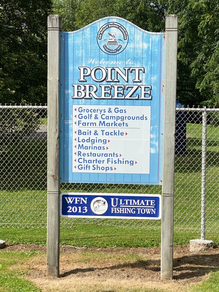
Oak Orchard lighthouse in Point Breeze isn’t included on the ‘official’ Seaway Trail historical markers but that was our next stop. It’s also a replica completed in 2010. The original 32-ft square pyramidal tower with a one-story keeper’s quarters was built in 1871. The Light was discontinued in 1914 and a storm in 1916 swept away the lighthouse and what remained of the pier after a storm 2 years earlier broke through the pier.
Next up, Braddock Point Lighthouse via the Lake Ontario State Parkway. No commercial vehicles are permitted and this time of year, it was not heavily traveled. All good since the first 8-9 miles are poorly maintained concrete which rendered the wide berm most unfriendly to bikes but the road wasn’t too bad. Much nicer ride when pavement switched to asphalt. Braddock Point is privately held, not open to the public but it listed on the Seaway trail posters, go figure. The original Light had an octagonal, 97-ft tower with 2 ½ story redbrick keeper’s quarters was constructed in 1896. Structural issues likely due to poor quality brick forced the USCG to deactivate the light in 1954. It’s been privately held ever since and a couple iterations of B&B’s. The tower was rebuilt in 1995 to height of 65 ft. The last B&B ceased operation in 2020. Several lighthouses, one isn’t included on the lighthouse list while another is private and not very accessible.
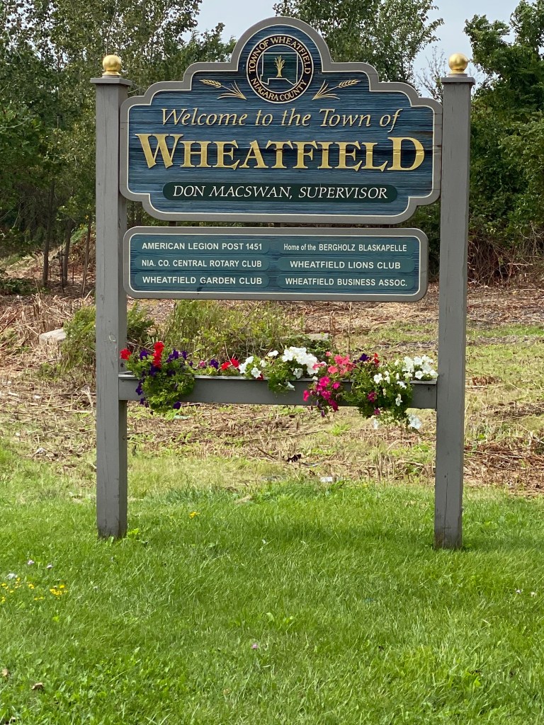
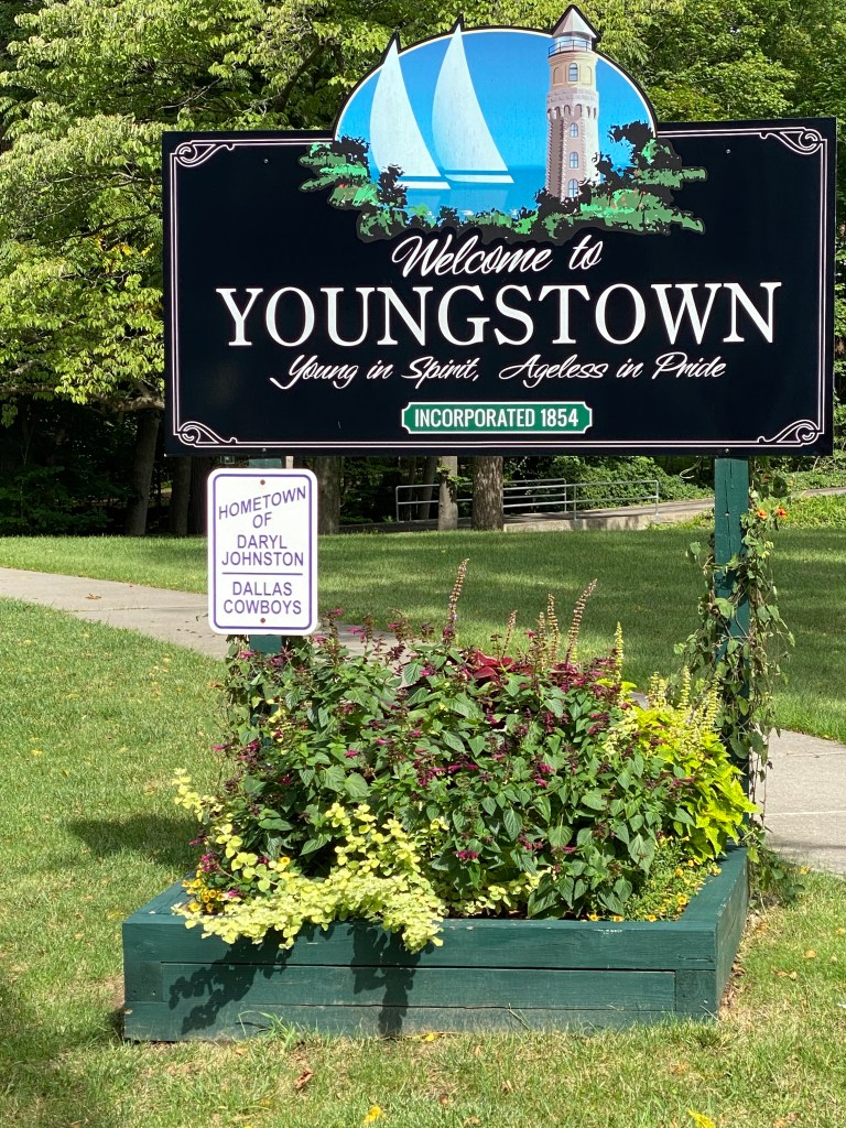
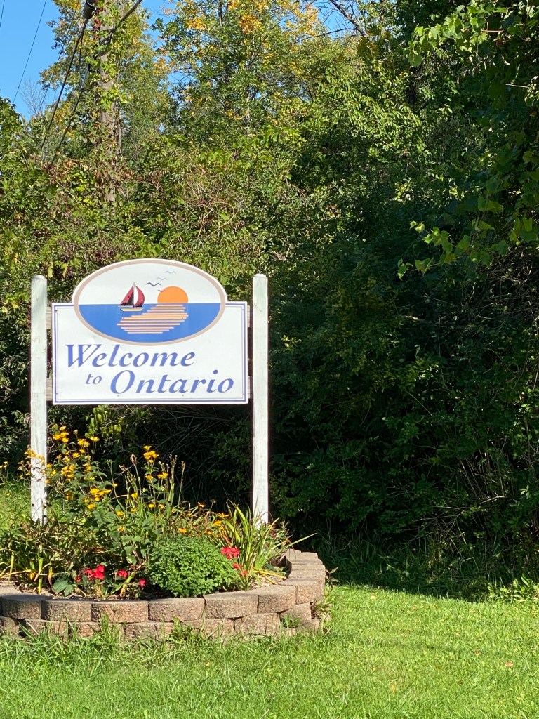
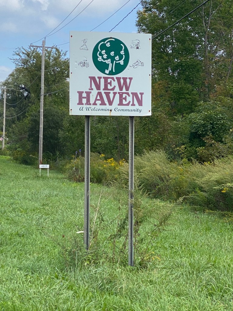
Riding through Rochester not nearly as congested as expected; interesting that town/city/village signage varies wildly and seems completely random. Sometimes very picturesque signs announce entrance to small towns while other times a plain brown or blue sign with white letters declares the name. Often wonder where the slogan originated as some are catchy, others make you scratch your head. So far, the bigger towns (Buffalo and Rochester) or cities didn’t have any welcoming signs, at least on my route.
Smaller rollers on the east side of town but legs didn’t feel like playing; a little fatigue buildup. Last 15 miles were a little uncomfortable. Haven’t ridden this distance in a while.
Minor tangent to go on an equipment rant: somewhere along the line, Roam stopped displaying a large blue body of water to the left of the route. Various rivers show up but not Lake Erie or Lake Ontario. What gives? Recently purchased new camelback podium water bottles as 2 of the 4 purple podium big chills popped out of the cage (on different rides) and were subsequently run over by a vehicle – one won’t stand up on its own, the other had a cracked lid. Anyways, not a fan of newly designed lid. Water flow is significantly reduced. Why do some socks have a L or R in the toe box? Does it matter? What about those socks without the designations? Are they inferior? Can anyone else tell the difference if the L sock is worn on the R foot or vice versa? GoPro mounted below the handlebar obviously provides a different view from either above the handlebar or on top of the helmet. Either handlebar location limits view to mostly direction of travel. Helmet mount offers greatest range of views since turning the head is far less dangerous in most situations compared with turning the handlebar but weight becomes a nuisance after a while and certainly would after 7 consecutive days. Haven’t tried either of the adhesive bases as neither version makes complete contact with Lazer helmet. Also concerned that adhesive alone isn’t strong enough to secure GoPro without it flying off at some point. Stopped using Garmin HRM due to limited (in my view) lifecycle. They work just fine but usually around the 18-month mark they just stop working. Replacing the battery has no affect. Have been using Powrlabs HRM for the last 8 months or so. Works fine, costs less than Garmin but have had to replace the battery twice so far.
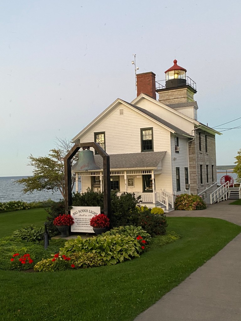
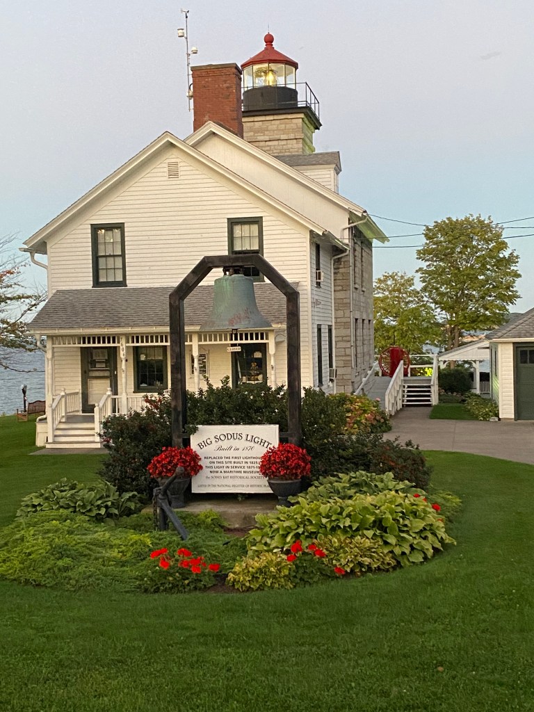
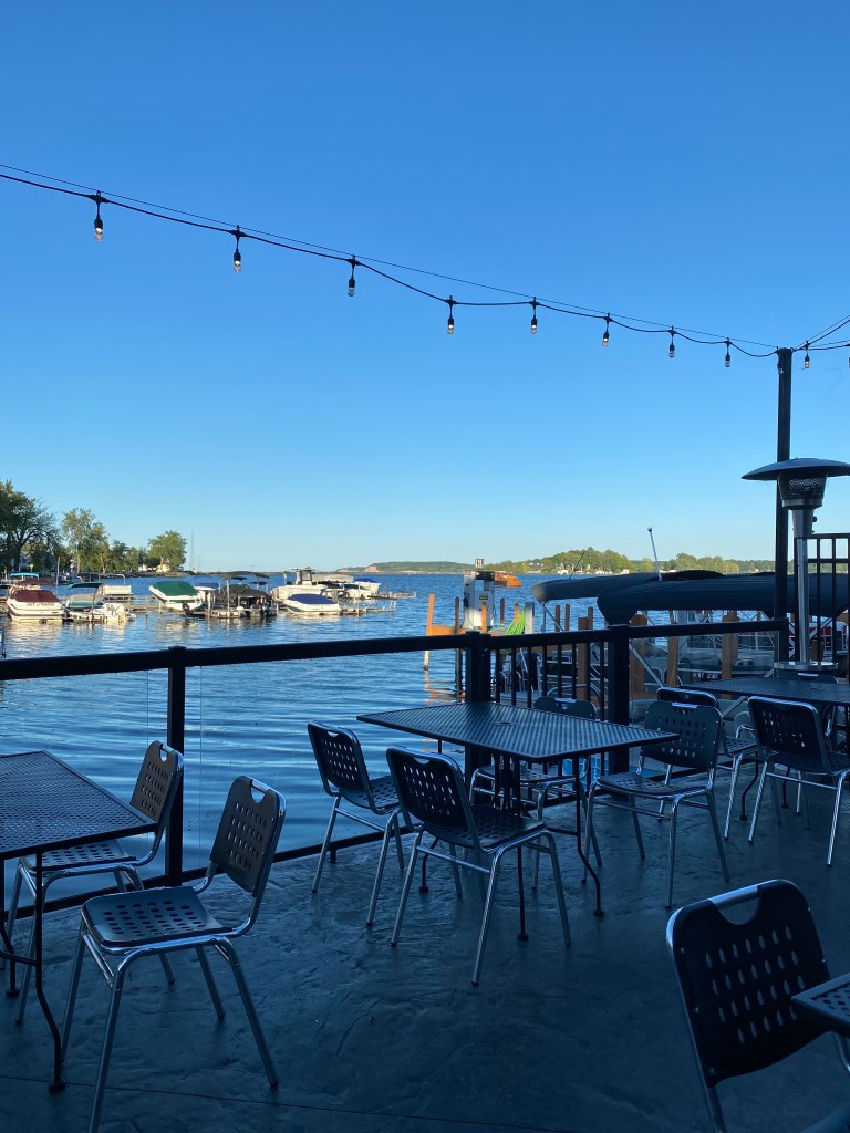
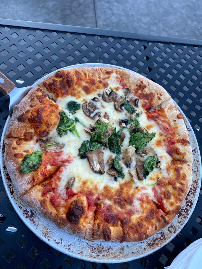
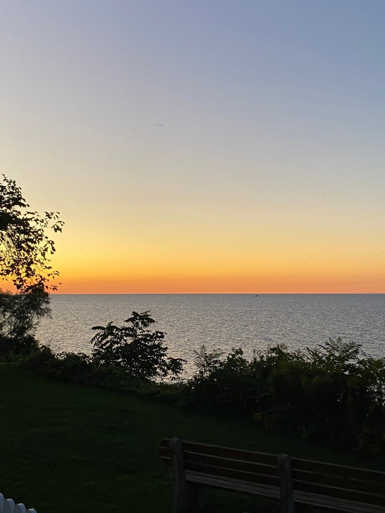
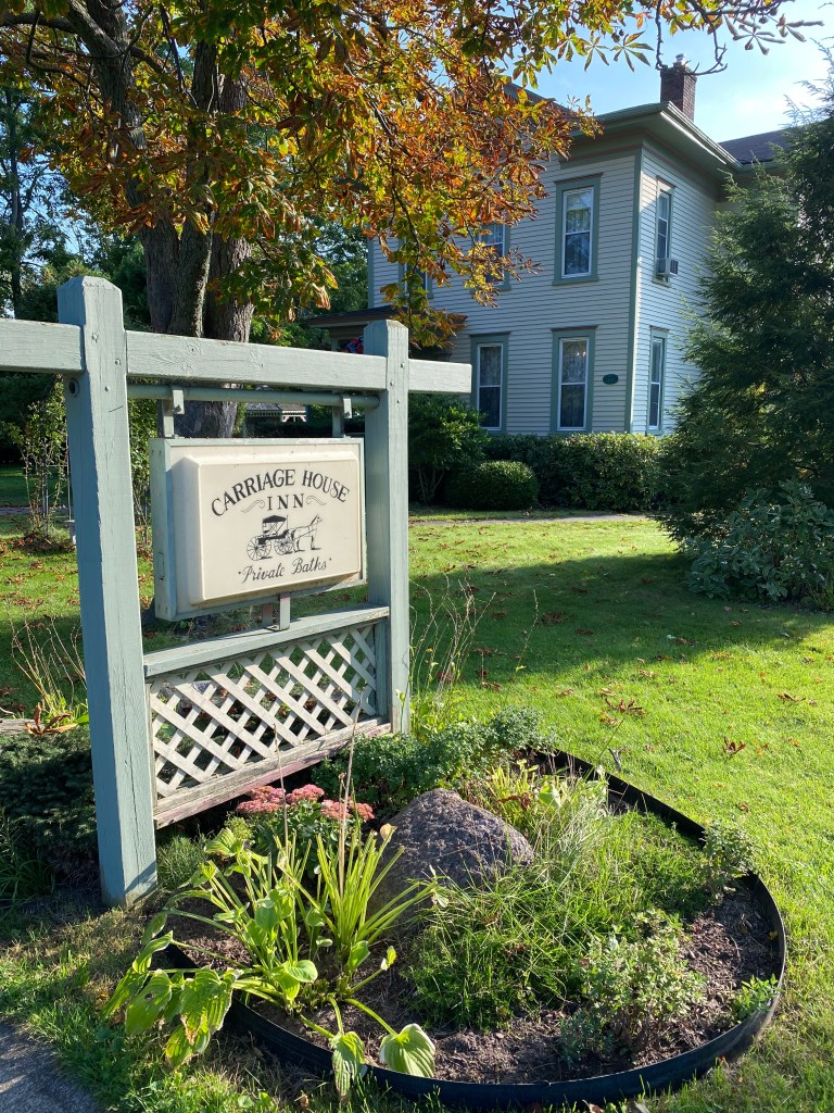
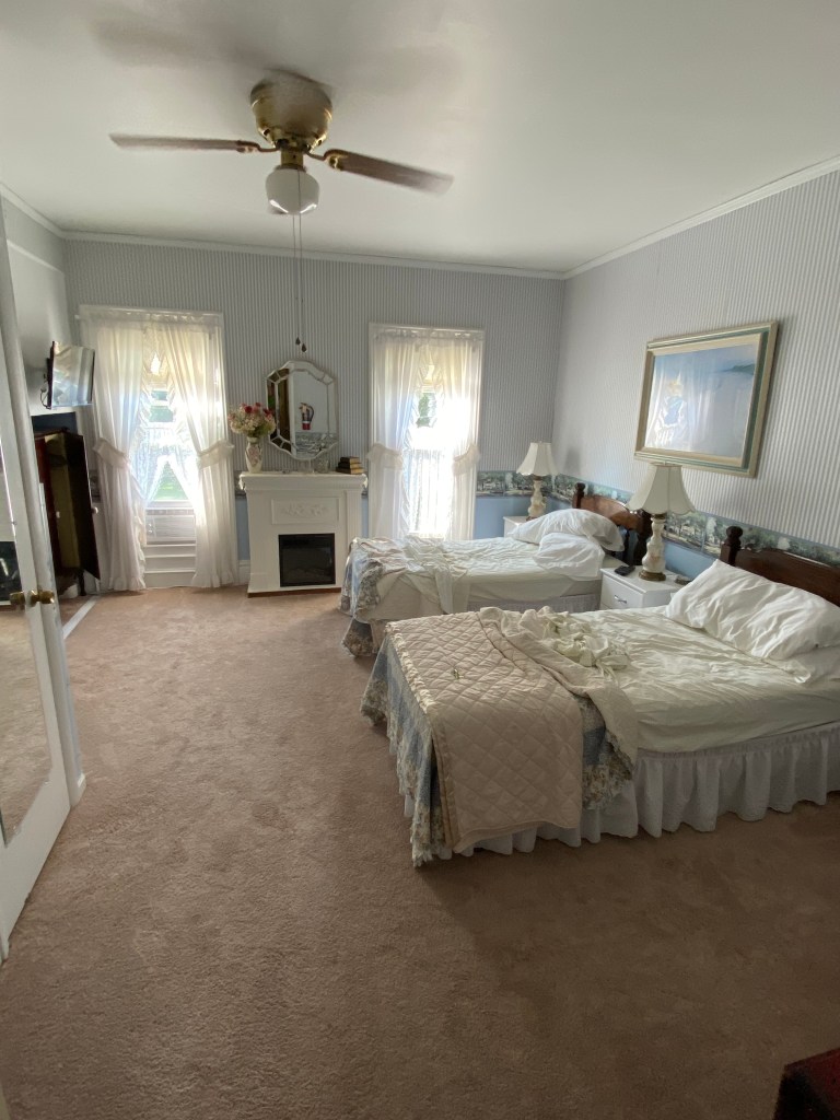
Finally rolled into Sodus Point, population ~ 825, around 4:15. So out of it, completely missed the lighthouse on the way to Carriage House Inn B&B. The original Sodus Bay lighthouse was completed in 1825 but had to be replaced in 1871. This structure exists today and also houses the Maritime Museum by the Sodus Bay Historical Society. Walked to dinner at Six50 (name comes from temperature of brick oven used to bake pizzas). Naturally had pizza – mushroom and spinach and Rohrbach Scotch Ale.


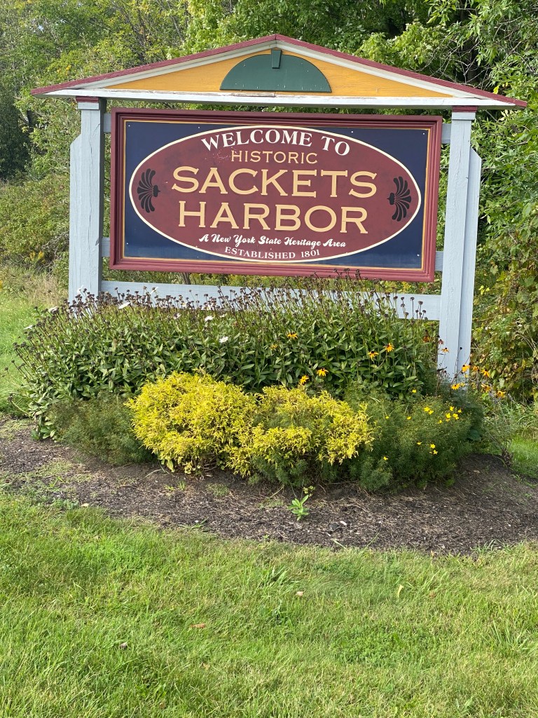
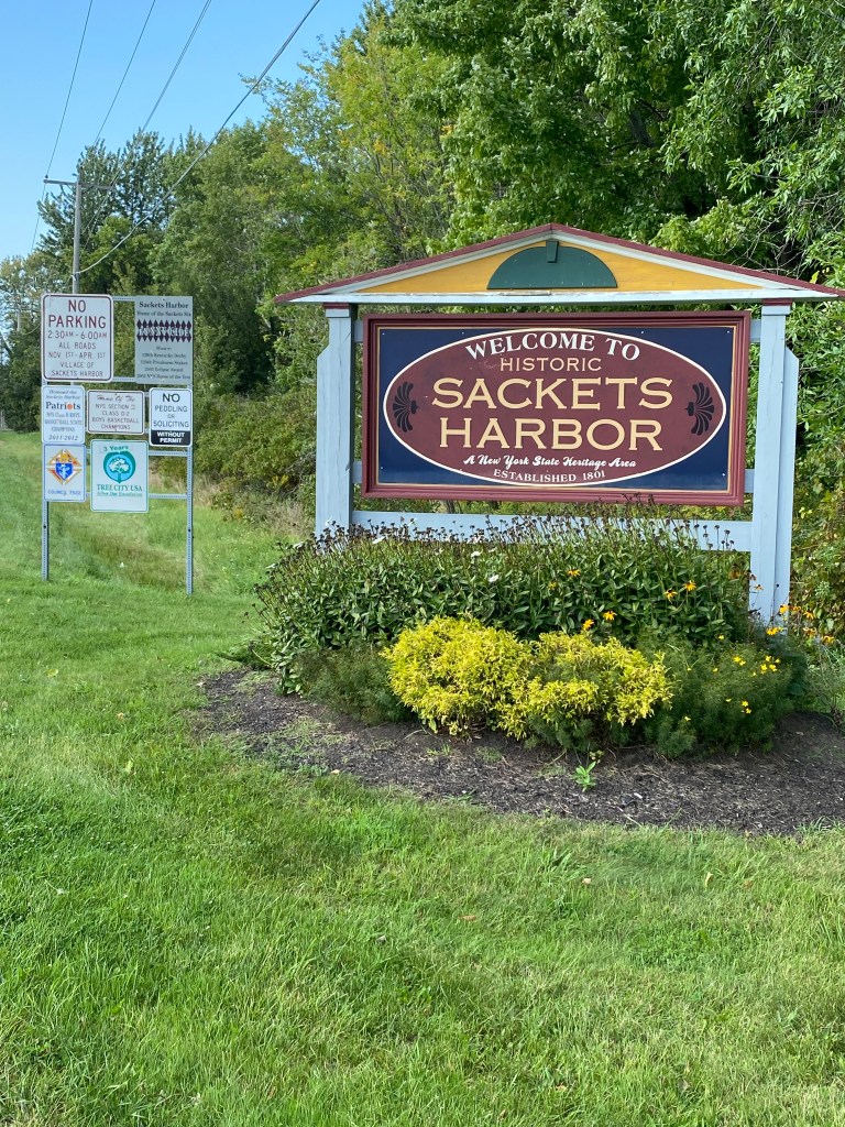
Great Lakes Seaway Trail Day 5: Sodus Point, NY – Sackets Harbor, NY
D: 103.07 miles Avg: 19.7 mph TSS: 262
T: 5:14:22 AP: 216 W IF: 0.71
E: 3,943’ NP: 194 KJ: 3654
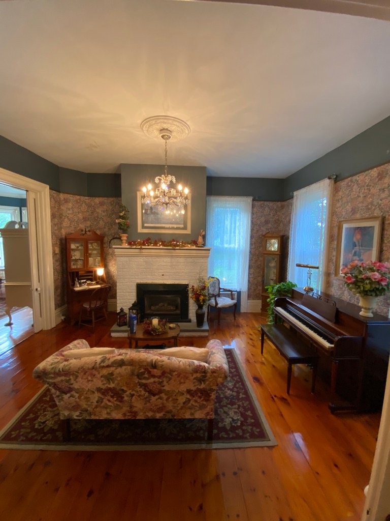
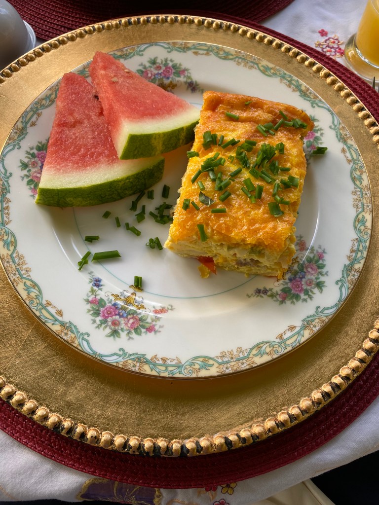
Later start than preferred because breakfasts at B&B’s are always a production. It was good, just don’t be in a hurry because that only leads to frustration. Guess you’re not supposed to have strict plans when you stay at B&Bs. Oh, well. It’s good food so just enjoy it. Started with a fruit (strawberries, blueberries, and granola) parfait. Won’t quibble about differences between parfait vs yogurt topping as yogurt normally isn’t a parfait ingredient. Applesauce and cinnamon muffin was next. Delicious, just needed to be bigger. Main course was egg casserole or quiche (red peppers and potatoes) with watermelon wedges. We sat on the patio next to a fruit-bearing tree which turned out to be a dogwood. Who knew? Kousa or Asian dogwood produces a berry in the fall resembling a raspberry but much bigger and with a tougher skin.
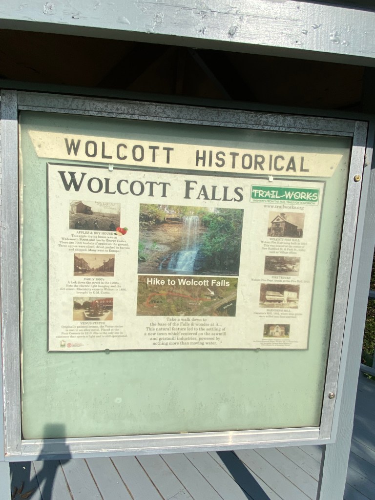
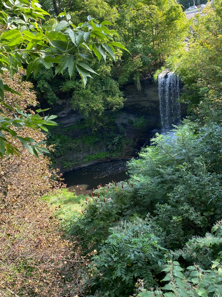
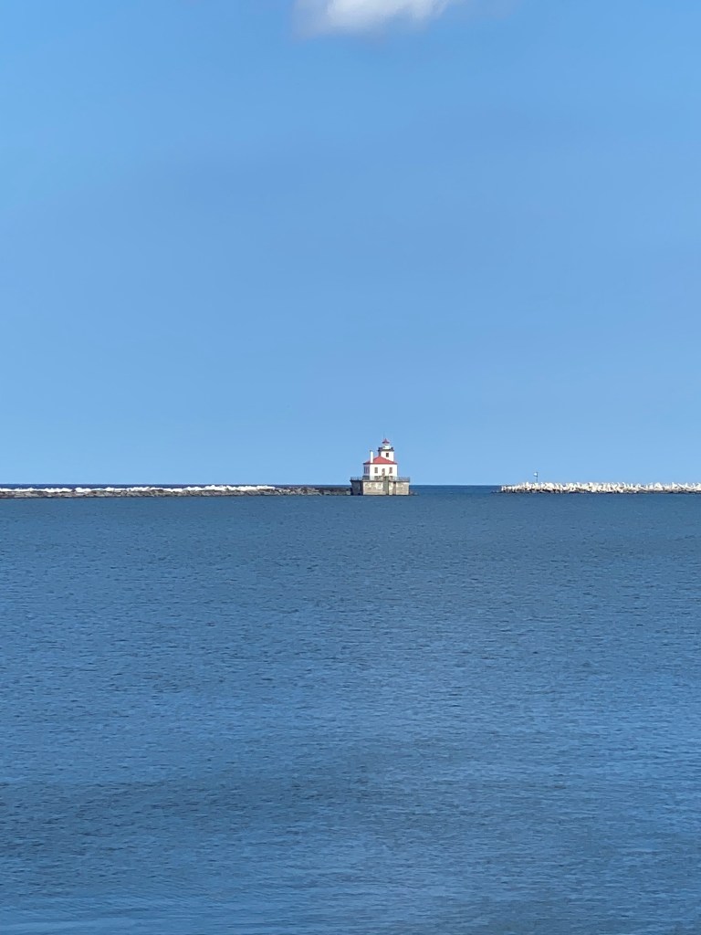
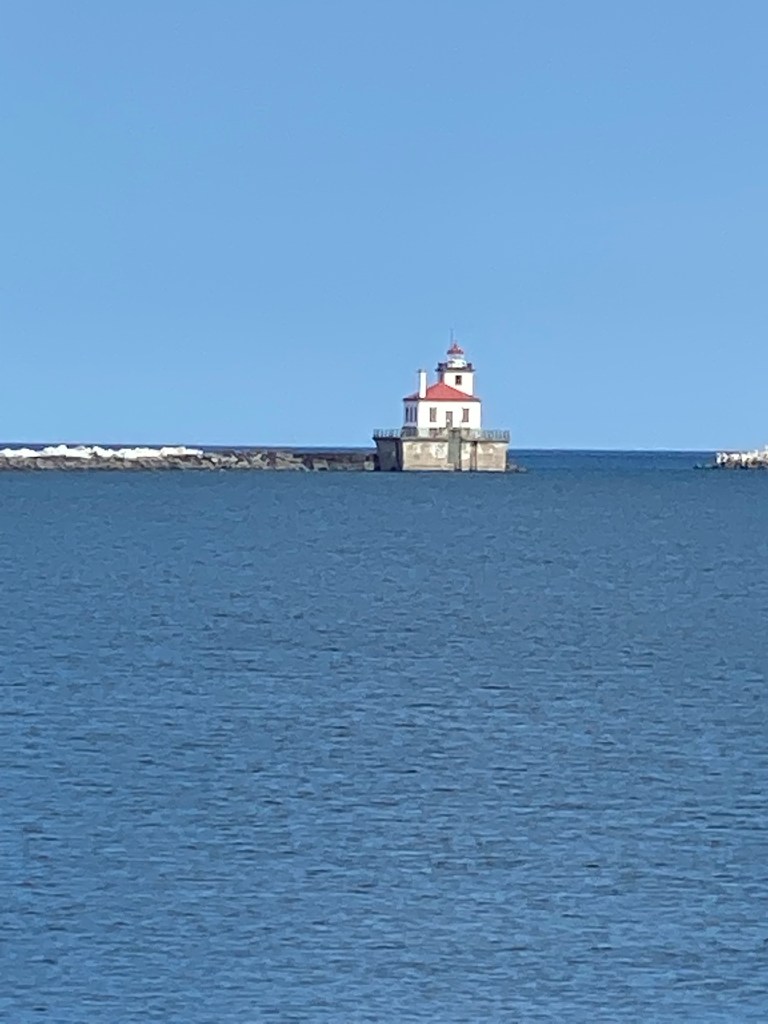
Around 0600, phone app indicated a westerly wind – yeah! Roll time wind had spun around for a south-easterly wind – boo! Translation; start with headwind, transition to mostly crosswind and finally a nice tail wind. Resumed travel through apple land for long stretches. First stop was an unplanned one at Wolcott Falls just before leaving the city. It wasn’t Niagara-sized but rather secluded and scenic. Next stop was at the Oswego West Pier Lighthouse. As the name implies, it was situated on a pier. Disappointing that it was too far away for a good picture with cell phone camera and didn’t feel like getting the Nikon DSLR out of vehicle with telephoto lens. Lazy. Stopped at Murdock’s Bicycles in Oswego which had a sharp jersey but no matching bib shorts. Don’t understand that – maybe I’m part of small segment of consumers that want a complete kit. No purchase. Sis was in the store first and told me her experience after we left the store. She was there a good 5 minutes, looking at the sale rack before finally being asked if she needed assistance. She was the only person in the store. As soon as I walked in, was immediately asked if there was something specific I was looking for. Peculiar? Normal?
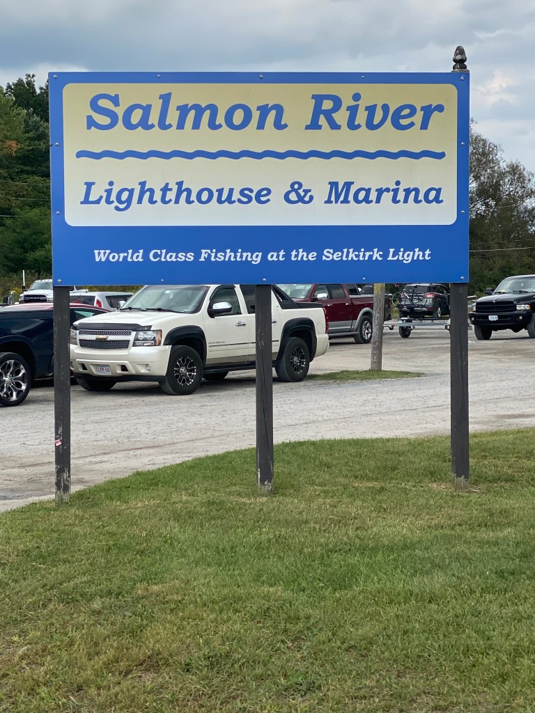
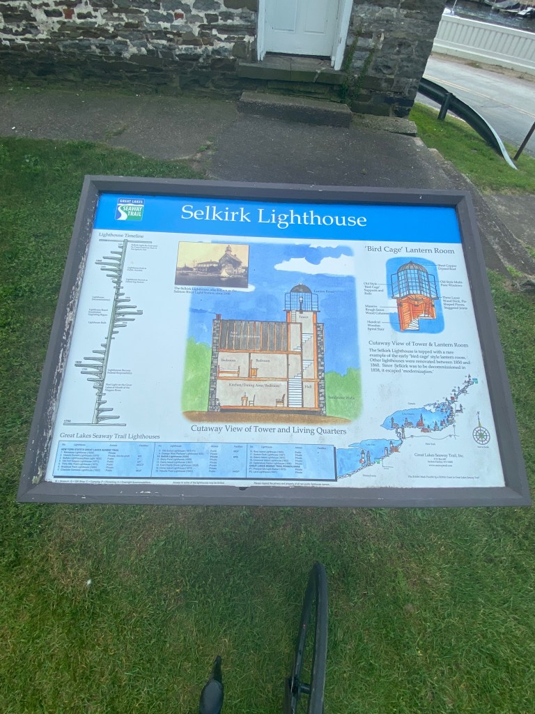
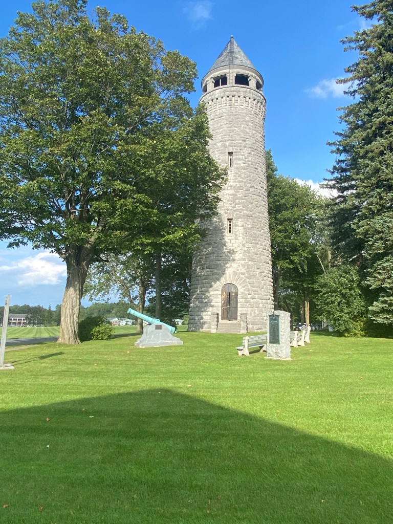
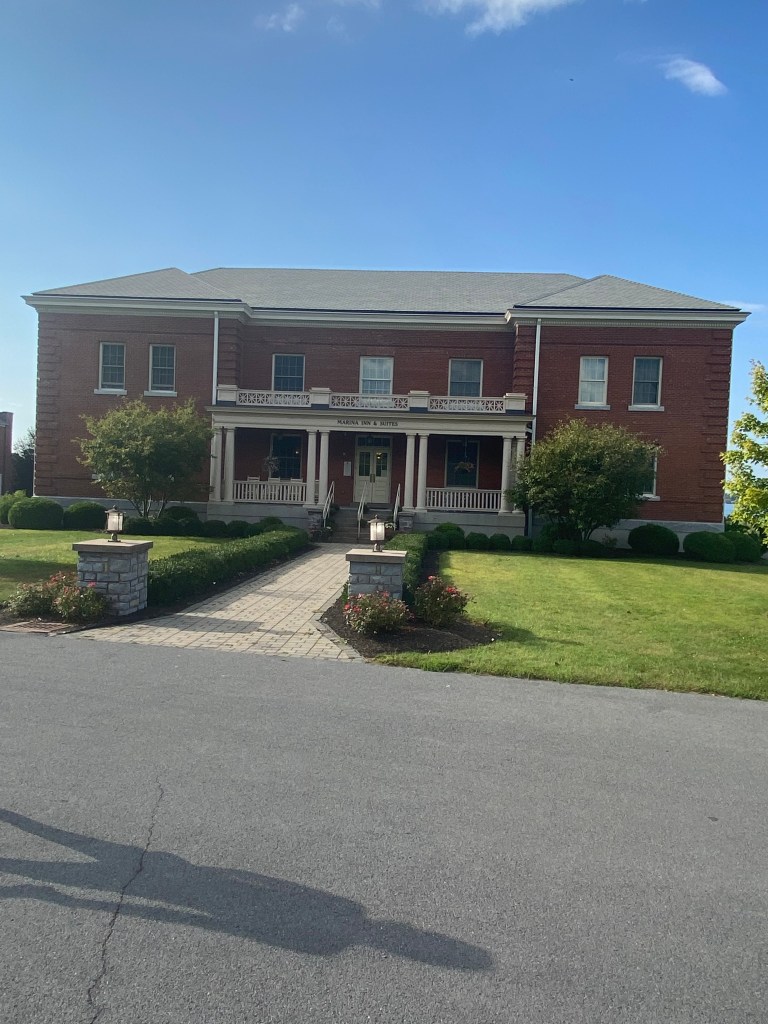
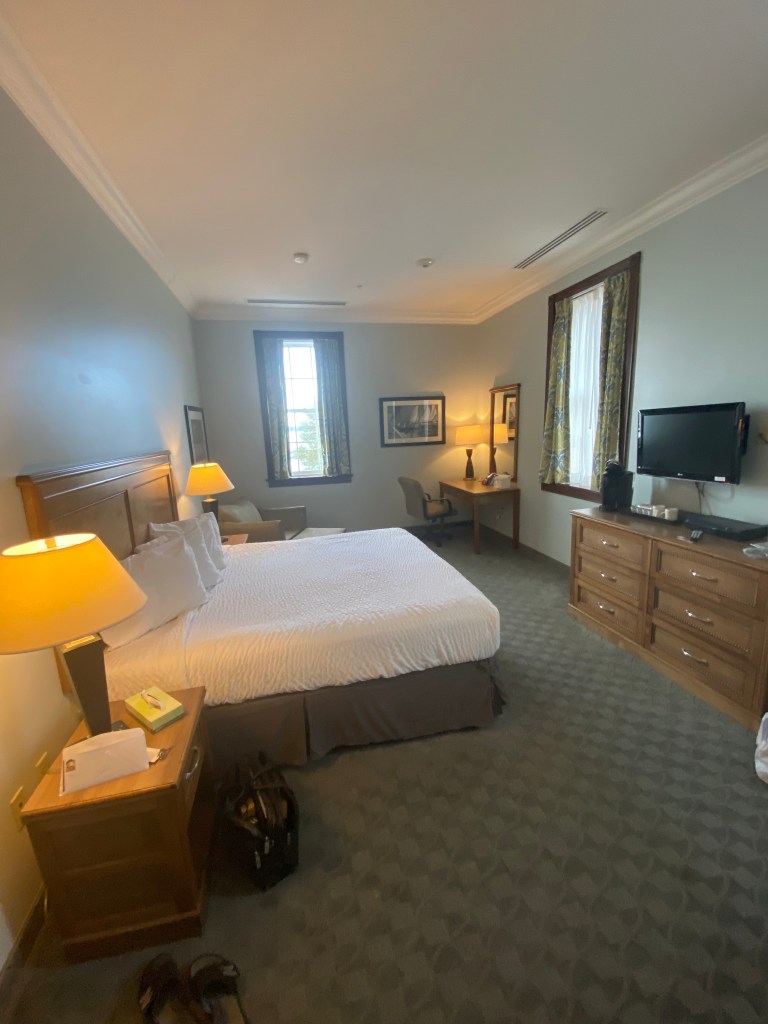
First 40 miles nothing but rollers with a few longer efforts with pitches topping 8%. RWGPS detailed 3402’ and reached 2250’ at 40. Not convinced the route data was correct? Why? Is my Roam overestimating? Why can 3 different people all using Roams riding same route end up with different elevation? Body was expressing itself from very beginning – thirsty. Thought I had consumed sufficient fluids yesterday. Apparently not. Consumed nearly 3 bottles by the Oswego stop (40 miles). Temps were mid 70s but drank for more than usual for that distance. Refilled all 4 plus drank a G2 before rolling. Tail wind for a bit – really nice, until nearly 2 mile section of milled road. Selkirk Lighthouse (Salmon River) next stop at mile 60. Name actually makes sense as salmon is stocked yearly chinook, Coho, two types of strain steelhead, and Atlantic. Next stop a private lighthouse in Henderson Bay which added about 11 miles to today’s distance. The private light and attached house are at the end of a dead-end road. Some of the roads leading to the Light were part of a triathlon course as run and bike directions were still visible. Minor rant: SiS gels that don’t open as intended make a mess on kit and bike. Not a fan. Home stretch to Sackets Harbor, population ~ 1600, ended up with 500 more feet of climbing than RWGPS route indicated. Unable to see the local lighthouse as it’s actually on Horse Island and not visible from the mainland. A local at the Barracks stated the best way to see it is to kayak to the island. Unfortunately, that’s nearly a 60-min one way trip: didn’t have time or kayak to make that happen. Lodging at Marina Inn & Suites on Madison Barracks. The Barracks were constructed due to area’s strategic importance during the War of 1812. Upon entering my room, lo and behold but what was found? Two cookies and 2 bottles of water. Exactly the reward needed. Dinner at Good Fellas – house salad, bread, chicken riggies (baked rigatoni with marinara sauce and chicken), and 1812 draft.


Great Lakes Seaway Trail Day 6: Sackets Harbor, NY – Ogdensburg, NY
D: 90.2 miles Avg: 18.6 mph TSS: 236
T: 4:50:53 AP: 206 W IF: 0.70
E: 1,526’ NP: 216 KJ: 3620
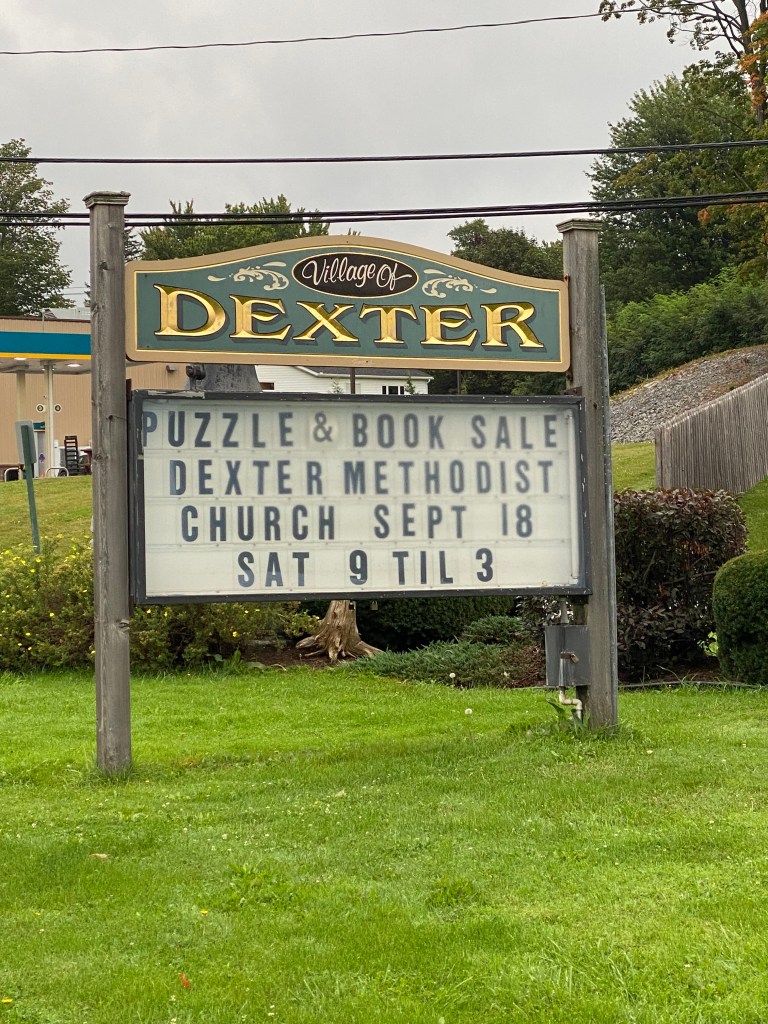
After a local recon and confirmation with a Google search, unable to find any breakfast restaurants in Sackets Harbor. The search did reveal Diane’s Diner in nearby Dexter, about 7.5 miles down the road. Plan was to depart at 0700, ride and drive respectively, and meet at the diner. The restaurant is a little hole in the wall that was literally standing room only. Had to wait 5’ or so to get a seat. Felt like ‘Cheers’ as we appeared to be only nonlocals in the restaurant. French toast, ham, OJ, and water this morning.
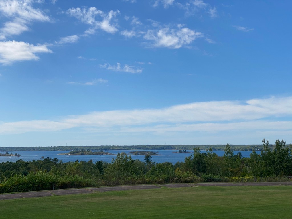
Would bid adieu to Lake Ontario as the route would curve around the eastern shore then parallel the St Lawrence Seaway. Weather was not very accommodating today – a few drops of rain after breakfast that never materialized but wind was a constant head/cross the entire day. End result was slowest, in terms of average speed, day of the week. Coolest day so far as well. Vineyards and orchards were replaced by cornfields. Eventually little agricultural activity – forests. St Lawrence was not visible for long stretches at a time. When it was visible, it had a slightly lighter but not pale shade of blue compared to Lake Ontario.
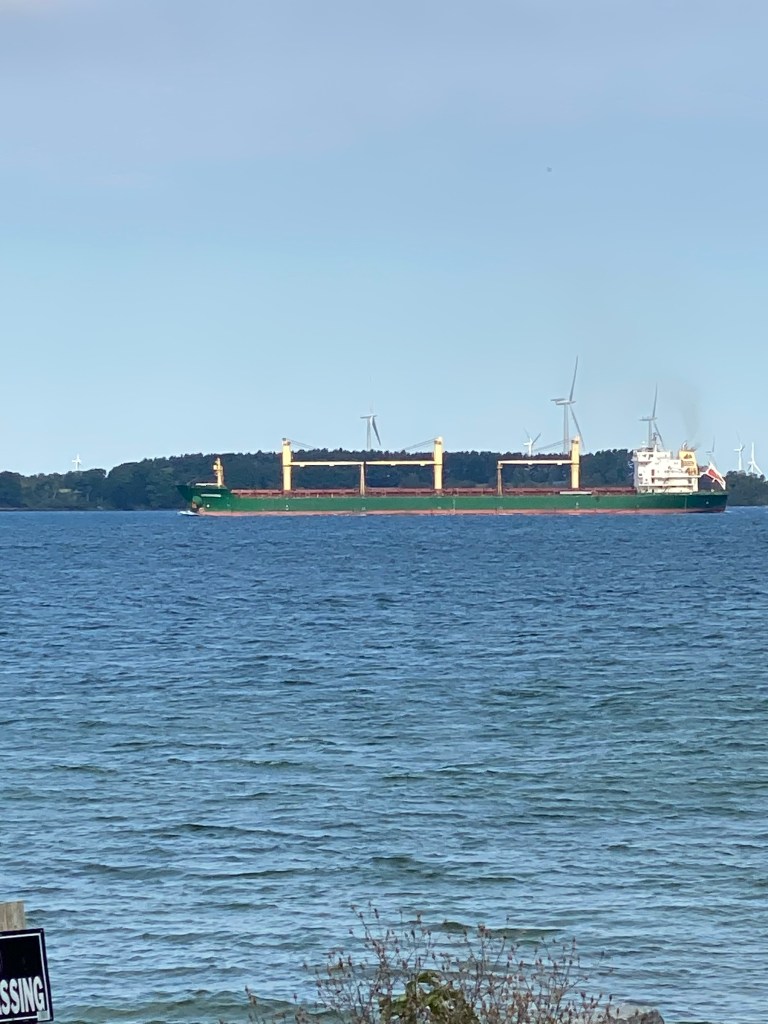
First stop Tibbett’s Point Light in Vincent Bay which is the only US city to enjoy both Lake Ontario and St Lawrence River. The Light was built in 1827 and features the only original working Fresnel lens on Lake Ontario. The tower was replaced in 1854 with current circular one. USCG ceased duties in 1981 and the quarters became a Youth Hostel in 1984. Two other Lights out on Lake Ontario, East Charity Shoal and Pigeon Island Lights, are visible from the back deck of the Fog Signal building. Pigeon Island Light, a Canadian Light, looks like a pencil out on the Lake as the island isn’t visible.
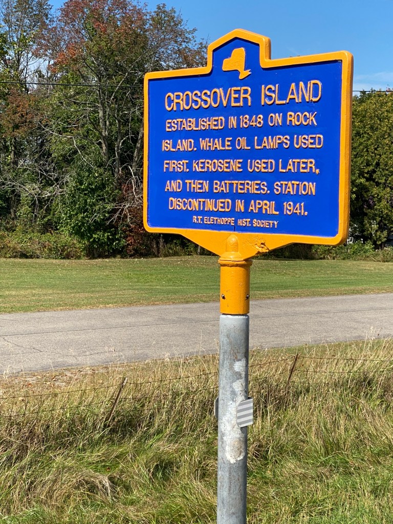
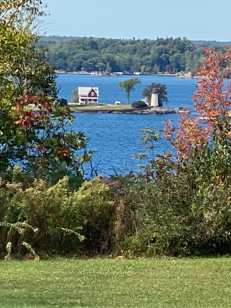
Had Sis motopace for a bit to block stiff head wind for a couple miles after leaving Vincent Bay. Never found Rock Island Lighthouse State Park but able to snap a photo of the Lighthouse thanks to a local who also cycles guided me to the best spot viewing spot. Still haven’t seen many other road bikes, could count them on one hand and still have fingers to spare, the entire trip. Caught up with Sis at one of the many parking lots along NY State Route 12. This one overlooked St Lawrence. Exchanged stories since our departure from Vincent Bay before finishing up last stretch. Sis finally found an open winery, 1000 Islands Winery, part of the 1000 Islands Wine Trail. Unheard of in VA wine country but a flight of 6 was on $5. Only saw one small vineyard but seemed to be more wineries and a few distilleries in a 15-mile stretch than anywhere along the Trail to include the Concord grape region. Don’t know where the grapes are coming from.
1000 Islands Wine Trail was established in 2007 and winds through 78 miles of the scenic Thousand Islands region with seven member wineries. Harsh winter conditions prevented the growth of traditional grape varieties until 1996 when the University of Minnesota introduced a high-quality, cold-hardy, disease-resistant wine grape cultivar, Frontenac. Further development of cold-hardy hybrid grape varieties in Northern New York now include Marquette, La Crescent, Frontenac Gris, La Crosse, Brianna.
Passed two sections yesterday with signs indicating horse-drawn carriages may be evident but didn’t see any. Today however, no signs but did cross paths with one. Unable to video the observance as the GoPro media card was full. Wasn’t able to capture any video today.
Tonight’s accommodations, the Inn at Gran View, was just outside Ogdensburg so saved myself 4 miles (will be added to tomorrow’s ride). Also received a refund of 500 feet of elevation from the RWGPS route metrics. Showered and off to the big city of just over 10,000 residents to pick up a new mini SD memory card for the GoPro, find Ogdensburg Light (another private one) and dinner at The Bayside Grill. Sat on the back deck overlooking the St. Lawrence trying to enjoy the cool, brisk breeze, and the dinner – house salad, shrimp scampi, dinner bread, Yuengling draft, and water.


Great Lakes Seaway Trail Day 7: Ogdensburg, NY – Rooseveltown, NY
D: 50.7 miles Avg: 18.7 mph TSS: 141
T: 2:42:44 AP: 209 W IF: 0.72
E: 382’ NP: 224 KJ: 2040
Today will conclude the Seaway Trail adventure. Schedule was breakfast at 0700, leisurely 50-mile ride to eastern terminus (hoping there’s some indication of the end; unlike the disappointment of the Natchez Trace Parkway last year), then drive to Montpelier, VT. Why there? Because it’s an hour away from the start of the route that will enable the inclusion of New Hampshire as a state I’ve ridden in. Brisk temperature of 45° at wake-up rising to 50° at roll time. Deluxe continental breakfast – scrambled eggs (cold), self made waffle, Apple Jacks cereal (no Raisin Bran or cheerios) and 2 muffins – blueberry and cream cheese streusel (mine are better and bigger), OJ, water.
No lighthouses on route although did pass Ogdensburg Light again(another private) on the way through town. Wind again but not as bad as yesterday. Cornfields were the primary crop along the way. A sprinkle of wineries but no visible vineyards. Some of the leaves were beginning to turn color giving just a small hint of what the area would look like in a week or so. Crossed paths with Sis about 8.5 miles from end of route and paced her back to the end. There actually was a sign declaring the end of the Scenic Byway, Great Lakes Seaway Trail. For the Missus, took an out of character selfie, solo and with Sis since she made it possible, to commemorate completion of the adventure and checking off bucket list item. Now must identify a replacement. Already have a few ideas.
Drove to Montpelier taking the ferry from Plattsburgh, NY to Grand Isle, VT, the northernmost crossing on Lake Champlain. Passed through the final wine trail: Adirondack Coast Wine Trail, established in 2013 consisting of 3 wineries in St. Lawrence County. Lodging accommodations were at the Hilton Tapestry in downtown. Walked to dinner at Positive Pi. Had to wait 30 minutes to be seated apparently due to being short staffed. Excellent food and service once seated though: house salad, creamy pesto pasta with chicken, Vermont Scarlet draft. The iPhone photo doesn’t do justice as it turned the pesto sauce to a sickly shade of green. It really didn’t look like that. As we walked the downtown area, nearly every store had a help wanted sign posted in the window. Interestingly, the response to Covid varied from store to store. Many stated masks were required upon entry regardless of vaccination status. Others encouraged masks for those vaccinated but required them for the unvaccinated. We thought we had identified our breakfast stop for the next morning, but it wasn’t meant to be. More on that tomorrow.


Great Lakes Seaway Trail Extended Day 7: St Johnsbury, – Woodsville, NH
D: 37.5 miles Avg: 18.7 mph TSS: 116
T: 2:01:45 AP: 206 W IF: 0.76
E: 1,778’ NP: 236 KJ: 1503
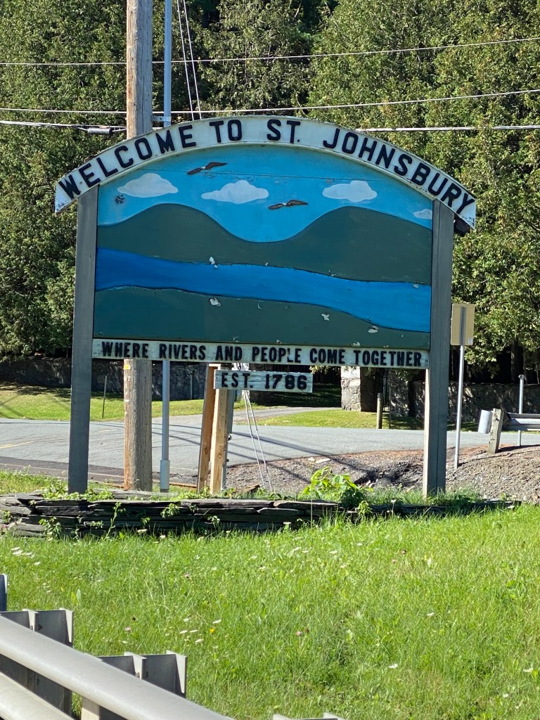
Return home day – after one final ride and a new state to add to the list. Sis discovered our intended breakfast stop didn’t open until 0830 – thirty minutes later than the restaurant sheet from the front desk indicated. There was another ‘supposed’ breakfast place that opened at 0800 but when we arrived, doors were closed, and lights were off. The adjoining café offered pre-made breakfast sandwiches. Pass. Thank you. The breakfast option at the Tapestry was ala cart (pay for each item) but there wasn’t an attendant in sight. So we finished loading up and drove to The Wayside Restaurant which was only a couple of miles away and mostly on the way. Today’s selection was the Canadian Combo – 2 eggs over easy, 2 pancakes, links, ham. It was foggy in stretches on the drive to the drop off point with temperatures fluctuating by 10°. Shocked as we drove through Saint Johnsbury as expected it be a small village. Quite the contrary. The downtown seemed bigger and more diverse than the capital. Knew Montpelier was small but turns out its population is only greater than St Johnsbury by about 150 people, 7,248 vs 7,110. Should have conducted more research and stayed much closer to the starting point. Lesson learned for next time.
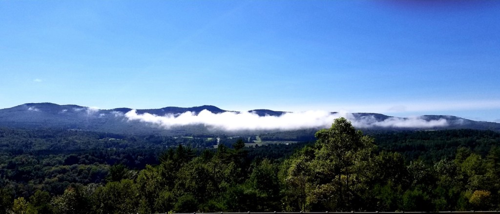
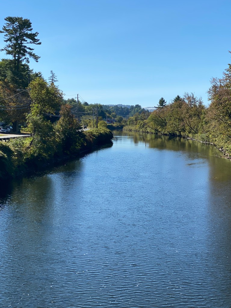
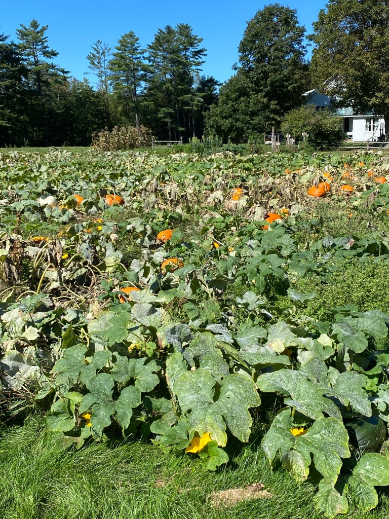
The route started with nearly a mile descent on well-packed VT gravel – dirt really. Turned left onto US 5 and paralleled the Possum River back through St Johnsbury then headed southeast. Road was gently rolling until the first climb, just short of 2 miles with an average grade of 4.5%. Crossed over the Connecticut River into New Hampshire, made a sharp right hand turn onto State Route 135 (Connecticut River Byway) and would keep the river on the right down to Woodsville. No signage evident to announce entry into the Granite State. Second climb of note was 1.3 miles at a misleading 3.5% average. Misleading because there’s a quarter mile false plateau and short descent in the middle but the final half mile averages over 6.5%. Awesome scenery along the way – every direction was picture worthy. After seeing pumpkins at road side stands and markets for the past 3 days, finally saw a pumpkin patch. Ended the ride in Woodsville at the Haverhill-Bath covered bridge to take pictorial evidence of a NH ride.
A great week of cycling and bonding time with Sis. A total of 594 miles across 5 states (OH, PA, NY, VT, and NH), with cycling time of 30:45:00, and almost 12,500 ft of climbing. Have to find next adventure.